
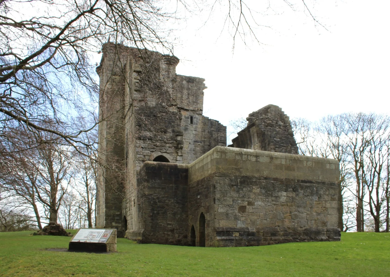
Crookston Castle in Glasgow City
Crookston Castle in Glasgow City is a castle, Brockburn Road (G53 5RY). Ⓦ.
- Postal Code
- G53 5RY
- Street
- Brockburn Road
- Building Type
- building
- Operator
- Historic Scotland
- Website
- https://www.historicenvironment.scot/visit-a-place/places/crookston-castle/
Image
Convenience stores
Bus stops
Roads nearby
Lyoncross RoadPollok, Lyoncross Road/ Barnbeth Road, Lyoncross Road / Dormanside Road, Lyoncross Road / Meiklerig Crescent, Pollok, Lyoncross Road/ Potterhill Road
150 m
Towerside Crescent150 m
Potterhill Road250 m
Linthaugh RoadLinthaugh Road / Dormanside Road, Linthaugh Road / Everton road, Linthaugh Road / Linthaugh Terrace, Linthaugh Road / Meiklerig Crescent, Linthaugh Road / No 101, Linthaugh Road / No 149, Linthaugh Road / Drums Road, Linthaugh Road / Moyne Road, Linthaugh Road / Hapland Road, Linthaugh Road / Lochar Crescent, Linthaugh Road / No 147, Linthaugh Road / Lyoncross Road
300 m
Moyne Road300 m
Barnbeth Road300 m
Calfhill Road300 m
Glenside Avenue300 m
Brockburn RoadBrockburn Road / No 121, Brockburn Road / Devol Crescent, Brockburn Road / Dowrie Crescent, Brockburn Road / Levernside Crescent, Brockburn Road / Brockburn Terrace, Brockburn Road / Crookston Castle School, Brockburn Road / Glenside Avenue, Brockburn Road / Leithland Avenue, Crookston Road / Leverndale Hospital, Brockburn Road / Crookston Road, Brockburn Road / Crosstobs Road
350 m
Towerside Road350 m
Crosstobs Road350 m
Beltrees Road350 m
Beltrees Avenue350 m
Beltrees Crescent350 m
Drums Road350 m
Barochan Road400 m
Barochan Place400 m
Brockburn Place400 m
Kempsthorn Road400 m
Bargaran Road450 m
Kempsthorn Place450 m
Whinhill Place500 m
Bonnyholm Avenue500 m
Dormanside Grove550 m
Whinhill Road550 m
Whinhill Gardens550 m
Dormanside Road550 m
Dowrie Crescent550 m
Bargany Place600 m
Kempsthorn Crescent600 m
Dermontside Close600 m
Markdow Avenue600 m
Crookston RoadCrookston Road / Cairnhill Circus, The Pines, Crookston, Crookston Road/ Cairnhill Circus, Rosshall, Crookston Road / Hatton Gardens, Scotmid, Crookston Road / Crovie Road, Crookston Road / Raeswood Road, Crookston, Crookston Road/ Sanquhar Drive, Crookston Road / Bullwood Court, Crookston Road / Bullwood Drive, Crookston Road / Leverndale Hospital, Tesco Express, Crookston Road, Crookston Road / Brockburn Road
600 m
Bargany Road650 m
Leverndale Road650 m
Chirmorie Place650 m
Newtyle Drive650 m
Bargany Court700 m
Dalmellington Road700 m
Brownfields nearby
Former Howford School400 m
Community centres nearby
Leithland Neighbourhood Centre500 m
Kindergartens nearby
Linthaugh Nursery School450 m
Parks nearby
Ross Hall Park450 m
Stirling Maxwell Forest Park650 m
Places of worship nearby
St James Parish Church500 m
Recreation grounds nearby
Rosshall Disc Golf Course500 m
Rivers nearby
White Cart Water500 m
School buildings nearby
St.Monicas Primary350 m
Supermarkets nearby
Lidl650 m
| Inception | 1180 |
|---|---|
| Commissioned by | Robert Croc |
| Heritage designation | scheduled monument, category A listed building |
| Located in | Glasgow City, Scotland |
| Country | United Kingdom |
| Native label | Crookston |
| Significant event | archaeological excavation, geophysical survey |
| Described by source | CastlesFortsBattles |
 Public transport map Glasgow City Legend
| Railway | |
| Bus | |
| Tram |
 Cycling map Glasgow City Legend
| Cycle path | |
| Cycle lane on road | |
| Cycling on bus lane | |
| Bicycle street | |
| Cyclists allowed | |
| Cyclists allowed, good surface | |
| No cycling | |
| Cobblestones |
| Long-distance cycle route | (depending on scale) | |
| Long-distance cycle route |
 Walking map Glasgow City Legend
| Path |
| Long-distance hiking trail | (depending on scale) | |
| Long-distance hiking trail | ||
| No pedestrians |