
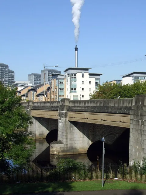
King's Bridge in Glasgow City
King's Bridge in Glasgow City is an asphalted, lit main road. It runs in a southeast-northwest direction starting from Ballater Street and ends at King's Drive. King's Bridge is also known as King's Bridge, River Clyde, Ballater Street, Glasgow. Ⓦ.
- Road Type
- main road
- Speed Limit
- 30 mph
- Route
- southeast-northwest
Image
Bookmakers
Beauty salons
Bicycle hires
Pubs
Artwork
Bus stops
- bus lines 65
Fast food restaurants
Convenience stores
Supermarkets
Attraction
Furniture shops
Roads nearby
McNeil Gardens100 m
Waterside Place100 m
McNeil Street150 m
King's DriveLow Green Gate, King's Drive / Football Centre
200 m
Hayfield Street200 m
Turnlaw Street250 m
River Clyde Walkway250 m
Moffat Street250 m
Benthall Street250 m
Waterside Street250 m
St Andrew's Suspension Bridge250 m
Clyde Walkway250 m
Blackfriars Court300 m
Snowdon Street300 m
Hayfield Court300 m
Waddell Court400 m
Adelphi Street400 m
The Green400 m
McPhail Street400 m
Templeton StreetCalton, Glasgow Green/ Templeton Business centre, Glasgow Green
450 m
Greenhead Street450 m
Templeton CourtWEST on the Green
450 m
Craignestock Place550 m
Binnie Place550 m
Monteith RowGlasgow Green/ Peoples Palace, Glasgow Green Gate, Top Up Tap
600 m
Attraction nearby
Nelson's Monument550 m
The Doulton Fountain550 m
Bicycle shops nearby
Cycletrade200 m
Body of waters nearby
River Clyde450 m
Buildings nearby
Hi-flyers Balloons200 m
Outspoken200 m
Mf2k200 m
Fittleworth200 m
Audio CP250 m
Glasgow Green Football Centre300 m
Glasgow Humane Society300 m
Commercial areas nearby
Riverside Business Park250 m
Gardens nearby
Senses Garden350 m
The Irish and Highland Famine Memorial550 m
Grass nearby
Drying Green400 m
Greenhouses nearby
Winter Gardens500 m
Industrial areas nearby
Strathclyde Distillery250 m
Museum nearby
People's Palace500 m
Office buildings nearby
Free Wheel North350 m
Pubs nearby
The Pig & Whistle200 m
Railway lines nearby
Argyle Line550 m
Sports centres nearby
Glasgow National Hockey Centre250 m
Tracks nearby
Glasgow Green Cycle Dirt Track300 m
Glasgow Green Cycle Track300 m
| Heritage designation | category C listed building |
|---|---|
| Located in | Glasgow City, Glasgow |
| Country | United Kingdom |
| Crosses | River Clyde |
| Carries thoroughfare | A74 road |
| Location | Glasgow |
 Public transport map Glasgow City Legend
| Railway | |
| Bus | |
| Tram |
 Cycling map Glasgow City Legend
| Cycle path | |
| Cycle lane on road | |
| Cycling on bus lane | |
| Bicycle street | |
| Cyclists allowed | |
| Cyclists allowed, good surface | |
| No cycling | |
| Cobblestones |
| Long-distance cycle route | (depending on scale) | |
| Long-distance cycle route |
 Walking map Glasgow City Legend
| Path |
| Long-distance hiking trail | (depending on scale) | |
| Long-distance hiking trail | ||
| No pedestrians |