
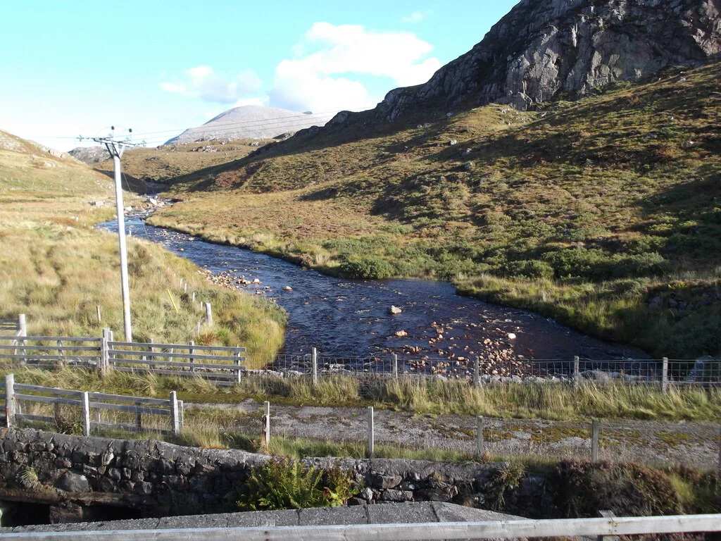
Achriesgill Bridge in Highland
Achriesgill Bridge in Highland is a service road. It runs in a northeast-southwest direction and ends in a cul-de-sac.
- Road Type
- service road
- Route
- northeast-southwest
Image
Roads nearby
Rhuvoult Road1,2 km
Rhimichie Road1,4 km
Rhiconich Bridge1,9 km
Badcall Road2,5 km
Old Inn Road3,3 km
Manse RoadHigh School, Ardersier, Lothmore, Kilmote, Columba House Hotel
3,4 km
Inchard PlaceCeilidh House
3,5 km
Innis Place3,5 km
Ardmore Road3,5 km
Macbeath Court3,6 km
Post Office Road3,7 km
Skerricha Loop4,0 km
Bervie RoadKinlochbervie
4,1 km
Skerricha Road4,2 km
Baies nearby
Loch Inchard650 m
Body of waters nearby
Loch a' Chaoruinn2,1 km
Lochan a' Mhuilinn Loisgte2,4 km
Loch Airigh an t-Slaith2,6 km
Loch na Làire Duibhe2,6 km
Loch na Gainimh2,8 km
Loch na Caillich2,9 km
Loch Mòr Ceann na Sàile3,1 km
Loch na Bèiste Brice4,2 km
Loch a' Phreasan Chailltean4,2 km
Loch Creag an Fhraoich4,2 km
Loch Innis na Bá Buidhe4,2 km
Lochan a' Mhullaich4,4 km
Loch a' Gharbh-bhaid Bhig4,5 km
Buildings nearby
Gull Cottage250 m
The Old School1,3 km
Kinlochbervie Telephone Exchange3,7 km
Coastguard3,7 km
Community centres nearby
Kinlochbervie Village Hall3,4 km
Convenience stores nearby
London Stores2,4 km
SPAR4,3 km
Doctor's practice nearby
Kinlochbervie Health Centre3,7 km
Hotels nearby
Rhiconich Hotel1,8 km
Industrial areas nearby
Kinlochbervie Harbour4,2 km
Kindergartens nearby
Kinlochbervie Pre-School3,4 km
Places of worship nearby
Church of Scotland3,7 km
Free Presbyterian Church of Scotland4,2 km
Post offices nearby
Kinlochbervie Post Office3,6 km
Rivers nearby
Achriesgill Water1,3 km
Rhiconich River2,4 km
Schools nearby
Kinlochbervie Primary School3,5 km
Kinlochbervie High School3,6 km
Streams nearby
Altan na Lamhaidh1,4 km
Allt an Lòin Bhàin2,7 km
Allt Sgeir a' Chadha4,1 km
| Inception | 1835 |
|---|---|
| Material | rubble masonry, flagstone |
| Located in | Highland, Eddrachillis |
| Country | United Kingdom |
| Crosses | Achriesgill Water |
| Carries thoroughfare | farm road |
 Public transport map Highland Legend
| Railway | |
| Bus | |
| Tram |
 Cycling map Highland Legend
| Cycle path | |
| Cycle lane on road | |
| Cycling on bus lane | |
| Bicycle street | |
| Cyclists allowed | |
| Cyclists allowed, good surface | |
| No cycling | |
| Cobblestones |
| Long-distance cycle route | (depending on scale) | |
| Long-distance cycle route |
 Walking map Highland Legend
| Path |
| Long-distance hiking trail | (depending on scale) | |
| Long-distance hiking trail | ||
| No pedestrians |