
Bridge Street in Crown and City Centre
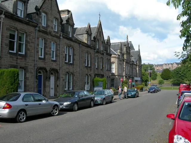
Bridge Street in Highland, Crown and City Centre is a three-lane, asphalted, lit secondary road (road number B861). The road has sidewalks (asphalt), with a roadway surface that is fair. There is no cycle path. It runs in a northeast direction starting from Castle Road and crosses Bank Street and continues into High Street. This road is part of the bicycle routes UK:National Cycle Network 7, NCN 1 Dundee to Tain and EuroVelo 12 - North Sea Cycle Route - part United Kingdom 7 and the long-distance road "North Coast 500" and the hiking trail "John O'Groats Trail (Inverness to Culbokie)". In the vicinity, you can find among other things 2 pubs, 2 clothing shops, 2 restaurants and a taxi rank. The nearest bus stop in the vicinity is Castle Street (approx. 100 m away). The bus lines 1B, 7, 14 and 16 serve this stop. Bridge Street also exists in Aberdeen City, Fife, Scottish Borders and Dundee City.
- Road Type
- secondary road
- Bicycle
- yes
- Speed Limit
- 20 mph
- Lanes
- 3
- Route
- northeast-southwest
Image
Bus stops
- bus lines 1B, 7, 14, 16
Off-licences
Pubs
Restaurants
Cafés
Roads nearby
Castle WyndAmenities nearby
The ClubAttraction nearby
Inverness CastleBars nearby
The Botanic HouseBed shops nearby
Highland BlindCraftBookshops nearby
Ablekids BookstoreGuest house nearby
Budget RoomsHostel nearby
Inverness Student HotelHotels nearby
Redcliffe HotelOffice buildings nearby
Comunn na GàidhligOpticians nearby
Ailsa MacInnes OptometristPlaces of worship nearby
Inverness Baptist ChurchStudios nearby
BBC ScotlandTown halls nearby
Inverness Town House| Railway | |
| Bus | |
| Tram |
| Cycle path | |
| Cycle lane on road | |
| Cycling on bus lane | |
| Bicycle street | |
| Cyclists allowed | |
| Cyclists allowed, good surface | |
| No cycling | |
| Cobblestones |
| Long-distance cycle route | (depending on scale) | |
| Long-distance cycle route |
| Path |
| Long-distance hiking trail | (depending on scale) | |
| Long-distance hiking trail | ||
| No pedestrians |