
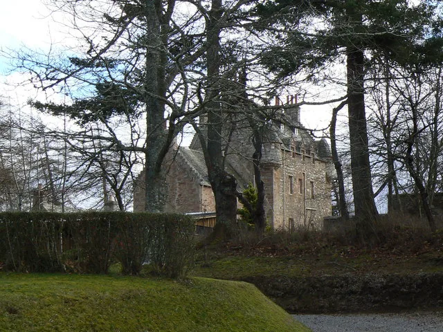
Dalcross Castle in Highland
Dalcross Castle in Highland is a guest house (IV2 5PS). Dalcross Castle is also known as Dalcross. Dalcross Castle is near Dalcross Drive. Ⓦ.
- Postal Code
- IV2 5PS
- Building Type
- castle
- Tourism
- guest house
- Website
- http://www.dalcross.org/
Image
Roads nearby
Dalcross Drive50 m
Cantray RoadCantray
1,3 km
Feabuie Road1,7 km
High Wood Road1,7 km
Dalvore1,8 km
Laggnagere1,8 km
The Loan1,8 km
Laggnagere Court1,8 km
Culaird Court1,8 km
School RoadLazy Crofter Bunkhouse/Hostel, Primary School Road End, Ardnamurchan High School, Àrainn Shuaineirt, UHI West Highland - Strontian, Strontian, North Ballachulish, Kinlochleven Road End, Chocolates of Glenshiel
1,8 km
Macleod Gardens1,8 km
Malvina Lane1,9 km
Milne Avenue1,9 km
Hillhead RoadTornagrain, Tornagrain Mid Coul, at, Tornagrain Pharmacy
1,9 km
Malvina Court1,9 km
Croy Road2,0 km
Glebe CottagesTornagrain
2,0 km
Miller Road2,0 km
Ardgowan2,0 km
Lochandinty Court2,0 km
Campbell Court2,0 km
School BraeGairloch, Public toilets, EV charging point, Black Pearl
2,0 km
Fraser Lane2,0 km
Mid Coul CourtStramash Outdoor Nursery Tornagrain
2,0 km
Douglas Court2,0 km
Lochandinty Lane2,0 km
Lochandinty RoadTornagrain Stores
2,1 km
MacKinnon Drive2,1 km
Bishop's Hill Court2,1 km
Ardgowan Access Road2,1 km
Mid Coul Road2,1 km
South Coul Ct2,2 km
Bishop's Hill Road2,2 km
Badgers Green2,2 km
The Neuk2,2 km
Dalcross Station RoadEaster Dalziel
2,4 km
Body of waters nearby
Lochan Dinty2,1 km
Buildings nearby
Easter Feabuie1,7 km
Cafés nearby
Hillhead cafe1,9 km
Coffee Shop - The Barn by Milk Bar2,1 km
Caravan site nearby
Culloden Moor Caravan Club Site2,5 km
Churches nearby
Petty Parish Church2,2 km
Forests nearby
Lochandinty Wood2,3 km
Gardens nearby
Malvina Green1,9 km
Playgrounds nearby
Tornagrain Play Area1,9 km
Rivers nearby
River Nairn2,0 km
Village greens nearby
Culaird Green1,8 km
Woodlands nearby
Culloden Forest850 m
High Wood1,5 km
| Heritage designation | category A listed building |
|---|---|
| Located in | Highland, Croy and Dalcross |
| Country | United Kingdom |
 Public transport map Highland Legend
| Railway | |
| Bus | |
| Tram |
 Cycling map Highland Legend
| Cycle path | |
| Cycle lane on road | |
| Cycling on bus lane | |
| Bicycle street | |
| Cyclists allowed | |
| Cyclists allowed, good surface | |
| No cycling | |
| Cobblestones |
| Long-distance cycle route | (depending on scale) | |
| Long-distance cycle route |
 Walking map Highland Legend
| Path |
| Long-distance hiking trail | (depending on scale) | |
| Long-distance hiking trail | ||
| No pedestrians |