
East Mill in Highland
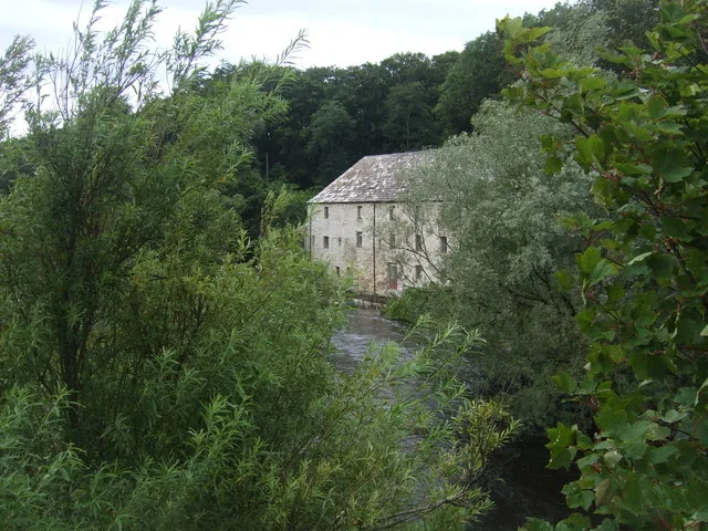
East Mill in Highland ist eine Anlage (listed building). East Mill is also known as Forss, East Mill. East Mill is near Bridge of Forss.
- Building Type
- building
Image
Roads nearby
Bridge of ForssBridge of Forss, Mill House
100 m
School PlaceForss Houses, Ardersier
1000 m
Hallum Road1,5 km
Olrig StreetThurso, Royal Bank of Scotland, Santander, Central Hotel, ScotVapes, Fone Care, Olrig Street, Commercial Bar, Bank of Scotland, RBS, T's Café
1,6 km
Brims Mains Road2,2 km
Skiall Road2,6 km
Lythmore RoadLythmore
3,2 km
ThusaterThusater
3,4 km
Cnoc an Fhreiceadain Long Cairns Car Park3,9 km
Oust Farm Road4,1 km
Janetstown Quarries RoadMurrayfield
4,2 km
Upper Dounreay RoadDounreay
4,7 km
Old peri track5,2 km
Mackenzie Terrace5,3 km
Bardnaclavan PlaceBardnaclavan Place, Janetstown
5,8 km
Lochside RoadAchvarasdal Junction
6,2 km
Achscrabster Road6,2 km
Body of waters nearby
Lochan Buidhe850 m
Scrabster Loch5,4 km
Loch Achbuiligan5,8 km
Coghill Loch5,9 km
Buildings nearby
Forss Telephone Exchange600 m
Bridge of Westfield Telephone Exchange5,1 km
Prototype Fast Reactor5,8 km
Shore Test Facility6,2 km
Churches nearby
St Mary's Chapel1,8 km
Reay Free Church4,8 km
Commercial areas nearby
Thurso Business Estate6,0 km
Farmyards nearby
Burn of Brims Farm1,7 km
Lythmore2,7 km
Oust4,1 km
Bardnaheigh4,1 km
Bardnaclavan Farm5,2 km
Achunabust6,0 km
Scrabster Mains6,0 km
Achiegullan6,2 km
Golf courses nearby
Thurso Golf Club5,9 km
Hotels nearby
Forss House150 m
Industrial areas nearby
Forss Business and Technology Park1,8 km
Dounreay Nuclear Power Development Establishment5,5 km
Thurso Depot6,2 km
Industrial buildings nearby
Dounreay Submarine Prototype 16,1 km
Military areas nearby
Vulcan Naval Reactor Test Establishment6,3 km
Retail buildings nearby
WKD Logs5,1 km
Rivers nearby
Forss Water2,9 km
Streams nearby
Kennachy Burn300 m
Craigan Well1,3 km
Burn of Brims1,7 km
Other nearby
Out of Bounds5,9 km
| Located in | Highland, Thurso |
|---|---|
| Country | United Kingdom |
 Public transport map Highland Legend
| Railway | |
| Bus | |
| Tram |
 Cycling map Highland Legend
| Cycle path | |
| Cycle lane on road | |
| Cycling on bus lane | |
| Bicycle street | |
| Cyclists allowed | |
| Cyclists allowed, good surface | |
| No cycling | |
| Cobblestones |
| Long-distance cycle route | (depending on scale) | |
| Long-distance cycle route |
 Walking map Highland Legend
| Path |
| Long-distance hiking trail | (depending on scale) | |
| Long-distance hiking trail | ||
| No pedestrians |