
Hartfield Place in Highland
Hartfield Place in Highland is a two-lane residential street. The road has a width of 5.0 m. It runs in an east-west direction and ends at Hartfield Road, while the other end is a cul-de-sac.
- Road Type
- residential street
- Lanes
- 2
- Route
- east-west
Image
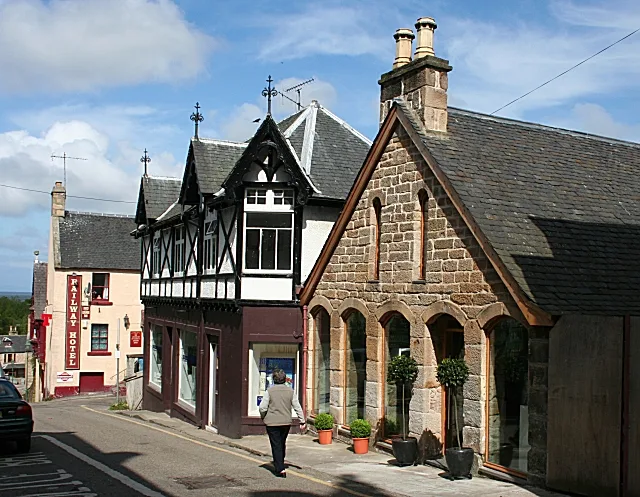
Roads nearby
Hartfield Road100 m
Cromartie Gardens150 m
Petley Place150 m
Victoria RoadGulf, Road End, Victoria Garage, St Marys School, Saint Andrew's Guest House, Stobahn B&B, Ardmory B&B, Gleaner, Sutherland Arms
200 m
Scotsburn RoadScotsburn Road, Scotsburn, Scotsburn road Bus Depot, Medical Centre, Arthurville
200 m
Upper King Street250 m
Argyle CourtBritish Red Cross, Cleos
250 m
Kingsway Avenue300 m
Seaforth RoadTarradale Auld Sweetie Shop, Tradespark
300 m
Quebec Avenue300 m
Scotsburn Court350 m
Cameron RoadGlenmoidart B&B, Ardblair B&B
350 m
Queen StreetKinWell Pharmacy, Uncle Bob's Bar
350 m
Cameron Avenue350 m
Mansefield Road400 m
Hartfield Gardens400 m
St Duthus Street400 m
Culpleasant Drive400 m
Cameron Gardens400 m
Ivy Lane450 m
St Andrew's Road450 m
Craighill TerraceCraighill Primary
450 m
Manse Street450 m
Craig Crescent450 m
Viewhill Crescent500 m
Culpleasant Avenue500 m
Quarry Lane500 m
Glebe Crescent550 m
Manse Gardens550 m
Manse Crescent550 m
Craig Avenue600 m
Provost Ferguson Drive650 m
Rowan Drive650 m
Bakeries nearby
William Grant Bakery450 m
Buildings nearby
Tain Telephone Exchange300 m
Butcher's nearby
John M. Munro350 m
Cinemas nearby
Tain Picture House500 m
Hotels nearby
Mansfield Castle Hotel350 m
The Royal Hotel Tain450 m
Pharmacies nearby
Well Pharmacy450 m
Places of worship nearby
Tain Free Church250 m
Associated Presbyterian Church300 m
Tain Parish Church300 m
St Vincent de Paul Catholic Church450 m
St Andrew's Episcopal Church600 m
Pubs nearby
The Star Inn350 m
Residential areas nearby
Mansfield Estate250 m
Restaurants nearby
Greens Restaurant450 m
Veterinary practices nearby
Johnson & Farrell Veterinary Surgeons150 m
 Public transport map Highland Legend
| Railway | |
| Bus | |
| Tram |
 Cycling map Highland Legend
| Cycle path | |
| Cycle lane on road | |
| Cycling on bus lane | |
| Bicycle street | |
| Cyclists allowed | |
| Cyclists allowed, good surface | |
| No cycling | |
| Cobblestones |
| Long-distance cycle route | (depending on scale) | |
| Long-distance cycle route |
 Walking map Highland Legend
| Path |
| Long-distance hiking trail | (depending on scale) | |
| Long-distance hiking trail | ||
| No pedestrians |