
Inverness Airport in Highland
Inverness Airport in Highland is an airfield (IATA: INV, ICAO: EGPE, international airport). Inverness Airport is also known as Dalcross Airport. Ⓦ.
- Alternative Name
- Dalcross Airport
- Website
- https://www.hial.co.uk/
Image
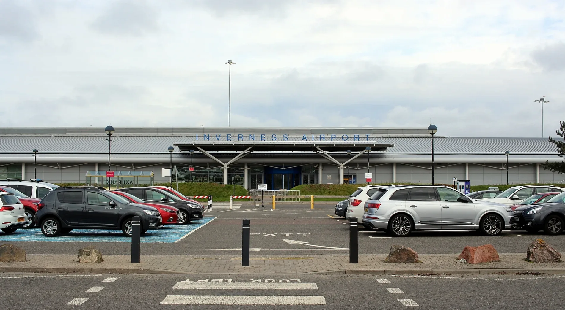
Roads nearby
Fresson CircleGolfer Sculpture
1000 m
Woodend Road1,2 km
Mid Coul Road1,3 km
Bishop's Hill Road1,3 km
South Coul Court1,3 km
South Coul Ct1,3 km
Bishop's Hill Court1,3 km
Langnachree1,3 km
Mid Coul CourtStramash Outdoor Nursery Tornagrain
1,4 km
Badgers Green1,4 km
Starmoss1,4 km
Douglas Court1,4 km
The Neuk1,4 km
School RoadLazy Crofter Bunkhouse/Hostel, Primary School Road End, Ardnamurchan High School, Àrainn Shuaineirt, UHI West Highland - Strontian, Strontian, North Ballachulish, Kinlochleven Road End, Chocolates of Glenshiel
1,4 km
Lochandinty RoadTornagrain Stores
1,4 km
Hillhead RoadTornagrain, Tornagrain Mid Coul, at, Tornagrain Pharmacy
1,4 km
Lochandinty Lane1,4 km
Lochandinty Court1,5 km
Malvina Court1,5 km
Croy Road1,5 km
Laggnagere Court1,5 km
Laggnagere1,5 km
Culaird Court1,5 km
The Loan1,5 km
Old Military RoadGranton-on-Spey and Anagach Woods, Castle Grant, really small camp site, not great but fits 2 person tent and has access to small river, Tigh na-sleubhaich, Airport Road End, Easterton Road End, Fisherton Road End, Castle Stuart, The Old Byre
1,5 km
Malvina Lane1,5 km
High Wood Road1,6 km
Dalvore1,6 km
Glebe CottagesTornagrain
1,8 km
Dalcross Station RoadEaster Dalziel
1,9 km
Milton of Breachlich RoadMilton of Gollanfield
2,0 km
Abandoned railways nearby
Gollanfield to Fort George Branch2,4 km
Body of waters nearby
Lochan Dinty1,8 km
Cafés nearby
Hillhead cafe1,4 km
Churches nearby
Petty Parish Church1,5 km
Commercial buildings nearby
Co-op Dalcross LSC1,4 km
Forests nearby
Lochandinty Wood1,8 km
Gardens nearby
Malvina Green1,5 km
Hotels nearby
Courtyard Inverness Airport1000 m
Industrial areas nearby
Mid Coul Pump Station650 m
Dalcross Industrial Estate1,0 km
Playgrounds nearby
Tornagrain Play Area1,4 km
Railway lines nearby
Aberdeen to Inverness Line2,3 km
Village greens nearby
Culaird Green1,5 km
Other nearby
Bristrow Search and Rescue200 m
South Apron850 m
North Apron (East)1,0 km
North Apron (West)1,1 km
Dalcross 33/11kV Substation1,1 km
| Named after | Inverness |
|---|---|
| Inception | 1947 |
| Opening | 1947 |
| Elevation | 9.5 m |
| Operator | Highlands and Islands Airports |
| Located in | Highland |
| Country | United Kingdom |
 Public transport map Highland Legend
| Railway | |
| Bus | |
| Tram |
 Cycling map Highland Legend
| Cycle path | |
| Cycle lane on road | |
| Cycling on bus lane | |
| Bicycle street | |
| Cyclists allowed | |
| Cyclists allowed, good surface | |
| No cycling | |
| Cobblestones |
| Long-distance cycle route | (depending on scale) | |
| Long-distance cycle route |
 Walking map Highland Legend
| Path |
| Long-distance hiking trail | (depending on scale) | |
| Long-distance hiking trail | ||
| No pedestrians |