
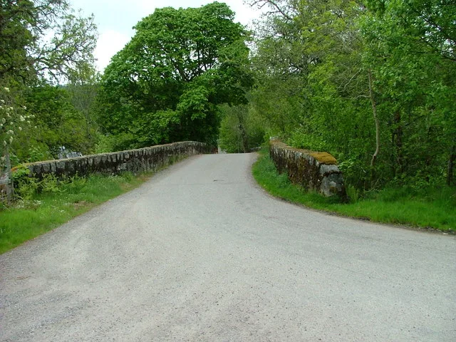
Knockfin Bridge in Highland
Knockfin Bridge in Highland is a single-lane, unlit minor road. It runs in a southeast-northwest direction and ends at Tomich Road, while the other end is a cul-de-sac. Knockfin Bridge is also known as Tomich, Knockfin Bridge. This road is part of the mountain bike route "Highland Trail 550".
- Road Type
- minor road
- Lanes
- 1
- Speed Limit
- 60 mph
- Route
- southeast-northwest
Image
Roads nearby
Balcladaich Road650 m
Tomich RoadTweedmouth Memorial Fountain, Post Office, Tomich, The Coach House cafe
1,2 km
Glen Affric RoadDog Falls, Top Car Park
2,7 km
Comar Gardens5,9 km
MacColl Road5,9 km
Glencannich RoadCannich, Leichtry, Shalavanich, Mullardoch Cottage, Mullardoch House, Coire Mhaim
6,0 km
Bein Achairen View6,2 km
Body of waters nearby
Coire Loch1,5 km
Loch a' Ghreidlein1,9 km
Loch na Beinne Moire2,2 km
Loch Caoireach2,3 km
Loch nam Freumh2,7 km
Loch nan Luch3,1 km
loch na Beinne Bige3,2 km
Loch Carn Bingally3,5 km
Lock nam Fiodhag3,8 km
Lochan na Craoibhe4,6 km
Loch na Gobhlaig5,1 km
Suilean Loch nan Eun6,2 km
Buildings nearby
The Gate Lodge2,7 km
Water Inlet3,0 km
Fasnakyle Power Station3,2 km
Cannich Telephone Exchange6,1 km
Cafés nearby
Bog Cotton Café6,0 km
Community centres nearby
Cannich Hall6,1 km
Dams nearby
Affric Dam2,8 km
Fire stations nearby
Cannich Community Fire Station6,2 km
Guest house nearby
Westward B&B6,1 km
Hotels nearby
Tomich Hotel750 m
Places of worship nearby
Our Lady and St. Bean, Cannich6,3 km
Post offices nearby
Tomich Post Office750 m
Restaurants nearby
Slaters Arms5,8 km
Rivers nearby
River Affric1,8 km
Allt na Sìdean2,4 km
River Glass3,9 km
Abhainn Deabhag4,0 km
Abhainn na Ruighe Duibhe4,3 km
River Cannich6,2 km
Ruins nearby
Guisachan House2,1 km
Streams nearby
Allt Loch Innis Gheamhraidh750 m
Allt Currachan1,5 km
Allt Ruigh na Sine2,8 km
An Cam-allt2,9 km
Allt Blar na Gamhna3,3 km
Allt na Fuiche Bige3,5 km
Allt na Bodachan3,8 km
Allt nam Fiodhag4,1 km
Allt an Ruighe Dhuibh4,1 km
Allt Lochan na Cràoibhe4,8 km
| Inception | 1800 |
|---|---|
| Heritage designation | category B listed building |
| Located in | Highland, Kiltarlity and Convinth |
| Country | United Kingdom |
| Crosses | Allt Riabhach |
| Carries thoroughfare | unclassified road |
 Public transport map Highland Legend
 | Railway | |
| Bus | |
| Tram |
 Cycling map Highland Legend
 | Cycle path | |
| Cycle lane on road | |
| Cycling on bus lane | |
| Bicycle street | |
| Cyclists allowed | |
| Cyclists allowed, good surface | |
| No cycling | |
| Cobblestones |
| Long-distance cycle route | (depending on scale) | |
| Long-distance cycle route |
 Walking map Highland Legend
 | Path |
| Long-distance hiking trail | (depending on scale) | |
| Long-distance hiking trail | ||
| No pedestrians |