
Little Garve Bridge in Highland
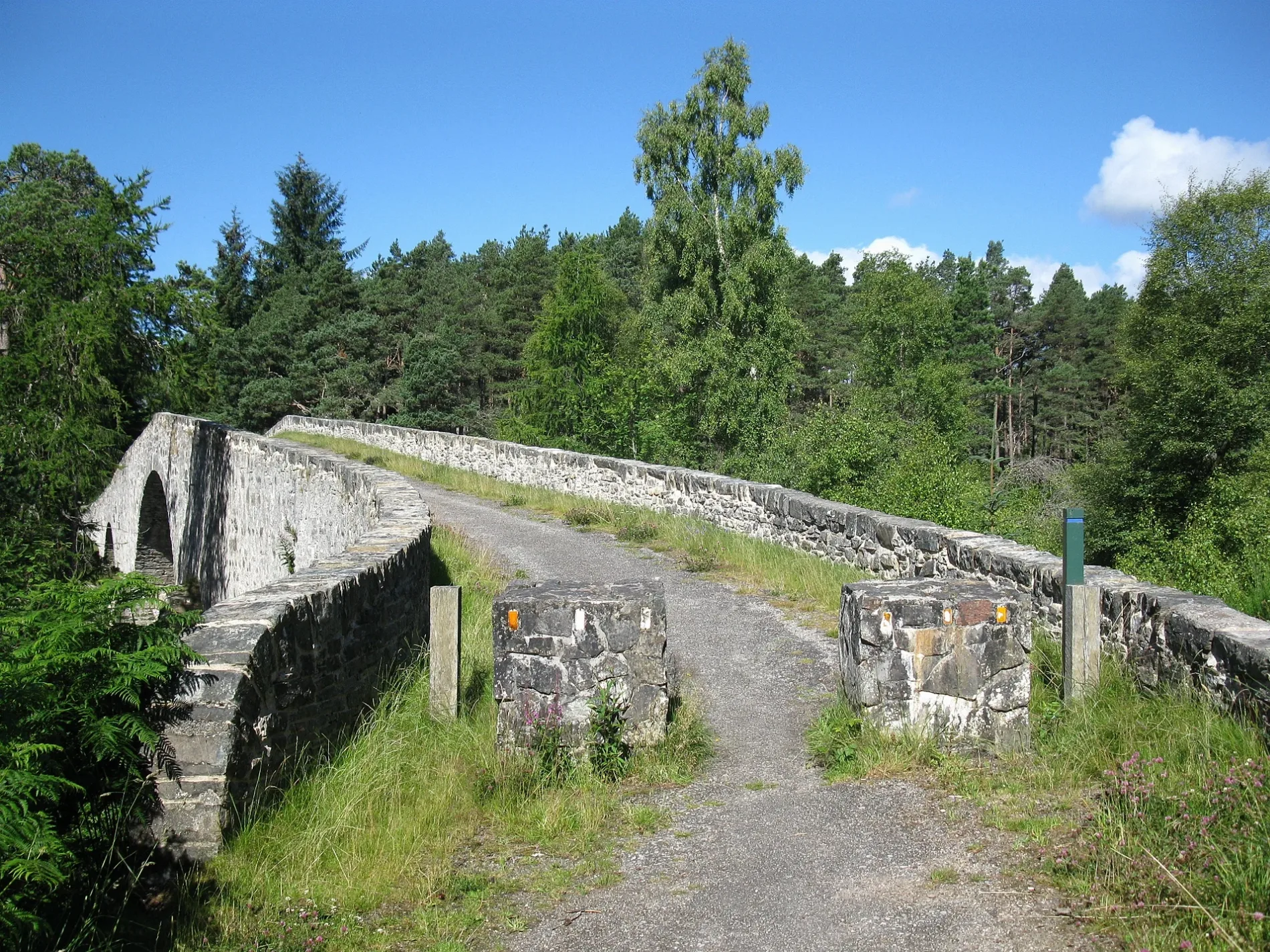
Little Garve Bridge in Highland is an asphalted footpath. It runs in an east-west direction and ends in a cul-de-sac. This road is part of the mountain bike routes Highland Trail 550 and Great North Trail (Northern Highlands) and the foot route "Two Bridges Trail".
- Bicycle
- yes
- Road Type
- footpath
- Route
- east-west
Image
Roads nearby
The Fish Road (Heritage path)750 m
Old Manse Road950 m
SilverbridgeBlack Water Falls
1,2 km
Stirling DriveGarve, Garve Post Office, Out of the Blue Catering
1,3 km
Matheson RoadGarve, Swordale
1,6 km
Station RoadMallaig, The Tea Garden Cafe, Marine Hotel, Marine Bar, The Co-operative Food, The Fishmarket, Ticket Office, J. Lawrie & Sons, An Cala, The Mallaig Cafe, Art Gallery and Crafts, Mallaig Toys & Gifts, The Highlands Koo Company, The Mission Bunkhouse, RNLI Shop, Welcome to Mallaig, Boots, Cromarty Bakery Shop, Nethy Bridge Hotel, Spean Bridge, Old Station Restaurant, Kyle of Lochalsh, Lochalsh Butchers, Kyle Post Office, Kyle Surgery, Mace, Skye & Lochalsh Dental Practice, Skye Bridge Distillery, The Islander, The Silver Seal, rightmedicine Pharmacy, Skye Car Hire, Skye Bridge Hotel, Central Filling Station, M & D MacLeod Funeral Directors, Achnasheen Terraces, Bridgend Filling Station, Beaufort Gardens, Beauly Laundry, Fort Augustus, The Lovat, Richmond House Hotel Bar & Restaurant, Angela‘s Giftshop, Richmond House Hotel, Bank House B&B, Kings Inn B&B, Beaufort House B&B, Caledonian Cottage B&B, Lorien House B&B, The Brasserie, Beauly, Beauly Railway Station, Dalwhinnie, Station Road End, 11. The Long Goodbye, Station Road, Conon Bridge, Arisaig, The Speyside Way, Golspie, Hospital Road, The Brown Trout, Glenglass Road Junction, Dingwall Railway Station, Kylelachin B&B, Garfield Guest House, Urrard B&B, Bus Shelter, Heather hut, Garve, Newtonmore, Badenoch, Melon Patch B&B, Istanbul Kebab House, Carrbridge Artists Studio, The Old Bank House, Visitor Centre, Lochluichart, Plockton, Plockton Car Park, Tain, Station Road Entrance, Platform 1864, Achnasheen, Achnasheen Post Office, Station, Morrisons Daily, Church, Ardersier Memorial Fountain, The Gun Lodge, Inchrye B&B, McLeod Farm Centre, Ardersier Station Road, Police Station, Ardersier Post Office, SPAR, Wendys Cafe, Post Office, Star Inn, Waterside, Kyle Station Museum
2,0 km
Garve-Stratpeffer-Track4,8 km
Garbat Bridge5,3 km
Inchbae Bridge6,6 km
Body of waters nearby
Lochan Dubh na Cùrra3,7 km
Lochan nam Breac4,0 km
Loch Garve4,4 km
Loch a' Bhealaich5,0 km
Loch na Croic5,0 km
Loch a' Chlarain5,9 km
Loch na' Sgarbh6,7 km
Buildings nearby
Rosemount cottage One1,4 km
Garve Telephone Exchange1,7 km
Conon Falls House5,4 km
Little Scatwell House6,1 km
Stalkers House6,2 km
Scatwell Farm6,6 km
Saw Mill6,7 km
Scatwell Mains6,8 km
Blackrock Cottages6,9 km
Coach House7,0 km
Cafés nearby
Tarvie Services5,1 km
Cemeteries nearby
Garve Old Burial Ground1,5 km
Community centres nearby
Garve Hall1,3 km
Farm buildings nearby
Laura's cottage kitchen800 m
Forests nearby
Tarvie Wood5,7 km
Hotels nearby
Garve Hotel1,1 km
Industrial buildings nearby
Water Outlet from Loch Meig5,0 km
Luichart Power Station5,9 km
Nature reserves nearby
Ben Wyvis National Nature Reserve5,4 km
Playgrounds nearby
Wyvis Natural Play Park - Garve150 m
Railway lines nearby
Kyle of Lochalsh Line4,4 km
Rivers nearby
Black Water4,6 km
Allt a' Chlinne5,5 km
River Conon5,7 km
River Meig6,4 km
Streams nearby
Allt Abhagaith1,8 km
Allt a' Bhealach Mhoir5,4 km
Allt Bad an t-Seabhaig5,7 km
Allt Loch na Sgarbh6,0 km
Allt a' Gharbh Bhaid6,9 km
Allt na Bana-mhorair7,0 km
Other nearby
Corriemoillie Substation5,0 km
Surge Shaft5,7 km
| Heritage designation | scheduled monument |
|---|---|
| Located in | Highland, Contin |
| Country | United Kingdom |
| Crosses | Black Water |
| Carries thoroughfare | footpath |
 Public transport map Highland Legend
| Railway | |
| Bus | |
| Tram |
 Cycling map Highland Legend
| Cycle path | |
| Cycle lane on road | |
| Cycling on bus lane | |
| Bicycle street | |
| Cyclists allowed | |
| Cyclists allowed, good surface | |
| No cycling | |
| Cobblestones |
| Long-distance cycle route | (depending on scale) | |
| Long-distance cycle route |
 Walking map Highland Legend
| Path |
| Long-distance hiking trail | (depending on scale) | |
| Long-distance hiking trail | ||
| No pedestrians |