
Image
Roads nearby
Mounteagle Road1,1 km
Gordon TerraceGordon Terrace
1,6 km
Gordon Place1,7 km
Broomhill Road1,7 km
Monks WalkHill of Fearn
1,7 km
Muldearg Place1,8 km
Rhynie Road1,8 km
Muldearg Road1,8 km
Finlayson Street1,8 km
Sutherland Street1,9 km
Main RoadHotel
1,9 km
School Street1,9 km
Smith Place1,9 km
Chicago Street1,9 km
Main StreetFearn Hall, Fearn Hotel, Post Office, Monarch Country Apartments, Toshac's Tuck Shop & Tea Room, The Wild Flour, Antlers Cafe, Mehmood's Curry House, Caledonian Hotel, Portmahomack Post Office, The Oystercatcher, Portmahomack Harbour Street Fountain, Lochcarron, Rockvilla Hotel, The Bistro, Waterside Cafe, Lochcarron Post Office, Pathend Bed and Breakfast, Bank of Scotland, Kyle of Lochalsh Library, RBS, Norwest Bar, Hector's 2 Go, Haircraft, Skye Beauty, Computer & Hi-Fi Solutions, Kyle Chinese, Primary School, Kessock Post Office, Old Ferry Pier, White Cottage Tearoom, Mission Hall, North Kessock Dental Practice, Drill Hall, Gulf, Golspie, o/s Stags Head Hotel, Car Park, opp Stags Head Hotel, Nisa, Stags Head Hotel, The Trawler, Lindsay & Co, Golspie Stone Shop, The Salt House, Identity, Tyke's Charity Shop, Chip Shop, Balintore Post Office, Spar, Ben Loyal Hotel, Tongue, Tongue Post Office, Tongue Deli & Coffee Shop, Tigh-nan-Ubhal, Ben Loyal, Culbokie Post Office O/S, Culbokie Post Office, Inver, Balavil Sport Hotel, Coop, Clune House, Village Green, Schoolhouse Pottery, Community Centre, Newtonmore, History of Newtonmore, A836 and A839 Junction
1,9 km
Station RoadMallaig, The Tea Garden Cafe, Marine Hotel, Marine Bar, The Co-operative Food, The Fishmarket, Ticket Office, J. Lawrie & Sons, An Cala, The Mallaig Cafe, Art Gallery and Crafts, Mallaig Toys & Gifts, The Highlands Koo Company, The Mission Bunkhouse, RNLI Shop, Welcome to Mallaig, Boots, Cromarty Bakery Shop, Nethy Bridge Hotel, Spean Bridge, Old Station Restaurant, Kyle of Lochalsh, Lochalsh Butchers, Kyle Post Office, Kyle Surgery, Mace, Skye & Lochalsh Dental Practice, Skye Bridge Distillery, The Islander, The Silver Seal, rightmedicine Pharmacy, Skye Car Hire, Skye Bridge Hotel, Central Filling Station, M & D MacLeod Funeral Directors, Achnasheen Terraces, Bridgend Filling Station, Beaufort Gardens, Beauly Laundry, Fort Augustus, The Lovat, Richmond House Hotel Bar & Restaurant, Angela‘s Giftshop, Richmond House Hotel, Bank House B&B, Kings Inn B&B, Beaufort House B&B, Caledonian Cottage B&B, Lorien House B&B, The Brasserie, Beauly, Beauly Railway Station, Dalwhinnie, Station Road End, 11. The Long Goodbye, Station Road, Conon Bridge, Arisaig, The Speyside Way, Golspie, Hospital Road, The Brown Trout, Glenglass Road Junction, Dingwall Railway Station, Kylelachin B&B, Garfield Guest House, Urrard B&B, Bus Shelter, Heather hut, Garve, Newtonmore, Badenoch, Melon Patch B&B, Istanbul Kebab House, Carrbridge Artists Studio, The Old Bank House, Visitor Centre, Lochluichart, Plockton, Plockton Car Park, Tain, Station Road Entrance, Platform 1864, Achnasheen, Achnasheen Post Office, Station, Morrisons Daily, Church, Ardersier Memorial Fountain, The Gun Lodge, Inchrye B&B, McLeod Farm Centre, Ardersier Station Road, Police Station, Ardersier Post Office, SPAR, Wendys Cafe, Post Office, Star Inn, Waterside, Kyle Station Museum
2,0 km
Jubilee Drive2,0 km
Lower Pitkerrie2,2 km
Balnagore Road2,2 km
Loans of Tullich Road3,1 km
Balinroich RoadFearn, Fearn Station, Fearn Siding
3,2 km
Hunting Hill Road3,2 km
Clashnamuiach DriveClashnamuiach
3,4 km
Shore StreetInn, Black Isle Barbers, Harbour, No 19, The Seaforth, Boots, Rhidorroch Distillery Bar and Eatery, West Shore Street, Ferry Teminal, Ullapool Youth Hostel, Highland Liquor Co., Deli-Ca-Sea, Lochbroom Hardware, Food For Thought, West Highland Woolen Company, Ceol Na Mara - Music of the Sea, Tea by the Sea, Caledonian MacBrayne, Top Up Tap, Scotmid, The Friary, The Gift, Yvonne's Hairdressers, Ferry Boat Inn, Brae Guest House, Fisher Biggins, Shandwick, The Mountain Coffee Co, Applecross, Applecross Inn
3,8 km
Shop StreetInn
3,8 km
Cadboll Castle Road3,8 km
Abandoned railways nearby
Fearn Siding2,8 km
Body of waters nearby
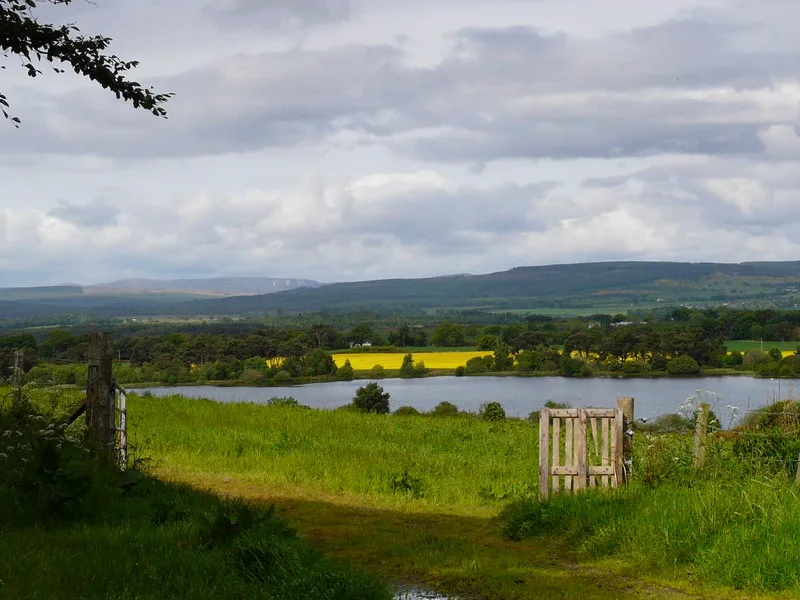
Loch Eye Curling Pond1,8 km
Buildings nearby
Fearn Telephone Exchange1,8 km
Control Tower2,3 km
Allan House3,5 km
Canals nearby
The Canal2,9 km
Commercial areas nearby
Fearn Service Station1,7 km
Drains nearby
Inver Burn3,7 km
Farmyards nearby
Balinroich3,7 km
Industrial areas nearby
Cadboll Industrial Estate3,8 km
Nature reserves nearby
Talich Wildlife Reserve1,8 km
Places of worship nearby
Fearne Abbey2,3 km
Post offices nearby
Fearn Post Office2,0 km
Railway lines nearby
Far North Line2,9 km
Ruins nearby
Knocknahar Farm2,8 km
Sports centres nearby
Tain Motorcross Track2,4 km
Wetlands nearby
Inver Bay2,9 km
Woodlands nearby
Mounteagle1000 m
Calrossie Woods3,9 km
Other nearby
Summerton Cottage2,9 km
Summerton House3,1 km
Sea View3,2 km
Inverbrae3,2 km
| Length | 2.4 |
|---|---|
| Area | 158 km² |
| Elevation | 12 m |
| Heritage designation | Ramsar site |
| Located in | Highland |
| Country | United Kingdom |
 Public transport map Highland Legend
| Railway | |
| Bus | |
| Tram |
 Cycling map Highland Legend
| Cycle path | |
| Cycle lane on road | |
| Cycling on bus lane | |
| Bicycle street | |
| Cyclists allowed | |
| Cyclists allowed, good surface | |
| No cycling | |
| Cobblestones |
| Long-distance cycle route | (depending on scale) | |
| Long-distance cycle route |
 Walking map Highland Legend
| Path |
| Long-distance hiking trail | (depending on scale) | |
| Long-distance hiking trail | ||
| No pedestrians |