
Loch Fleet National Nature Reserve in Highland
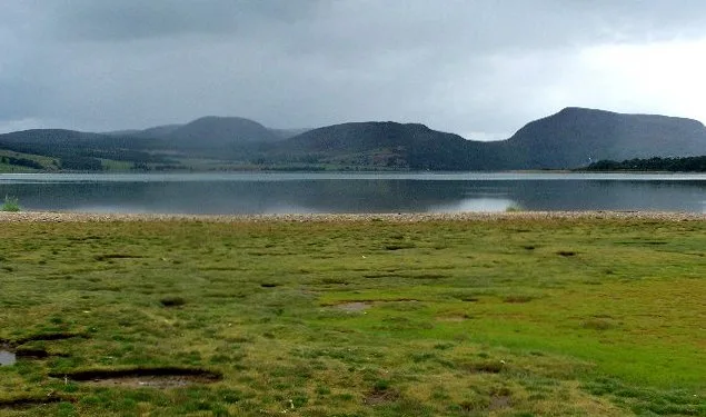
Loch Fleet National Nature Reserve in Highland is a nature reserve (NatureScot) 🌐. Loch Fleet National Nature Reserve is also known as Tèarmann Nàdair Nàiseanta Loch Fleòid. Loch Fleet National Nature Reserve is near Kirkton Road. Ⓦ.
- Alternative Name
- Tèarmann Nàdair Nàiseanta Loch Fleòid
- Leisure
- nature reserve
- Operator
- NatureScot
- Website
- https://www.nature.scot/enjoying-outdoors/places-visit/nnrs/loch-fleet-national-nature-reserve
Image
Roads nearby
Culmaily Bridge1,1 km
Kirkton RoadKirkton Level Crossing
1,1 km
Turn 71,9 km
Start/Finish Straight1,9 km
Golf Straight1,9 km
Turn 21,9 km
Short Course1,9 km
Club Straight1,9 km
Caravan Straight2,0 km
Turn 12,0 km
Outer Circuit2,0 km
Turn 62,0 km
Turn 32,0 km
Back Straight2,0 km
Turn 52,0 km
Turn 42,0 km
Queen's Drive2,3 km
Creag Bheag Climbers Path2,3 km
Mound Sluice Keepers Road2,7 km
Drummuie Brae2,7 km
The MoundThe Mound
2,9 km
Golspie Business Park3,0 km
Tarbat View3,0 km
Lundie Drive3,1 km
Golspie Business Park U15323,1 km
Clachan Way3,1 km
Drummuie Terrace3,1 km
Church StreetMcGintys, John M Munro, Feel Good Ink, West End Garage, Old Manse, Ardgay, The Fishertown Inn, Cromarty Cafe, Cutting Room, Post Office, Jemimaville, Highland Dry Cleaners, The Dornoch Inn, Durchnoch MOT Centre, Coach House, Outside the Box, North Coast Cars, Ferguson Medical Centre
3,2 km
Ben Bhraggie Drive3,3 km
Station RoadGolspie, Hospital Road, Mallaig, The Tea Garden Cafe, Marine Hotel, Marine Bar, The Co-operative Food, The Fishmarket, Ticket Office, J. Lawrie & Sons, An Cala, The Mallaig Cafe, Art Gallery and Crafts, Mallaig Toys & Gifts, The Highlands Koo Company, The Mission Bunkhouse, RNLI Shop, Welcome to Mallaig, Boots, Cromarty Bakery Shop, Nethy Bridge Hotel, Spean Bridge, Old Station Restaurant, Kyle of Lochalsh, Lochalsh Butchers, Kyle Post Office, Kyle Surgery, Mace, Skye & Lochalsh Dental Practice, Skye Bridge Distillery, The Islander, The Silver Seal, rightmedicine Pharmacy, Skye Car Hire, Skye Bridge Hotel, Central Filling Station, M & D MacLeod Funeral Directors, Achnasheen Terraces, Bridgend Filling Station, Beaufort Gardens, Beauly Laundry, Fort Augustus, The Lovat, Richmond House Hotel Bar & Restaurant, Angela‘s Giftshop, Richmond House Hotel, Bank House B&B, Kings Inn B&B, Beaufort House B&B, Caledonian Cottage B&B, Lorien House B&B, The Brasserie, Beauly, Beauly Railway Station, Dalwhinnie, Station Road End, 11. The Long Goodbye, Station Road, Conon Bridge, Arisaig, The Speyside Way, The Brown Trout, Glenglass Road Junction, Dingwall Railway Station, Kylelachin B&B, Garfield Guest House, Urrard B&B, Bus Shelter, Heather hut, Garve, Newtonmore, Badenoch, Melon Patch B&B, Istanbul Kebab House, Carrbridge Artists Studio, The Old Bank House, Visitor Centre, Lochluichart, Plockton, Plockton Car Park, Tain, Station Road Entrance, Platform 1864, Achnasheen, Achnasheen Post Office, Station, Morrisons Daily, Church, Ardersier Memorial Fountain, The Gun Lodge, Inchrye B&B, McLeod Farm Centre, Ardersier Station Road, Police Station, Ardersier Post Office, SPAR, Wendys Cafe, Post Office, Star Inn, Waterside, Kyle Station Museum
3,3 km
Ferry RoadHarry Gow, John M. Munro Ltd, Dingwall, Moid Inbhir Pheofharain, Parking Place, Littleferry
3,3 km
Abandoned railways nearby
Dornoch Branch2,3 km
Body of waters nearby
Loch Fleet1000 m
Loch Lunndaidh3,0 km
Buildings nearby
Skelbo Castle Cottage2,4 km
Skelbo2,6 km
Caravan site nearby
Golspie Links Caravan Park2,2 km
Cliffs nearby
Creag Bheag1,9 km
Commercial areas nearby
Golpsie Business Park3,1 km
Farmyards nearby
Skelbo Farm2,7 km
Grasslands nearby
Coul Links2,3 km
Hotels nearby
The Golf Links Hotel3,4 km
Houses nearby
Drrummuie House2,7 km
Office buildings nearby
Drummuie Offices2,7 km
Places of worship nearby
Golspie Free Church of Scotland3,3 km
Railway lines nearby
Far North Line1,9 km
Sports centres nearby
North of Scotland Kart Club2,1 km
Sports pitches nearby
Golspie Stafford F.C.3,3 km
Streams nearby
Culmaily Burn1,4 km
| Located in | Highland |
|---|---|
| Country | United Kingdom |
Public transport map Highland Legend
| Railway | |
| Bus | |
| Tram |
Cycling map Highland Legend
| Cycle path | |
| Cycle lane on road | |
| Cycling on bus lane | |
| Bicycle street | |
| Cyclists allowed | |
| Cyclists allowed, good surface | |
| No cycling | |
| Cobblestones |
| Long-distance cycle route | (depending on scale) | |
| Long-distance cycle route |
Walking map Highland Legend
| Path |
| Long-distance hiking trail | (depending on scale) | |
| Long-distance hiking trail | ||
| No pedestrians |