
Loch na Mnà in Highland
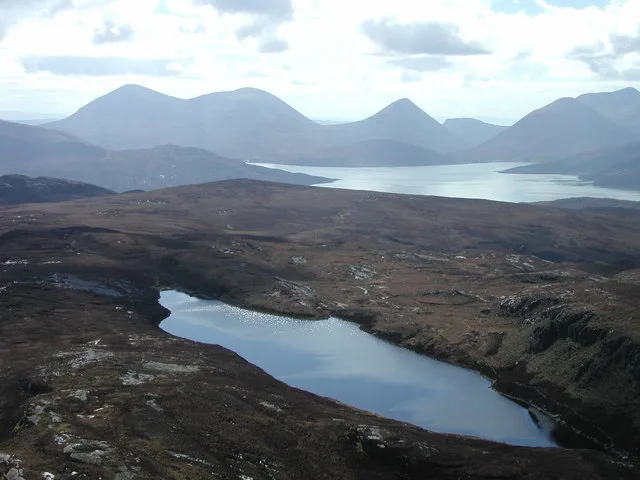
Loch na Mnà in Highland is a body of water.
- Nature
- body of water
Image
Roads nearby
Dùn Caan path1,2 km
General's Path2,8 km
Castle RoadGarth Hotel, Service Point, Park School, McGinty's, ArtiClan
2,9 km
Balachurn3,0 km
Oskaig RoadOskaig
3,2 km
Pàirc nam Fiadh3,3 km
Henderson's Bridge3,3 km
Pàirc nan Cotaichean3,3 km
Hallaig RoadGlen, North Fearns
3,3 km
Emigrants Path3,4 km
Mill RoadScorrybreck Road, opp Scorrybreck Road, Rosemarkie Community Toilets, Mill Road, St Andrews Drive, Dunvegan Bakery and Coffee Shop
3,5 km
Inverarish TerraceRaasay Community Stores
3,7 km
School Park3,8 km
Mill PlaceInverarish
3,8 km
Attraction nearby
Isle of Raasay Distillery3,5 km
Baies nearby
Holoman Bay3,0 km
Body of waters nearby
Loch na Clarlaich800 m
Loch a' Chada-chàrnaich900 m
Loch na Meilich1,1 km
Loch a' Storaibh1,5 km
Loch Meall Daimh1,7 km
Loch Eadar Dà Bhaile3,2 km
Loch an Rathaid4,0 km
Buildings nearby
Glen Lodge2,8 km
Creachan Cottage2,8 km
Dùn Bhorghadail, Broch3,3 km
Raasay Telephone Exchange3,6 km
Inverarish Mill3,7 km
Cemeteries nearby
Old Cemetery3,7 km
Clinics nearby
Raasay Clinic3,8 km
Community centres nearby
Raasay Community Hall3,8 km
Forests nearby
A' Choille Mhòr2,0 km
Orchard Wood3,2 km
Coille Bhorghadail3,7 km
Guest house nearby
Allt Arais3,5 km
Oystercatcher House3,7 km
Hostel nearby
Raasay Youth Hostel2,8 km
Houses nearby
Old Free Church Manse3,1 km
Jeweller's nearby
Silver Grasshopper3,6 km
Places of worship nearby
Free Church Of Scotland3,2 km
Free Presbyterian Church of Scotland3,7 km
Streams nearby
Allt Hallaig1,3 km
Inverarish Burn1,6 km
Allt Fearns2,1 km
Allt Thòmais2,8 km
Storab Burn2,8 km
Holoman Burn2,9 km
Allt na Mòine2,9 km
Eyre Burn3,9 km
| Located in | Highland, Portree |
|---|---|
| Country | United Kingdom |
 Public transport map Highland Legend
| Railway | |
| Bus | |
| Tram |
 Cycling map Highland Legend
| Cycle path | |
| Cycle lane on road | |
| Cycling on bus lane | |
| Bicycle street | |
| Cyclists allowed | |
| Cyclists allowed, good surface | |
| No cycling | |
| Cobblestones |
| Long-distance cycle route | (depending on scale) | |
| Long-distance cycle route |
 Walking map Highland Legend
| Path |
| Long-distance hiking trail | (depending on scale) | |
| Long-distance hiking trail | ||
| No pedestrians |