
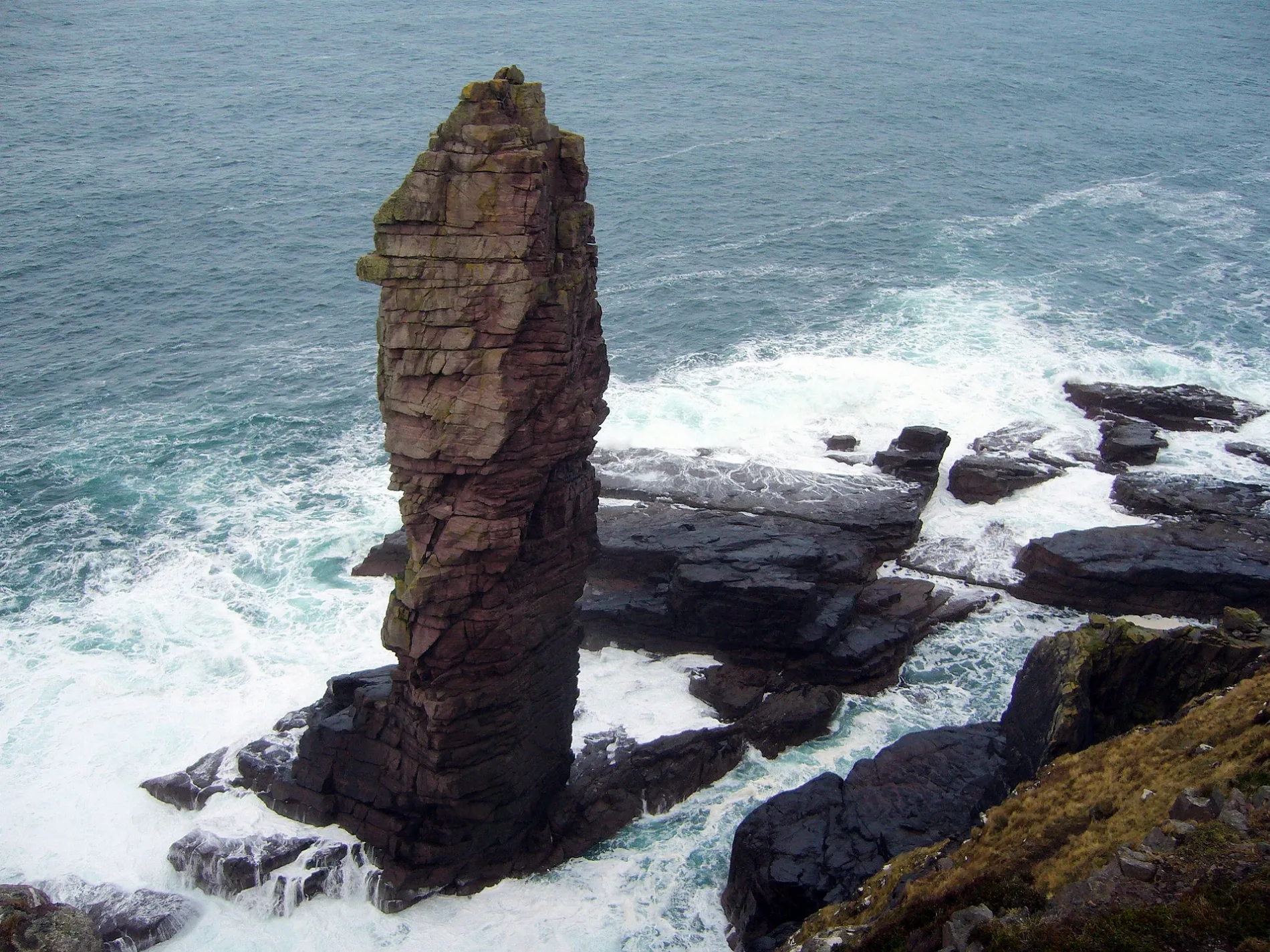
Old Man of Stoer in Highland
Old Man of Stoer in Highland is a Climbing crag. Old Man of Stoer is also known as Bodach an Stòir. Old Man of Stoer is near Stoerhead Lighthouse Road. Ⓦ.
- Leisure
- climbing_crag
- Nature
- cliff
Image
Roads nearby
Dhunan Road2,7 km
Stoerhead Lighthouse Road3,0 km
Culkein North RoadShore Road
3,0 km
Achnacarnain RoadAchnacarnin
4,1 km
Clashnessie Road5,5 km
Lochend6,2 km
Stoer Church Road7,1 km
Stoer Cemetery Road7,3 km
Clachtoll Peat Road9,0 km
Nature nearby
Eilean nan G8,0 km
Eilean na Ligheach8,3 km
Beaches nearby
Clashnessie Bay5,9 km
Clachtoll Beach8,4 km
Body of waters nearby
Loch Neil Bhain5,7 km
Loch a' Chnoic6,2 km
Lochain nan Ealachan6,6 km
Loch an Easain7,0 km
Loch an Aigeil7,6 km
Lochan Fearba8,5 km
Loch Leathad nan Aighean8,7 km
Maiden Loch9,5 km
Loch na Creige Leithe9,6 km
Buildings nearby
Stoer Head Lighthouse2,6 km
Heatherbank5,3 km
Stoer Telephone Exchange5,4 km
Assynt Crofters Trust6,1 km
Highland Council6,3 km
Stoer House7,0 km
Stoer Lodge7,2 km
Campsite nearby
Clachtoll Beach Campsite8,1 km
Cemeteries nearby
Stoer Cemetery7,3 km
Chalet nearby
Assynt Cottage3,8 km
Community centres nearby
Rhu Stoer Village Hall6,1 km
Convenience stores nearby
Flossie's Beach Store8,2 km
Gift shops nearby
The Culkein Store3,4 km
Hostel nearby
Stoer Hostel5,8 km
Places of worship nearby
Stoer Church7,1 km
Residential areas nearby
Clachtoll8,3 km
Residential buildings nearby
Solus na Mara3,7 km
Rivers nearby
Amhainn Claisan Eas5,9 km
Ruins nearby
Clachtoll Broch7,7 km
Streams nearby
Alltan na Fithriach2,9 km
Allt a' Mhi Runaich6,0 km
Garbh Allt6,3 km
Altan nan Iall6,8 km
Other nearby
Eilean Chrona5,3 km
Eilean nan Gobhar8,0 km
Eilean nan Uan8,1 km
Eilean Loisgte8,4 km
| Located in | Highland |
|---|---|
| Country | United Kingdom |
| Body of water | Atlantic Ocean |
| Native label | Bodach an Stòir |
| Official name | Old Man of Stoer |
| Location | Sutherland |
 Public transport map Highland Legend
| Railway | |
| Bus | |
| Tram |
 Cycling map Highland Legend
| Cycle path | |
| Cycle lane on road | |
| Cycling on bus lane | |
| Bicycle street | |
| Cyclists allowed | |
| Cyclists allowed, good surface | |
| No cycling | |
| Cobblestones |
| Long-distance cycle route | (depending on scale) | |
| Long-distance cycle route |
 Walking map Highland Legend
| Path |
| Long-distance hiking trail | (depending on scale) | |
| Long-distance hiking trail | ||
| No pedestrians |