
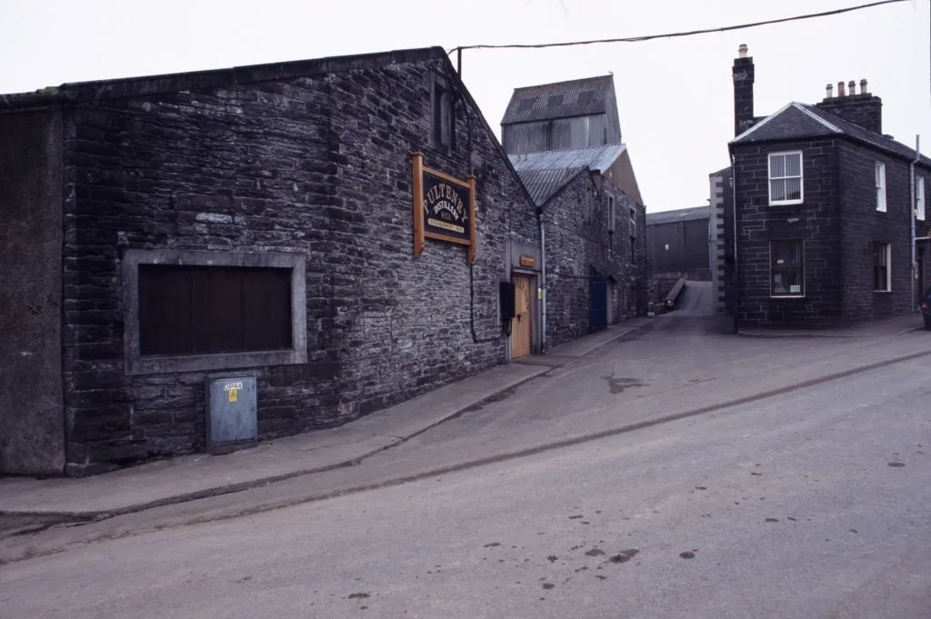
Pulteney Distillery in Highland
Pulteney Distillery in Highland is an industrial area (InterBev (Inver House Distillers)), Huddard Street (KW1 5BA). Pulteney Distillery is also known as Old Pulteney Distillery. Ⓦ.
- Postal Code
- KW1 5BA
- Street
- Huddard Street
- Alternative Name
- Old Pulteney Distillery
- Land Use
- industrial area
- Operator
- InterBev (Inver House Distillers)
- Website
- https://www.oldpulteney.com/
Image
Roads nearby
Roxburgh Road50 m
Oldwick RoadOld Wick Road
100 m
Albert StreetGlen Ridding Dental Practice, West End
100 m
Huddart StreetBarrigal Hall, Pulteney Distillery Visitor Centre
200 m
Cairndhuna TerraceCairndhuna Terrace
200 m
Murchison Street250 m
Harrow Terrace250 m
Wellington Street250 m
Kinnaird Street250 m
Rutherford Street300 m
Nicolson Street300 m
Harrow Hill300 m
Vansittart Street300 m
North Murchison Street350 m
Barrogill Street350 m
Macrae StreetMacrae Street
350 m
Royal PlaceHuddard Street
350 m
Swanson Avenue400 m
Bexley Terrace400 m
Battery RoadBattery Road, Shillinghill
400 m
Kennedy Terrace400 m
Harbour RoadCaledonian MacBrayne, Ferry Terminal, Caithness SeaCoast tours, Old Fog Cannon
400 m
Scarfs Craig Place450 m
Smith TerraceSmith Terrace, Mountain Dew Bar, Camping Grounds, Lidl, Pennyland House B&B
450 m
Argyle SquarePulteneytown
450 m
Grant StreetDewar Memorial Fountain
450 m
North View450 m
Macarthur Street450 m
Upper Dunbar Street500 m
Wellington AvenueWellington Avenue
500 m
South Quay Road500 m
Brown Place500 m
Northcote StreetFrancis Street
500 m
Swanson Drive500 m
Loch StreetThe Francis Street Club
500 m
Breadalbane Terrace500 m
Harbour Terrace550 m
Carnaby Road550 m
Sutherland Street600 m
Anne's Crescent600 m
Mill Lade Avenue600 m
South Head650 m
Bleacherses nearby
North Stand500 m
Farmyards nearby
Seaview Farm500 m
Industrial areas nearby
Disused South Primary School200 m
Places of worship nearby
East Caithness Church of Scotland550 m
Recreation grounds nearby
Bignold Park450 m
Sports centres nearby
Harmsworth Park550 m
Streams nearby
Mill Lade600 m
| Inception | 1826 |
|---|---|
| Located in | Highland, Wick |
| Country | United Kingdom |
 Public transport map Highland Legend
| Railway | |
| Bus | |
| Tram |
 Cycling map Highland Legend
| Cycle path | |
| Cycle lane on road | |
| Cycling on bus lane | |
| Bicycle street | |
| Cyclists allowed | |
| Cyclists allowed, good surface | |
| No cycling | |
| Cobblestones |
| Long-distance cycle route | (depending on scale) | |
| Long-distance cycle route |
 Walking map Highland Legend
| Path |
| Long-distance hiking trail | (depending on scale) | |
| Long-distance hiking trail | ||
| No pedestrians |