
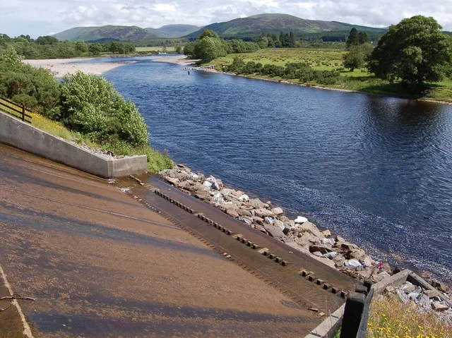
River Lochy in Highland
River Lochy in Highland is a river. River Lochy is also known as Abhainn Lòchaidh. Ⓦ.
- Waterway Type
- river
Image
Roads nearby
Camisky Road1,1 km
Happy ValleyHappy Valley, Factor's Cottage, Factor's Inn
2,0 km
Fort William - Nevis Range cycle trackStramash, Lochy Bridge, The Highland Soap Company Visitor Centre, Shell, Lochy Bridge (Glenmhor terrace), Torlundy
2,2 km
Bridge of LundyTorlundy
2,2 km
Tower Ridge Courtyard2,2 km
Victoria WalkInverlochy Castle Hotel, Thurso Historic Walk, Victoria Walk, The Blue Door diner
2,6 km
Ben View Crescent2,7 km
Old Blar Mhor Road3,0 km
Am Blar Mhor Road3,0 km
Locheil Crescent3,1 km
Crown Cottages3,1 km
Blar Mhor Roundabout3,2 km
Road to the IslesNTS Glenfinnan Monument, Strathan 9m, Mallaig Library, Mallaig, UHI West Highland - Mallaig, A Necklace Of Volcanos (Geopark 13), Glasnacardoch, Glenfinnan, Glenfinnan Station & Viaduct Trail Car Park, Station Road, Caledonian Canal, B8004 Junction, Corpach, Co-op Food, Tradewinds, Corpach Hotel, Hotel, Museum, Co-op, Drumfada Terrace, Paper Mill, Sawmill, Annat View, Farrow Drive, Beasdale, Station, Larachmore Garden, The School House, Glenfinnan Coffee, Slatach Road End, Camagael Road, Loch Eil Outward Bound, Road End, East Road End, Kilmallie Hall, Farm Foods, Locheilside, Post Office, Kinlocheil, West Road End, Locheilside Station, Lochailort, Monument, Viewpoint Monument and Viaduct, Top Up Tap, Trislaig Road End, J J's Cafe', Farmfoods, Primary School, Primary School Road End, Hillview Drive, Banavie, Wilson Way, Annat Industrial Estate, Harbro Country Stores, Linnhe Caravan Park, Midfield B&B, Lochailort Junction
3,2 km
Great Glen Way - Slighe a' Ghlinne MhòirGairlochy, Canal Bridge, Locks, lighthouses ... and a dark goddess?, Forestry Houses, Aberchalder Swing Bridge, Laggan Locks informal campsite, Le Boat, Laggan Locks Take Away, Leitirfearn, Leitirfearn Trailblazer Rest, Welcome to Leitirfearn Trailblazer Rest, Invergarry Station Project, Clunebeg Lodge, fairy dell, The Viewcatcher, Stone Cave, Secrets of the only island in Loch Ness, Loch Oich Food Co., Seven Heads Store, Drynachan Bed And Breakfast, Troll Bridge, Moy Bridge informal campsite, Neptune's Staircase, Eagle Barge Inn, Great Glen Ways, Great Glen Way, Old Fort William, Kiltane of Scotland, Caledonian Canal Centre, Bus Stance, Monster Fish and Chips, Wash Me, Top Up Tap, Great Glen, Spar, Euronet, Miele's Gelato, Road End, Grotaig, Cullochy Lock, Kytra Lock
3,2 km
Kilmallie RoadCuil Na Sithe, Lochyside RC Primary School, Caol, Health Centre, Co-op, No 238, No 236, Glenmallie Rd, Rosscott House
3,3 km
Witch's Brew3,3 km
Puggy Line3,3 km
Caol Industrial EstateBanavie
3,3 km
Abandoned railways nearby
Lochaber Narrow Gauge Railway3,3 km
Body of waters nearby
Allt Sheangain350 m
Lochan nam Bèistean1,2 km
Buildings nearby
Torlundy Courtyard2,2 km
North Steading2,2 km
Hill Farm2,3 km
Inverlochy Castle Farm2,7 km
Ben View2,8 km
Fort William Golf Club2,9 km
SEPA3,2 km
Canals nearby
Caledonian Canal350 m
Car dealerships nearby
Vauxhall3,3 km
Caravan site nearby
Lochy Holiday Park2,9 km
Farmyards nearby
Strone Farm2,8 km
Gardens nearby
Walled Garden2,3 km
Guest house nearby
Avilon2,3 km
Glen Loy Lodge3,0 km
Hostel nearby
Chase The Wild Goose3,1 km
Hotels nearby
The Moorings3,0 km
Industrial areas nearby
Highland Council TEC Services Yard3,2 km
Carr's Corner Industrial Estate3,3 km
Meadows nearby
Dail a' Chait450 m
Railway lines nearby
West Highland Line3,2 km
Railway stations nearby
Banavie Signal Box3,2 km
Razed railways nearby
Banavie Pier Branch2,8 km
Rivers nearby
Allt Achadh na Dalach1,6 km
River Lundy2,3 km
River Loy3,0 km
Streams nearby
Allt na Caillich2,8 km
Wetlands nearby
Am Blàr Mòr2,8 km
Corpach Moss3,2 km
| Located in | Highland |
|---|---|
| Country | United Kingdom |
| Mouth | inner Loch Linnhe |
 Public transport map Highland Legend
| Railway | |
| Bus | |
| Tram |
 Cycling map Highland Legend
| Cycle path | |
| Cycle lane on road | |
| Cycling on bus lane | |
| Bicycle street | |
| Cyclists allowed | |
| Cyclists allowed, good surface | |
| No cycling | |
| Cobblestones |
| Long-distance cycle route | (depending on scale) | |
| Long-distance cycle route |
 Walking map Highland Legend
| Path |
| Long-distance hiking trail | (depending on scale) | |
| Long-distance hiking trail | ||
| No pedestrians |