
Saint Andrew's in Highland
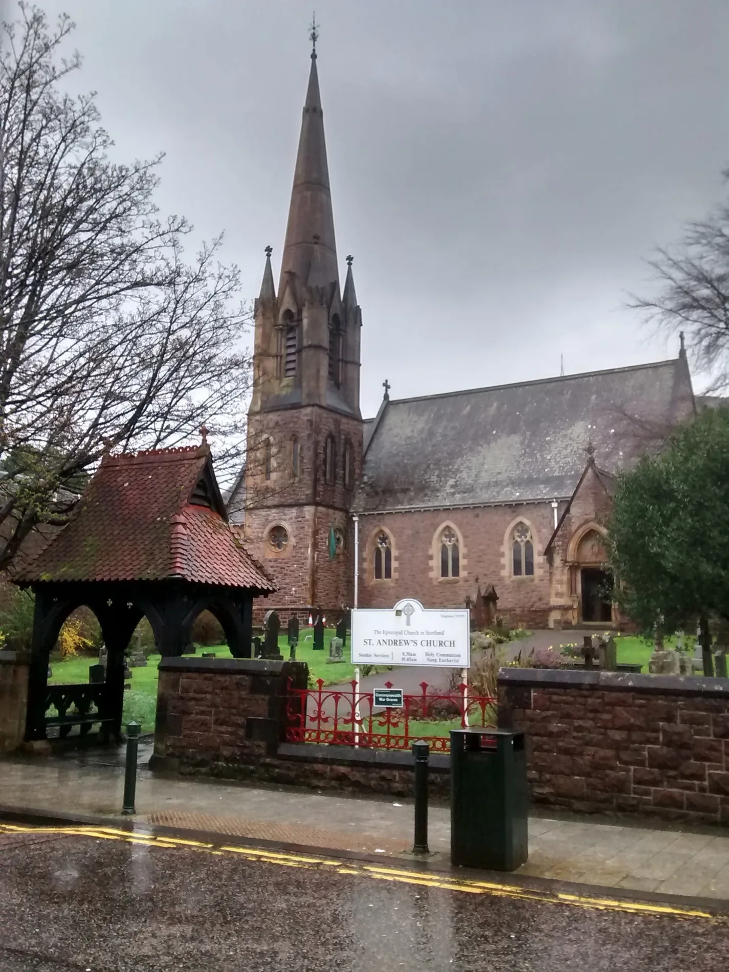
Saint Andrew's in Highland is a church. It is near Fraser Square and is also known as Fort William, High Street, St Andrew's Episcopal Church. The church is a listed building. Ⓦ.
- Amenity
- place of worship
- Building Type
- church
- Operator
- Scottish Episcopal Church
- Wheelchair Access
- no
Image
Roads nearby
Parade RoadGo Outdoors Express
50 m
Bank StreetBank Street Lodge, The Royal Hotel, Tianavaig, RBS, Post Office, Carmina Gadelica, Taste of India
100 m
Dudley RoadStables Restaurant, McCallum Art House
100 m
Duff LaneInternational Food Store, Boots
100 m
Fassifern RoadAldourie B&B, Constantia B&B, Caberfeidh n°1 B&B, Gara Ni B&B, Caberfeidh Lodge, St Marys School, Anagrae B&B, The Hub
100 m
Fraser Square100 m
MacIver LaneAbi's Takeaway, Tesco Express
100 m
Cinema LaneCafé Mango, Sleeping Beauty Salon, Faith Mission Centre, Abi's Kebabs
150 m
Ainslie LaneMarshall & Pearson
150 m
Rankin LaneNevisport, The Parade, Fort William Library
150 m
Cameron LaneHighland Cinema, Ladbrokes
200 m
Cameron SquareFort William, West Highland Museum, Garrison West, The Bronze Ford, Highland Cinema Café
200 m
Hill Road200 m
Linnhe RoadBest Western Imperial Hotel, Rio Pizzeria
200 m
Kennedy LaneThe Volunteer Arms, William Hill
200 m
Middle StreetAlexandra Hotel, Middle St, Cozy Cafe, Fort William Delivery Office
200 m
Victoria RoadSt Marys School, Saint Andrew's Guest House, Stobahn B&B, Ardmory B&B, Gulf, Road End, Victoria Garage, Gleaner, Sutherland Arms
250 m
Alma RoadCraig Nevis, Guisachan Guesthouse, Alma Road, B&B
250 m
Macfarlane WayScotRail, Lochaber Cafe, Fort William Bus Station 5/6, Fort William Bus Station 7/8, Fort William Supercharger, Fort William Bus Station, Fort William Bus Station 3/4, The Café, Fort William Bus Station 1/2, MacFarlane Way;Bus Station, Signal Box Shop, Photo-Me, Bus Station, Wash Me
250 m
Monzie SquareBen Nevis Book Corner
250 m
Pine Grove300 m
Pine Grove Court300 m
An Aird Road350 m
Macrae's Lane350 m
Cameron RoadGlenmoidart B&B, Ardblair B&B
400 m
Gordon Square - Ceàrnag GhòrdainTravelodge, End of the West Highland Way, Top Up Tap, Well-earned rest
450 m
Gordon SquareBlack Isle Bar - Fort William
450 m
Carmichael Way450 m
Station SquareCamusnagaul passenger ferry, Crannog Seafood Restaurant, Camusnagaul Ferry, Middle St, The Old Station Bar-Ber, Dingwall, Brora
450 m
An Aird Roundabout450 m
Great Glen Way - Slighe a' Ghlinne MhòirGreat Glen Way, Old Fort William, Gairlochy, Canal Bridge, Locks, lighthouses ... and a dark goddess?, Forestry Houses, Aberchalder Swing Bridge, Laggan Locks informal campsite, Le Boat, Laggan Locks Take Away, Leitirfearn, Leitirfearn Trailblazer Rest, Welcome to Leitirfearn Trailblazer Rest, Invergarry Station Project, Clunebeg Lodge, fairy dell, The Viewcatcher, Stone Cave, Secrets of the only island in Loch Ness, Loch Oich Food Co., Seven Heads Store, Drynachan Bed And Breakfast, Troll Bridge, Moy Bridge informal campsite, Neptune's Staircase, Eagle Barge Inn, Great Glen Ways, Kiltane of Scotland, Caledonian Canal Centre, Bus Stance, Monster Fish and Chips, Wash Me, Top Up Tap, Great Glen, Spar, Euronet, Miele's Gelato, Road End, Grotaig, Cullochy Lock, Kytra Lock
450 m
Union RoadGowan Brae House
500 m
Buildings nearby
Parade House100 m
Citizens Advice Bureau100 m
Loch Linnhe Buildings150 m
An Dorus Dearg400 m
Waverley Court450 m
Fort William Telephone Exchange500 m
Fitness stations nearby
Three Wise Monkeys300 m
Funeral directors nearby
John McLellan Funeral Directors100 m
Grass nearby
Fort William Old Fort350 m
Hotels nearby
Highland Hotel400 m
Parks nearby
Parade Gardens150 m
Places of worship nearby
Duncansburgh MacIntosh Church150 m
Free Presbyterian church of Scotland250 m
Playgrounds nearby
Pinegrove Playground350 m
Razed railways nearby
West Highland Line150 m
Residential areas nearby
Fulton House450 m
Other nearby
The walls of Fort William350 m
| Heritage designation | category A listed building |
|---|---|
| Located in | Highland, Fort William |
| Country | United Kingdom |
 Public transport map Highland Legend
| Railway | |
| Bus | |
| Tram |
 Cycling map Highland Legend
| Cycle path | |
| Cycle lane on road | |
| Cycling on bus lane | |
| Bicycle street | |
| Cyclists allowed | |
| Cyclists allowed, good surface | |
| No cycling | |
| Cobblestones |
| Long-distance cycle route | (depending on scale) | |
| Long-distance cycle route |
 Walking map Highland Legend
| Path |
| Long-distance hiking trail | (depending on scale) | |
| Long-distance hiking trail | ||
| No pedestrians |