
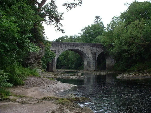
Spean Bridge in Highland
Spean Bridge in Highland is a two-lane, lit expressway. The road has sidewalks (asphalt). There is no cycle path. This road is part of the long-distance road "A82". The bus lines 919 and 915 run along this road. Spean Bridge is also known as Spean Bridge over River Spean. In the vicinity, there are among other things post office and restaurant. The nearest bus stop in the vicinity is Spean Crescent (approx. 250 m away).
- Road Type
- expressway
- Lanes
- 2
- Speed Limit
- 30 mph
- Operator
- Transport Scotland
Image
Roads nearby
Dalour CottagesDalour Cottages
150 m
Aonachan Gardens150 m
Nursery Park150 m
Altour Gardens200 m
Spean LodgeRiverside Lodge Garden
200 m
Altour Road200 m
Burnside250 m
The Galleries250 m
Spean CrescentSpean Crescent
300 m
Morrison Avenue350 m
Station RoadSpean Bridge, Old Station Restaurant, Mallaig, The Tea Garden Cafe, Marine Hotel, Marine Bar, The Co-operative Food, The Fishmarket, Ticket Office, J. Lawrie & Sons, An Cala, The Mallaig Cafe, Art Gallery and Crafts, Mallaig Toys & Gifts, The Highlands Koo Company, The Mission Bunkhouse, RNLI Shop, Welcome to Mallaig, Boots, Cromarty Bakery Shop, Nethy Bridge Hotel, Kyle of Lochalsh, Lochalsh Butchers, Kyle Post Office, Kyle Surgery, Mace, Skye & Lochalsh Dental Practice, Skye Bridge Distillery, The Islander, The Silver Seal, rightmedicine Pharmacy, Skye Car Hire, Skye Bridge Hotel, Central Filling Station, M & D MacLeod Funeral Directors, Achnasheen Terraces, Bridgend Filling Station, Beaufort Gardens, Beauly Laundry, Fort Augustus, The Lovat, Richmond House Hotel Bar & Restaurant, Angela‘s Giftshop, Richmond House Hotel, Bank House B&B, Kings Inn B&B, Beaufort House B&B, Caledonian Cottage B&B, Lorien House B&B, The Brasserie, Beauly, Beauly Railway Station, Dalwhinnie, Station Road End, 11. The Long Goodbye, Station Road, Conon Bridge, Arisaig, The Speyside Way, Golspie, Hospital Road, The Brown Trout, Glenglass Road Junction, Dingwall Railway Station, Kylelachin B&B, Garfield Guest House, Urrard B&B, Bus Shelter, Heather hut, Garve, Newtonmore, Badenoch, Melon Patch B&B, Istanbul Kebab House, Carrbridge Artists Studio, The Old Bank House, Visitor Centre, Lochluichart, Plockton, Plockton Car Park, Tain, Station Road Entrance, Platform 1864, Achnasheen, Achnasheen Post Office, Station, Morrisons Daily, Church, Ardersier Memorial Fountain, The Gun Lodge, Inchrye B&B, McLeod Farm Centre, Ardersier Station Road, Police Station, Ardersier Post Office, SPAR, Wendys Cafe, Post Office, Star Inn, Waterside, Kyle Station Museum
350 m
West TirindrishWest Tirindish, Coire Glas Guest House
650 m
Achnabobane RoadCamden House
2,6 km
Leanachan RoadLeanachan
2,9 km
Insh RoadThe Village Fryer, Commando Bar, Spean Bridge
2,9 km
General Wade's Military RoadHouses, Saw Mill, Suidhe Chuimein
3,1 km
Inverroy RoadUpper Inverroy
3,4 km
Bridge 17?4,4 km
Bridge 164,4 km
Glen Gloy RoadGlen Gloy
4,7 km
Abandoned railways nearby
Spean Bridge to Fort Augustus Branch4,6 km
Attraction nearby
Spean Bridge Mill100 m
Buildings nearby
Spean Bridge Telephone Exchange400 m
Club House400 m
Springburn Farm2,9 km
Mucomir Power Station4,4 km
Cafés nearby
The Bridge Cafe350 m
Commercial buildings nearby
Rosebank Guest House250 m
Community centres nearby
Spean Bridge Community Centre300 m
Convenience stores nearby
Spar100 m
Farmyards nearby
Great Glen Cattle Ranch3,6 km
Golf courses nearby
Spean Bridge Golf Club400 m
Guest house nearby
Inverour Guest House100 m
Mahaar250 m
Corrieview Lodges400 m
Distant Hills500 m
Tirindrish House1,2 km
Hotel nearby
Spean Bridge Hotel200 m
Aonach Mor Hotel350 m
Places of worship nearby
Saint Joseph's Catholic Church250 m
Kilmonivaig Parish Church950 m
Railway lines nearby
Spean Viaduct1,7 km
West Highland Line2,9 km
Rivers nearby
River Spean2,2 km
Uisge Dudh4,0 km
Allt Coire an Eoin4,3 km
Allt Leachdach4,4 km
Streams nearby
Allt an Loin3,1 km
Allt a' Bhalbhain4,5 km
| Located in | Highland, Kilmonivaig |
|---|---|
| Country | United Kingdom |
| Crosses | River Spean |
| Carries thoroughfare | A82 road |
 Public transport map Highland Legend
 | Railway | |
| Bus | |
| Tram |
 Cycling map Highland Legend
 | Cycle path | |
| Cycle lane on road | |
| Cycling on bus lane | |
| Bicycle street | |
| Cyclists allowed | |
| Cyclists allowed, good surface | |
| No cycling | |
| Cobblestones |
| Long-distance cycle route | (depending on scale) | |
| Long-distance cycle route |
 Walking map Highland Legend
 | Path |
| Long-distance hiking trail | (depending on scale) | |
| Long-distance hiking trail | ||
| No pedestrians |