
Glenesk Viaduct in Midlothian
Glenesk Viaduct in Midlothian is a railway line (Network Rail, 1435 mm, branch line). The train routes Tweedbank => Edinburgh and Edinburgh => Tweedbank run along this road. Glenesk Viaduct is also known as Edinburgh and Dalkeith Railway, Glenesk Bridge. Ⓦ.
- Speed Limit
- 55 mph
- Operator
- Network Rail
Image
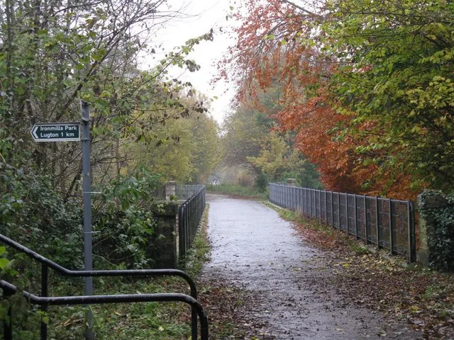
Veterinary clinic
Bus stops
Roads nearby
Melville RoadEskbank Court
350 m
Railway Cottages350 m
Eskview Villas350 m
Glenesk Crescent400 m
Weir Court400 m
Avenue Road400 m
Weir Crescent450 m
Eskbank Court450 m
Eskbank RoadGlenesk Crescent, Eskbank Toll, Kings Park, Croft Street, Hampton's, boss barbers, William Purves, M & F Funeral Services, Pendreich Avenue, Viewbank Avenue, Mayshade Garden Centre
450 m
Esk Point450 m
David Mushet Gardens450 m
Church View450 m
Mitchell Street500 m
Lasswade RoadLasswade Road, Costcutter, Three Craws, Eskbank Antiques, Station Road, Haveral Wood, South Melville, Wester Melville
500 m
Cemetery Road500 m
Ironmills Road550 m
Eskview Grove600 m
Waverley Road600 m
Park Road650 m
Esk Place650 m
Parkside Court650 m
Old Edinburgh RoadOld Edinburgh Road, Glebe Street
650 m
Parkside Place650 m
Eskside Court700 m
North WyndNationwide
700 m
Old Dalkeith RoadLugton Brae, Melville Gate Road
700 m
Croft StreetItihaas, Braid Vets
700 m
Edinburgh RoadBridgend Court, Queensway, Cuiken Avenue, Glencorse Barracks, Fisher's Tryst, Golf Club, Milton Bridge, Market Cross Veterinary Clinic, Mauricewood Road, Beeslack High School, Samoa Terrace, Jade Palace, Encee
750 m
Abandoned railways nearby
Glenesk Junction to Dalkeith Branch300 m
Buildings nearby
RP9400 m
Dalkeith Telephone Exchange400 m
Old Water Tower450 m
Car repair shops nearby
Kwik Fit700 m
Cemeteries nearby
Dalkeith Cemetery450 m
Commercial areas nearby
Royal Bank of Scotland Data Centre250 m
Fast food restaurants nearby
Domino's650 m
Parks nearby
Ironmills Park250 m
King's Park550 m
Places of worship nearby
St David's550 m
St John's and Kings Park Parish Church650 m
Dalkeith Baptist Church700 m
Post depots nearby
Dalkeith Delivery Office650 m
Pubs nearby
Harrow Hotel650 m
Railway lines nearby
Borders Railway50 m
Sports centres nearby
Midlothian Indoor Bowling Club450 m
Sports pitches nearby
Dalkeith Bowling Club350 m
Dalkeith Lawn Tennis Club450 m
Buccleuch Bowling Club700 m
Supermarkets nearby
Morrisons650 m
| Inception | 1831 |
|---|---|
| Located in | Midlothian, Dalkeith |
| Country | United Kingdom |
| Crosses | River North Esk |
| Carries thoroughfare | Waverley Route |
 Public transport map Midlothian Legend
| Railway | |
| Bus | |
| Tram |
 Cycling map Midlothian Legend
| Cycle path | |
| Cycle lane on road | |
| Cycling on bus lane | |
| Bicycle street | |
| Cyclists allowed | |
| Cyclists allowed, good surface | |
| No cycling | |
| Cobblestones |
| Long-distance cycle route | (depending on scale) | |
| Long-distance cycle route |
 Walking map Midlothian Legend
| Path |
| Long-distance hiking trail | (depending on scale) | |
| Long-distance hiking trail | ||
| No pedestrians |