
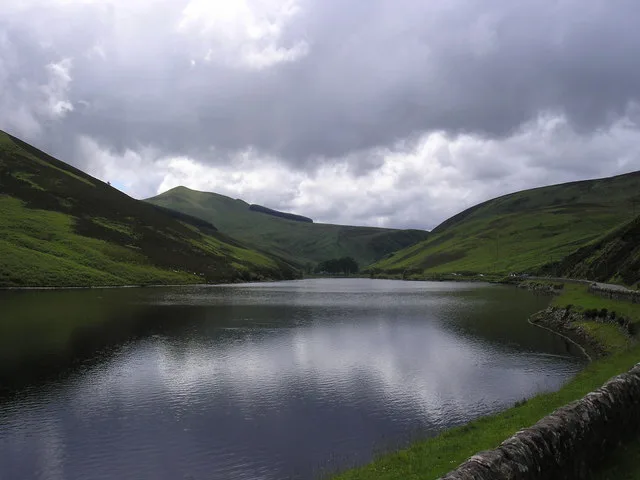
Loganlea Reservoir in Midlothian
Loganlea Reservoir in Midlothian is a fishing. Loganlea Reservoir is also known as Loganlee Reservoir. Loganlea Reservoir is near Johnstons Bridge. Ⓦ.
- Leisure
- fishing
- Nature
- body of water
Image
Bus stops
Roads nearby
Johnstons Bridge550 m
Old Kirk Road1,0 km
Black Hill path1,2 km
Kirk Road1,4 km
Biggar RoadSilverburn, Hopelands Road, Hillend Terminus, Lothianburn
2,2 km
Den's Cleugh2,2 km
Red Road2,6 km
Hopelands RoadHopelands Road
2,8 km
Maiden's Cleugh3,1 km
Knightfield Rig3,1 km
The Quad Track3,2 km
Monk's RigScroggy Hill
3,2 km
Harbour Hill Bypass3,2 km
Ranges Road3,3 km
Phantom's Cleugh3,4 km
Carlops RoadHarlaw Grove, Carsewell
3,5 km
Attraction nearby
Harlaw House Visitor Centre3,3 km
Body of waters nearby
Harlaw Reservoir2,7 km
Spillway2,7 km
Quarrel Burn Reservoir3,4 km
Buildings nearby
Loganlea Reservoir Cottage1000 m
Look About Ye2,8 km
Cafés nearby
Loganlea Fishery500 m
Campsite nearby
Carsewell Guide Camp3,4 km
Farmyards nearby
Eastside2,0 km
Easter Bavelaw2,4 km
Coates3,0 km
Carsewell3,3 km
Gardens nearby
Harlaw Wildlife Garden3,3 km
Houses nearby
Bavelaw Castle2,5 km
Residential areas nearby
Cornton3,8 km
Service buildings nearby
Harlaw Hydro3,3 km
Streams nearby
White Cleugh Burn1,5 km
Logan Burn1,6 km
Silverburn1,9 km
Eastside Burn2,1 km
Eight Mile Burn2,4 km
Lawhead Burn2,5 km
Braidwood Burn2,8 km
Quarrel Burn2,9 km
Walstone Burn3,4 km
Joppa Burn3,6 km
Cornton Burn3,7 km
Valleies nearby
Green Cleugh950 m
Woodlands nearby
Kip's Wood1,7 km
Troughmoss Wood2,8 km
Joppa Wood3,7 km
Other nearby
sheiling700 m
Silverburn Quarry (whinstone, disused)1,8 km
| Protected area | Pentland Hills Regional Park |
|---|---|
| Located in | Midlothian |
| Country | United Kingdom |
 Public transport map Midlothian Legend
| Railway | |
| Bus | |
| Tram |
 Cycling map Midlothian Legend
| Cycle path | |
| Cycle lane on road | |
| Cycling on bus lane | |
| Bicycle street | |
| Cyclists allowed | |
| Cyclists allowed, good surface | |
| No cycling | |
| Cobblestones |
| Long-distance cycle route | (depending on scale) | |
| Long-distance cycle route |
 Walking map Midlothian Legend
| Path |
| Long-distance hiking trail | (depending on scale) | |
| Long-distance hiking trail | ||
| No pedestrians |