
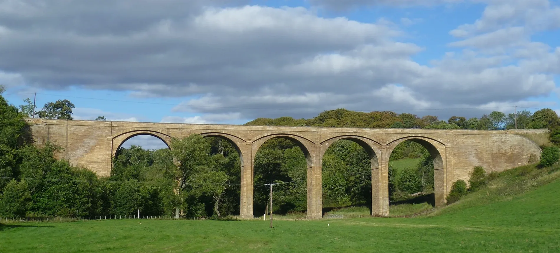
Lothian Bridge in Midlothian
Lothian Bridge in Midlothian is a two-lane, asphalted, unlit expressway. This road is part of the long-distance road "A68". Lothian Bridge is also known as Lothian Bridge, Tyne Water, Tyne Valley, Pathhead. Ⓦ.
- Bicycle
- yes
- Road Type
- expressway
- Lanes
- 2
- Speed Limit
- 30 mph
- Operator
- Transport Scotland
Image
Post offices
Café
Bus stops
Roads nearby
Hill Road200 m
Ormiston Road300 m
Oxenfoord Drive400 m
Crichton Avenue400 m
Crichton Road400 m
Crichton Terrace450 m
Crichton Drive500 m
Oxenfoord AvenuePathhead
500 m
Preston Place550 m
Tyne Bridge600 m
Dreepy Burn Drive600 m
Main StreetPathhead Post Office, Bowling Green, Roman Camp, Oxenfoord Avenue, Crichton Avenue, Pathhead Pharmacy, Day-Today express, Gorebridge Inn, Gorefry, Gorebridge Post Office, Wilmo's, New Wong's, Orchid, The Station Cafe, The Family Dental Practice, Roslin Institute, Screwfix, Toolstation, St Anne's Court, Primrose Gardens, Dewartown, Roslin, Station Road, Original Rosslyn Hotel, Springfield Place, Affleck's, Beauty By Amy, Roslin Dental Practice, Roslin Mini Market, Dolly’s Tearoom, Newtongrange, Fourth Street, Dean Park Place, The BARBER Shop, Nitten Food Box, Main Street Convenience Store
650 m
Roman Camp Way700 m
Roman Camp750 m
Roman Court850 m
Laird's Entry1,8 km
Buildings nearby
Lions Lodge750 m
Oxenfoord Castle1,1 km
Ford Telephone Exchange1,1 km
Guide Center1,5 km
Outdoor Classroom1,6 km
Vogrie House1,7 km
Cemeteries nearby
Cranston Cemetery1,0 km
Community centres nearby
Pathhead Village Hall250 m
Doctor's practice nearby
Pathhead Medical Centre1,1 km
Farmyards nearby
Loanhead1000 m
Woodhead1,1 km
Oxenfoord Home Farm1,2 km
Sauchenside1,3 km
Turniedykes1,4 km
Rosemains1,8 km
Forests nearby
Ford Glen450 m
Gardens nearby
Preston Hall Walled Garden1,5 km
Hotel nearby
The Stair Arms Hotel500 m
Industrial areas nearby
Sewerage Works200 m
Parks nearby
Vogrie Country Park1,8 km
Pavilions nearby
Callander Park Pavilion650 m
Places of worship nearby
Cranstoun Church1,3 km
Pubs nearby
The Foresters600 m
Residential areas nearby
Red Row1,7 km
Tynebank1,7 km
Residential buildings nearby
The Dowery House500 m
Beechwood900 m
Rivers nearby
Tyne Water950 m
Sports pitches nearby
Pathhead & District Bowling Club900 m
Streams nearby
Vogrie Burn1,5 km
Woodlands nearby
Dewar Town Glen Wood950 m
Jeffery's Wood1,3 km
Fleming's Wood2,0 km
| Inception | 1831 |
|---|---|
| Located in | Midlothian, Crichton |
| Country | United Kingdom |
| Crosses | River Tyne |
| Carries thoroughfare | A68 road |
 Public transport map Midlothian Legend
 | Railway | |
| Bus | |
| Tram |
 Cycling map Midlothian Legend
 | Cycle path | |
| Cycle lane on road | |
| Cycling on bus lane | |
| Bicycle street | |
| Cyclists allowed | |
| Cyclists allowed, good surface | |
| No cycling | |
| Cobblestones |
| Long-distance cycle route | (depending on scale) | |
| Long-distance cycle route |
 Walking map Midlothian Legend
 | Path |
| Long-distance hiking trail | (depending on scale) | |
| Long-distance hiking trail | ||
| No pedestrians |