
Old Pentland Cemetery in Midlothian
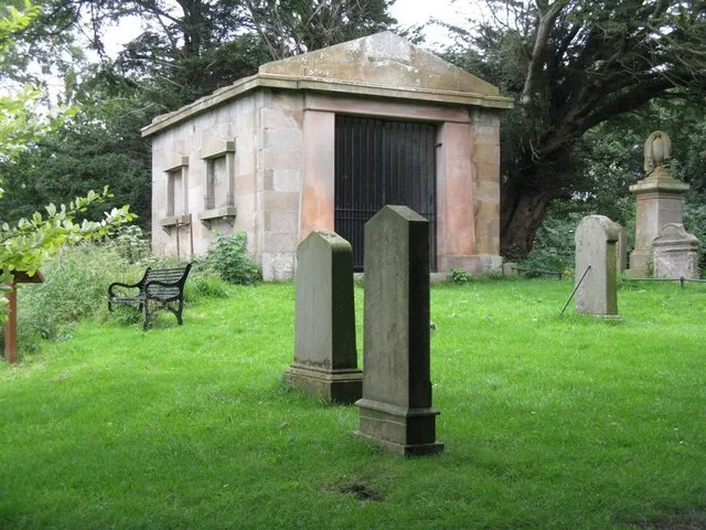
Old Pentland Cemetery in Midlothian is a cemetery. Old Pentland Cemetery is also known as Old Pentland, Burial Ground. Ⓦ.
- Land Use
- cemetery
Image
Fast food restaurants
Supermarkets
Artwork
Bookshops
Bus stops
Car washes
Cafés
Bed shops
Charging stations
Furniture shops
Gift shops
Roads nearby
Pentland Bridge200 m
Pentland RoadNew Pentland Road, Pentland Road, Aldi, Old Pentland
500 m
Burnside600 m
Burndene Drive800 m
Lomond Walk850 m
Straiton RoadStraiton Cottages, Loanhead Road, Bensons for Beds, The Works, Archers Sleepcentre, Loaf, Starbucks, Card Factory, Greggs, Straiton
900 m
Lorne Grove900 m
Straiton ParkSounds Fade, Silence Unfolds
950 m
Oak Avenue950 m
Ash Lane950 m
Seafield Moor RoadDamhead, Old Pentland Road, Hillend, Bush Road End, Ploverhall Cottages
1000 m
Pentland ParkNivensknowe Park
1000 m
Holly Walk1000 m
Cedar Road1000 m
Costkea WayCostco Tyres
1000 m
Fir View1,0 km
Hazel Lane1,0 km
City of Edinburgh BypassStraiton Junction, Gilmerton Junction, Lasswade Junction
1,0 km
Birch Crescent1,0 km
Spruce Walk1,0 km
Sycamore Path1,0 km
Poplar Path1,1 km
Acklam PathNivensknowe Park
1,1 km
Hedge Row1,1 km
Corby Craig GardensCafé Panola
1,1 km
Amos Path1,1 km
Land Use nearby
Straiton Bing700 m
Bed shops nearby
Straiton Beds850 m
Car dealerships nearby
Nissan1,1 km
Farmyards nearby
Jacaranda Cottage250 m
Pentland Mains Farm900 m
Fast food restaurants nearby
KFC800 m
Burger King850 m
Furniture shops nearby
IKEA950 m
Garden centres nearby
Damhead Nursery950 m
Pentland Plants1,0 km
Gardens nearby
Secret Herb Garden200 m
Apothecary Garden300 m
Houses nearby
Herb Cottage250 m
Industrial areas nearby
Tarmac Loanhead450 m
Locksmiths nearby
Timpson1000 m
Petrol stations nearby
Asda1,0 km
Residential areas nearby
Straiton Mobile Park Homes750 m
Nivensknowe Park1,1 km
Retail areas nearby
Straiton Retail Park1000 m
Sheds nearby
Big Barn200 m
Streams nearby
Pentland Burn550 m
Lothian Burn850 m
Woodlands nearby
Cameron Wood200 m
| Heritage designation | category B listed building |
|---|---|
| Located in | Midlothian, Lasswade |
| Country | United Kingdom |
 Public transport map Midlothian Legend
| Railway | |
| Bus | |
| Tram |
 Cycling map Midlothian Legend
| Cycle path | |
| Cycle lane on road | |
| Cycling on bus lane | |
| Bicycle street | |
| Cyclists allowed | |
| Cyclists allowed, good surface | |
| No cycling | |
| Cobblestones |
| Long-distance cycle route | (depending on scale) | |
| Long-distance cycle route |
 Walking map Midlothian Legend
| Path |
| Long-distance hiking trail | (depending on scale) | |
| Long-distance hiking trail | ||
| No pedestrians |