
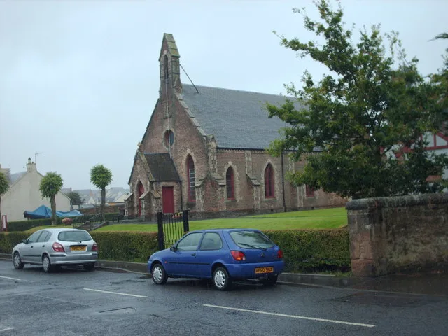
Rosewell Parish Church in Midlothian
Rosewell Parish Church in Midlothian is a church. It is near Carnethie Street and is also known as Rosewell, Carnethie Street, Rosewell Parish Church. The church is a listed building.
- Amenity
- place of worship
- Building Type
- church
Image
Public bookcases
Caravan site
Dentist
Hairdressers
Bus stops
Pubs
Convenience stores
Cafés
Beauty salons
Roads nearby
Shiel Hall Way150 m
Carnethie StreetRosewell Book Box, Rosewell, Gorton Road, St Joseph's, Prestonhall Road, Terminus
200 m
Gorton Loan200 m
Shiel Hall Loan200 m
Greenside Place200 m
Lindsay Circus250 m
Gorton Road250 m
Shiel Hall Medway300 m
Cochrina Place300 m
Shiel Hall Square300 m
Shiel Hall Circle300 m
Louisa Square350 m
Sheil Hall Square350 m
Thornton Road350 m
Villa Dean Park350 m
Shiel Hall Grove350 m
Preston Street350 m
Whitehill RoadNewcraighall East Junction
350 m
Lothian StreetWaverley Crescent, Douglas Crescent, Maryfield Place
400 m
Victoria Street400 m
Shiel Hall Row400 m
Rosedale Neuk400 m
Abden Avenue450 m
Shiel Hall Gardens450 m
Prestonhall Road450 m
Lindsay Row500 m
Gorton Place500 m
Shiel Hall Crescent500 m
Villa Dean500 m
Prestonhall Crescent550 m
Rosedale Grove550 m
Pentland Crescent550 m
Eskbank RoadKings Park, Croft Street, Hampton's, boss barbers, William Purves, M & F Funeral Services, Glenesk Crescent, Eskbank Toll, Pendreich Avenue, Viewbank Avenue, Mayshade Garden Centre
600 m
Rosedale Court600 m
Roslin Glen Road600 m
Amenities nearby
Rosewell Miners Welfare Social & Bowling Club300 m
Cemeteries nearby
Rosewell Cemetery750 m
Commercial buildings nearby
Thomson Roddick Scottish Auctions200 m
Community centres nearby
Rosewell War Memorial Hall50 m
The Steading Community Centre150 m
Convenience stores nearby
Loves local200 m
Parks nearby
Rosewell Park300 m
Kick About Area300 m
Razed railways nearby
Whitehill Collieries450 m
Peebles Branch550 m
Hawthornden Junction to Penicuik Branch600 m
Residential areas nearby
Avant Homes Hawthornden400 m
Residential buildings nearby
Orchard House500 m
Streams nearby
Shiel Burn400 m
| Heritage designation | category B listed building |
|---|---|
| Located in | Midlothian, Lasswade |
| Country | United Kingdom |
 Public transport map Midlothian Legend
| Railway | |
| Bus | |
| Tram |
 Cycling map Midlothian Legend
| Cycle path | |
| Cycle lane on road | |
| Cycling on bus lane | |
| Bicycle street | |
| Cyclists allowed | |
| Cyclists allowed, good surface | |
| No cycling | |
| Cobblestones |
| Long-distance cycle route | (depending on scale) | |
| Long-distance cycle route |
 Walking map Midlothian Legend
| Path |
| Long-distance hiking trail | (depending on scale) | |
| Long-distance hiking trail | ||
| No pedestrians |