
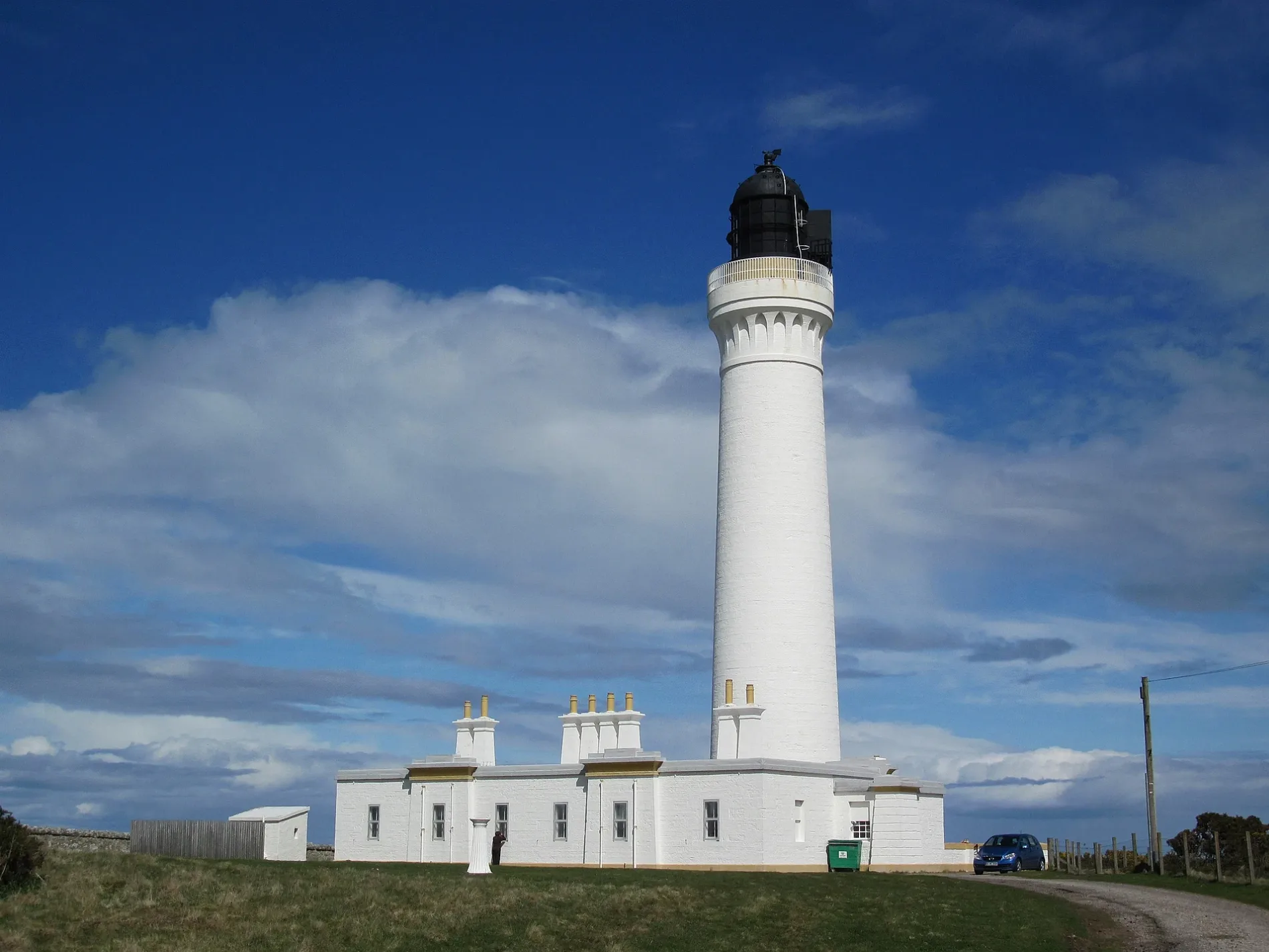
Covesea Skerries Lighthouse in Moray
Covesea Skerries Lighthouse in Moray is a lighthouse (elevation 25 m). Covesea Skerries Lighthouse is also known as Lossiemouth, Covesea Skerries Lighthouse. Covesea Skerries Lighthouse is near Aurora Drive. Ⓦ.
- Building Type
- building
Image
Hairdressers
Tailors
Hotels
Recycling centres
Fast food restaurants
Cafés
Beauty salons
Guest house
Veterinary clinic
Supermarkets
Pubs
Bus stops
Places of worship
Convenience stores
Bicycle shops
Butcher's
Pharmacy
Roads nearby
Aurora Drive250 m
Beachside300 m
Moray Way400 m
Lighthouse View450 m
The Dunes500 m
Covesea500 m
Estuary Place600 m
Beach Development650 m
Fairways700 m
Sandy Way900 m
Pebble Cove900 m
Buildings nearby
Former Rapier Training Dome1,0 km
Combined Line Engineering Building1,4 km
Fire Training Facility1,4 km
Station Headquarters1,8 km
2622 (Highland) Squadron1,9 km
Aircraft Hush House1,9 km
Ogstoun Theatre2,3 km
Bunkers nearby
Type 27 Pillbox1,1 km
Pillbox1,5 km
Caravan site nearby
Silver Sands Leisure Park500 m
Cemeteries nearby
Drainie Old Parish Church Burial Ground2,1 km
Constructions nearby
Construction Compound1000 m
Farmyards nearby
Sweethillock Farm1,9 km
Golf courses nearby
Golf Dedication Centre Pitch & Putt450 m
Covesea Links1,5 km
Hangars nearby
Hangar L31900 m
Hangar L261000 m
US Navy Hangar1000 m
Atlantic Building1,0 km
Hangar K161,4 km
Hangar K171,5 km
Hangar 2 (XI(B) Sqn)1,7 km
Hangar 3 (1(F) Squadron)1,7 km
Hangar 1 (6 Sqn)1,9 km
Houses nearby
Burgie Cottage1,3 km
Military areas nearby
Obstacle Course1,0 km
Quick Reaction Alert (QRA) North1,5 km
Recreation grounds nearby
Gordonstoun Playing Fields2,2 km
Sports centres nearby
Firing Range1,7 km
Streams nearby
Covesea Burn1,2 km
Other nearby
D Apron1,0 km
Waste Water Treatment Works1,0 km
Post Flight Rinse Facility1,1 km
Wash Bay1,2 km
Halliman Skerries1,5 km
A North Apron1,6 km
E Apron1,6 km
A South Apron1,9 km
| Inception | 1846 |
|---|---|
| Operator | Northern Lighthouse Board |
| Heritage designation | category A listed building |
| Located in | Moray, Lossiemouth and Branderburgh |
| Country | United Kingdom |
| Location | Lossiemouth |
 Public transport map Moray Legend
| Railway | |
| Bus | |
| Tram |
 Cycling map Moray Legend
| Cycle path | |
| Cycle lane on road | |
| Cycling on bus lane | |
| Bicycle street | |
| Cyclists allowed | |
| Cyclists allowed, good surface | |
| No cycling | |
| Cobblestones |
| Long-distance cycle route | (depending on scale) | |
| Long-distance cycle route |
 Walking map Moray Legend
| Path |
| Long-distance hiking trail | (depending on scale) | |
| Long-distance hiking trail | ||
| No pedestrians |