
St Ninian's Church in Moray
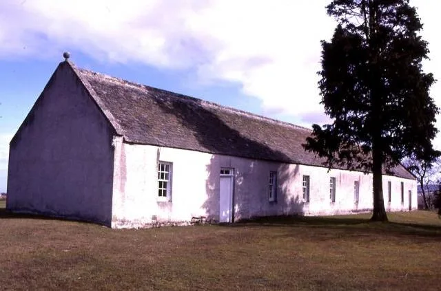
St Ninian's Church in Moray is a church. It is near Bridge of Tynet and is also known as St Ninian's Chapel, Tynet. The church is a listed building. St Ninian's Church also exists in Argyll and Bute, Fife and Angus. Ⓦ.
- Amenity
- place of worship
- Building Type
- building
Image
Tourist information offices
Recycling centres
Convenience stores
Cafés
Post offices
Fast food restaurants
Doctor's office
Attraction
Butcher's
Parking
Bus stops
Community centre
Garden centres
Artwork
Hotels
Roads nearby
Bridge of TynetMill House Hotel
550 m
Chapelford Bridge1,5 km
Howe of Enzie2,0 km
Reid Terrace3,0 km
Earls View3,1 km
Earl Street3,1 km
Garden Lane3,1 km
Stewart StreetGarden Lane
3,1 km
Crown Terrace3,1 km
Crown StreetIanstown
3,2 km
Station RoadSpar, Compass rose, Keith, Dufftown, Station Court, Findochty, Elgin, Elgin Train Station
3,2 km
Lennox Place3,2 km
Richmond TerracePortgordon Fairy Walk
3,3 km
Tannachy Road3,3 km
Cross StreetPortgordon Fairytale Walk
3,4 km
West High StreetThe Lampie Hoose Café, Portgordon Community Trust, Portgordon, Portgordon Fairytale Walk
3,4 km
Cross Lane3,4 km
Hope Street3,4 km
Gordon Square3,4 km
Duke StreetPortgordon Fairytale Walk
3,4 km
Beaches nearby
Tannachy Sands3,1 km
Buildings nearby
Dryburn1,9 km
Manse1,9 km
Clochan Telephone Exchange2,3 km
Dovecot2,4 km
Community centres nearby
Clochan Community Hall2,3 km
Portgordon Village Hall3,4 km
Constructions nearby
bonded warehouses extension2,0 km
Farm shops nearby
Lower Tynet Farm Shop600 m
Farmyards nearby
Lower Mill of Tynet Farm750 m
Burnside of Tynet1,3 km
Upper Auchenreath1,5 km
Windsoer1,7 km
Core2,1 km
Braes of Enzie2,2 km
Den Farm2,2 km
Glasterim2,4 km
Forests nearby
Gowktree Wood2,0 km
Bellie Banks2,3 km
Golf courses nearby
Spey Bay Golf Course3,3 km
Hotels nearby
The Mill House Hotel600 m
Houses nearby
Chapel House150 m
Industrial areas nearby
Crisp's2,3 km
Places of worship nearby
Enzie South Parish Church1,8 km
Ruins nearby
Church Hall150 m
Streams nearby
Wellheads Burn900 m
Core Burn2,5 km
Burn of Tynet2,5 km
Woodlands nearby
Broadley Wood1,3 km
| Heritage designation | category A listed building |
|---|---|
| Located in | Moray, Bellie |
| Country | United Kingdom |
 Public transport map Moray Legend
 | Railway | |
| Bus | |
| Tram |
 Cycling map Moray Legend
 | Cycle path | |
| Cycle lane on road | |
| Cycling on bus lane | |
| Bicycle street | |
| Cyclists allowed | |
| Cyclists allowed, good surface | |
| No cycling | |
| Cobblestones |
| Long-distance cycle route | (depending on scale) | |
| Long-distance cycle route |
 Walking map Moray Legend
 | Path |
| Long-distance hiking trail | (depending on scale) | |
| Long-distance hiking trail | ||
| No pedestrians |