
Fir Park Stadium in North Lanarkshire
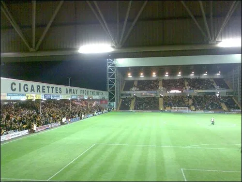
Fir Park Stadium in North Lanarkshire is a stadium (Soccer, Motherwell Football Club) (ML1 2QN). Fir Park Stadium is near Fir Park Street. Ⓦ.
- Postal Code
- ML1 2QN
- Leisure
- stadium
- Operator
- Motherwell Football Club
Image
Convenience stores
Studios
Cafés
Bus stops
Roads nearby
Knowetop Avenue50 m
Ellis Way100 m
Blair Path150 m
Fir Park Street150 m
Toll Street150 m
Edward Street200 m
Dellburn StreetTesco Express
200 m
Kingfisher Court250 m
Dalzell Drive250 m
Windmillhill StreetMotherwell, Windmillhill Street opp Motherwell Police Station, Motherwell, Windmillhill Street at Motherwell Police Station, Motherwell, Windmillhill Street before Airbles Street, Motherwell, Windmillhill Street at Motherwell Baptist Church, Boots, Flemington, Windmillhill Street at Toll Street, Flemington, Windmillhill Street opp Fern Street, Flemington, Windmillhill Street at Fern Street
300 m
Orbiston StreetLimitless Coffee House
300 m
Airbles RoadNorth Lodge, Airbles Road opp Chestnut Grove, North Lodge, opposite Freesia Court, North Lodge, Airbles Road at Clyde Tower, Gulf, North Lodge, Airbles Road before Chestnut Grove
300 m
Findlay StreetWindmillhill
350 m
Woodlands Road400 m
Woodlands Street400 m
Gadwall Grove400 m
Adele StreetMotherwell, Adele Street before Emily Drive, North Lodge, Adele Street at Hamilton Drive, North Lodge, Adele Street at Broomside Crescent, North Lodge, Adele Street opp Leven Street, North Lodge, Adele Street at Catherine Street, North Lodge, Adele Street opp Catherine Street, North Lodge, Adele Street opp Findlay Street, North Lodge, Adele Street at Findley Street
400 m
Rose StreetCondorrat
450 m
Manse RoadKnowetop, Westfield, Kilsyth, Manse Road after Howe Road, Kilsyth, Manse Road before Howe Road, Kilsyth, Manse Road opp Barlandfauld Street, Kilsyth, Manse Road before Barlandfauld Street, Kilsyth, Manse Road before South Barrwood, Kilsyth, Manse Road opp South Barrwood, Newmains, Newmains Post Office, Scotmid, 7 Spices, Newmains and District Credit Union, D. BARBERS, House of Shah, Newmains, Cambusnethan Street at 509 Cambusnethan Street, Newmains, Cambusnethan Street at 462 Cambusnethan Street, Newmains, Manse Road opp School Road
450 m
Gavin Street450 m
Meadow Road450 m
Lapwing Crescent500 m
Heron ViewFirpark
500 m
George Street500 m
Broomside Street500 m
Glencairn Street550 m
Camp Street550 m
Muirhead Terrace550 m
Hamilton Drive550 m
Primrose Crescent550 m
Broomside Crescent600 m
Leven StreetNorth Lodge, Leven Street opp Freesia Court, North Lodge, Leven Street before Freesia Court, North Lodge, Leven Street at Catherine Street, North Lodge, Leven Street opp Catherine Street
600 m
Wetland Route600 m
Cafés nearby
Tim Hortons150 m
Car dealerships nearby
Lookers Land Rover Lanarkshire250 m
Evans Halshaw Ford Motherwell250 m
Fire stations nearby
Motherwell Fire Station200 m
Funeral directors nearby
W O'Mara and Sons Funeral Directors350 m
Grandstands nearby
East Stand50 m
Davie Cooper Stand50 m
Phil O'Donnell Stand100 m
South Stand200 m
Places of worship nearby
The Salvation Army - Motherwell500 m
Police stations nearby
Motherwell Police Station350 m
Sports pitches nearby
Motherwell FC150 m
Supermarkets nearby
Lidl550 m
Theatres nearby
Motherwell Theatre450 m
Motherwell Concert Hall450 m
Town halls nearby
Civic Centre400 m
| Opening | 1895 |
|---|---|
| Located in | North Lanarkshire |
| Country | United Kingdom |
| Location | Motherwell |
 Public transport map North Lanarkshire Legend
| Railway | |
| Bus | |
| Tram |
 Cycling map North Lanarkshire Legend
| Cycle path | |
| Cycle lane on road | |
| Cycling on bus lane | |
| Bicycle street | |
| Cyclists allowed | |
| Cyclists allowed, good surface | |
| No cycling | |
| Cobblestones |
| Long-distance cycle route | (depending on scale) | |
| Long-distance cycle route |
 Walking map North Lanarkshire Legend
| Path |
| Long-distance hiking trail | (depending on scale) | |
| Long-distance hiking trail | ||
| No pedestrians |