
Motherwell TMD in North Lanarkshire
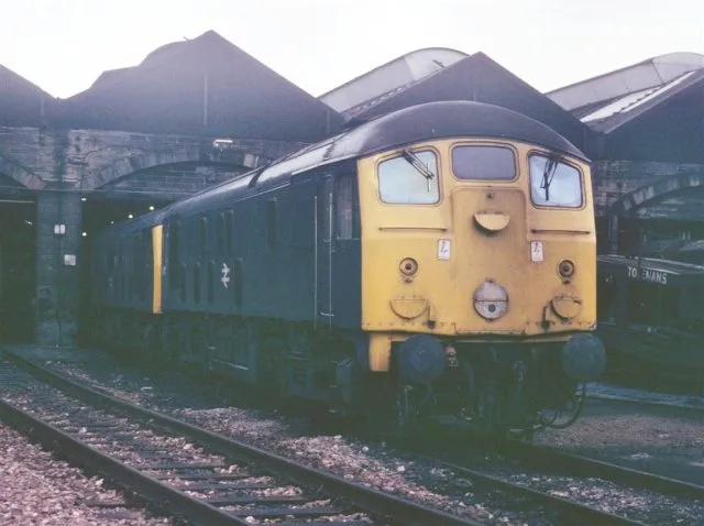
Motherwell TMD in North Lanarkshire is a railway. Ⓦ.
- Land Use
- railway
Image
School
Convenience stores
Bus stops
Fast food restaurants
Community centre
Hairdressers
Post offices
Roads nearby
Thyme Square200 m
Parkneuk Street200 m
Daffodil Way300 m
Newhut Road300 m
Cassels StreetFirpark Primary ASN School
350 m
Sunflower Gardens350 m
Alyssum Crescent400 m
Marigold Avenue450 m
Lantana Grove450 m
Barr Street450 m
Campion Road450 m
Morton Street450 m
Hardie Street450 m
Owen Street500 m
Milton StreetMotherwell, Milton Street at Northfield Street, Motherwell, Milton Street opp Northfield Street, Motherwell, Milton Street opp Queen Street, Motherwell, Milton Street at Roman Road, Motherwell, Milton Street after Duke Street, Motherwell, Milton Street opp Morton Street
500 m
Wood Crescent550 m
Northfield Street550 m
Greenlink550 m
Duke Street600 m
Vulcan Street600 m
Braidhurst StreetMotherwell, Braidhurst Street opp Milton Street
600 m
Millfield Avenue600 m
Craigview Road600 m
Roman Road600 m
Mission Place600 m
Wood StreetElm Church
600 m
Princes Street600 m
Paterson Street650 m
Riverside Walk650 m
Caldergrove650 m
Woodburn Street700 m
Caldegrove750 m
Millburn Street750 m
Brown Street800 m
Mill RoadQueenzieburn
800 m
North Street800 m
Addie Street900 m
Attraction nearby
Mountain Bike Skills Zone250 m
Buildings nearby
Scottish Rifles House600 m
Commercial buildings nearby
RoukenBio400 m
Fast food restaurants nearby
RollxRolls700 m
Industrial areas nearby
Braidhurst Industrial Estate200 m
Military areas nearby
Army Reserve Centre600 m
Places of worship nearby
Calvary650 m
Post depots nearby
Motherwell Royal Mail Delivery Office700 m
Railway lines nearby
Scottish Central Main Line300 m
West Coast Main Line700 m
School buildings nearby
Braidhurst High School250 m
Sports centres nearby
Aquatec Motherwell800 m
| Located in | North Lanarkshire |
|---|---|
| Country | United Kingdom |
 Public transport map North Lanarkshire Legend
| Railway | |
| Bus | |
| Tram |
 Cycling map North Lanarkshire Legend
| Cycle path | |
| Cycle lane on road | |
| Cycling on bus lane | |
| Bicycle street | |
| Cyclists allowed | |
| Cyclists allowed, good surface | |
| No cycling | |
| Cobblestones |
| Long-distance cycle route | (depending on scale) | |
| Long-distance cycle route |
 Walking map North Lanarkshire Legend
| Path |
| Long-distance hiking trail | (depending on scale) | |
| Long-distance hiking trail | ||
| No pedestrians |