
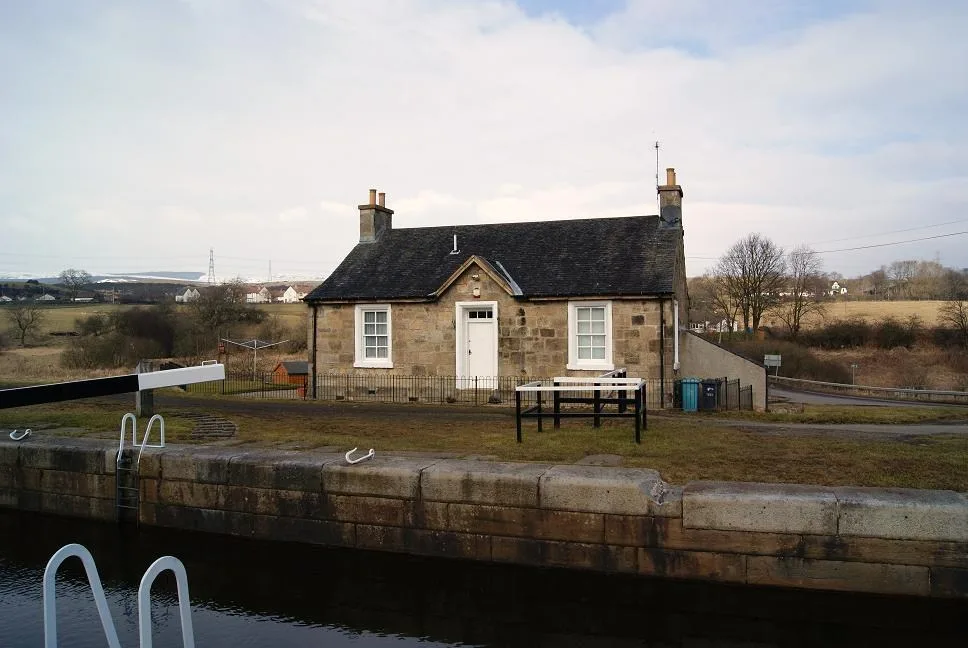
Wyndford Lock in North Lanarkshire
Wyndford Lock in North Lanarkshire is a house (FK4 2HW). Wyndford Lock is also known as Forth And Clyde Canal, Wyndford Lock-keeper's Cottage. Wyndford Lock is near Wyndford Road.
- Postal Code
- FK4 2HW
- Building Type
- house
Image
Electrical shops
Carpet shops
Kitchen showrooms
Variety stores
Supermarkets
Vending machines
Bus stops
DIY stores
Furniture shops
Car repair shops
Bed shops
Interior decorators
Car parts shops
Roads nearby
Wyndford Road150 m
Wellpark Road350 m
Coneypark Place450 m
Coneypark CrescentConeypark
450 m
Rowan Drive500 m
John Bassy Drive500 m
Laurel Square550 m
Viewfield Road600 m
Larch Drive600 m
Laburnum Road650 m
Braeface Road650 m
Cedar Road650 m
Bog RoadBanknock, Costcutter
700 m
Maple Place700 m
Ash Place700 m
Almond Drive700 m
Willow Drive750 m
Cherry Lane750 m
Kelvin View Avenue800 m
Bankier RoadBankier Community Education Wing
800 m
Hillhead Avenue800 m
Hazel Road800 m
Hawthorn Drive850 m
Castlehill Crescent850 m
Bankier Terrace900 m
Glenview Avenue900 m
Linden Drive900 m
Ballinkier Avenue950 m
Holly Grove950 m
Kilsyth RoadBanknock, Kilsyth Road at Orchard Farm, Haggs, Haggs, at Church, Haggs, at Kerr Crescent, Esso, Premier, Wash Me, Well Pharmacy, Scotmid, Haggs Post Office
950 m
Hollandbush Avenue950 m
Napier Place1,0 km
Hollandbush Crescent1,1 km
Napier RoadWardpark, Wardpark, Napier Road opp Napier Crescent, Kelvin Wardrobes
1,1 km
Caisteal Road1,1 km
Garnhall Farm Road1,1 km
Tollpark RoadThe Carpet & Floor Store, Toolstation
1,2 km
Abandoned railways nearby
Old Canal Tramway350 m
Kilsyth and Bonnybridge Branch550 m
Body of waters nearby
Netherwood Basin900 m
Canals nearby
Forth and Clyde Canal50 m
Hotels nearby
Glenskirlie Castle Hotel450 m
Industrial areas nearby
Wardpark East1,1 km
Industrial buildings nearby
TPS1,1 km
Thomson Pettie Limited1,1 km
Playgrounds nearby
Holland Bush Park1,1 km
Rivers nearby
Red Burn1000 m
Streams nearby
Doups Burn300 m
Bonny Water650 m
| Heritage designation | category B listed building |
|---|---|
| Located in | North Lanarkshire, Cumbernauld |
| Country | United Kingdom |
| Body of water | Forth and Clyde Canal |
 Public transport map North Lanarkshire Legend
| Railway | |
| Bus | |
| Tram |
 Cycling map North Lanarkshire Legend
| Cycle path | |
| Cycle lane on road | |
| Cycling on bus lane | |
| Bicycle street | |
| Cyclists allowed | |
| Cyclists allowed, good surface | |
| No cycling | |
| Cobblestones |
| Long-distance cycle route | (depending on scale) | |
| Long-distance cycle route |
 Walking map North Lanarkshire Legend
| Path |
| Long-distance hiking trail | (depending on scale) | |
| Long-distance hiking trail | ||
| No pedestrians |