
Hoglinns Water in Orkney
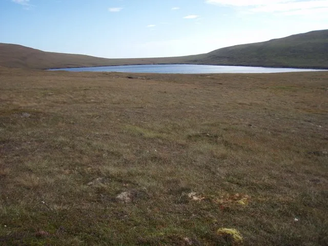
Hoglinns Water in Orkney Islands is a body of water. Hoglinns Water is also known as Hoglins Water. Ⓦ.
- Nature
- body of water
Image
Roads nearby
Slipway5,4 km
Longhope PierLonghope Post Office
5,4 km
St Colm's Quadrant5,5 km
French Road6,4 km
Millburn Bridge6,4 km
Baldreys Road7,0 km
Body of waters nearby
Heldale Water2,0 km
Sands Water2,4 km
Loch of Torness2,9 km
Buildings nearby
Melsetter Farm, Shed2,9 km
Steading, Melsetter Farm2,9 km
Stables, Melsetter Farm2,9 km
Melsetter Farmhouse2,9 km
Outbuilding to W of Factor's House2,9 km
Former Kennels2,9 km
Gardener's Cottage2,9 km
Estate Office2,9 km
The Hall2,9 km
Cartshed2,9 km
The Laundry House2,9 km
Spinning Cottage2,9 km
Melsetter House3,0 km
St John's Manse3,3 km
Little Muirs4,3 km
Manclett4,3 km
Original 1874 Lifeboat Shed4,4 km
Muirs4,5 km
Stonequoy5,0 km
Longhope Telephone Exchange5,2 km
John M F Groat & Sons Ltd5,4 km
Longhope Lifeboat Station5,4 km
Hoy and Walls Health Centre6,1 km
Hoy Telephone Exchange6,3 km
Scapa Flow Visitor Center & Museum - exhibition space6,8 km
Cafés nearby
Emily's Tearoom6,6 km
Cemeteries nearby
Royal Naval Cemetery6,1 km
Chapels nearby
Melsetter Chapel3,0 km
Farmyards nearby
Melsetter Farm2,9 km
Haybrake6,3 km
Site of former RC Church (Royal Navy)6,7 km
Hotels nearby
The Hoy Hotel6,2 km
Military areas nearby
Pill Box (Burn of Or - Royal Navy oil terminal5,8 km
Former Officer Quarters (Royal Navy)6,1 km
pill box (C20)6,2 km
Former Torpedo Depot - now council depot6,6 km
Places of worship nearby
Saint John4,8 km
Saint Columba6,3 km
Pubs nearby
Royal Hotel5,4 km
Streams nearby
Mill Burn6,2 km
| Located in | Orkney Islands |
|---|---|
| Country | United Kingdom |
 Public transport map Orkney Islands Legend
| Railway | |
| Bus | |
| Tram |
 Cycling map Orkney Islands Legend
| Cycle path | |
| Cycle lane on road | |
| Cycling on bus lane | |
| Bicycle street | |
| Cyclists allowed | |
| Cyclists allowed, good surface | |
| No cycling | |
| Cobblestones |
| Long-distance cycle route | (depending on scale) | |
| Long-distance cycle route |
 Walking map Orkney Islands Legend
| Path |
| Long-distance hiking trail | (depending on scale) | |
| Long-distance hiking trail | ||
| No pedestrians |