
Loch Fender in Perth and Kinross
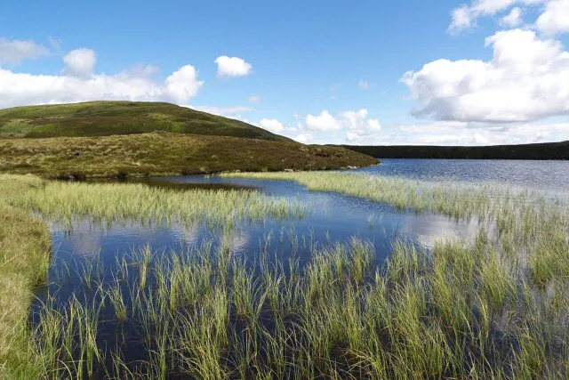
Loch Fender in Perth and Kinross is a body of water. Ⓦ.
- Nature
- body of water
Image
Viewpoint
Water points
Guest house
Bookshops
Bus stops
Tourist information offices
Attraction
Hofläden
Artwork
Library
Pubs
Roads nearby
Aldmad Bridge6,5 km
General Wade's Military RoadEasthaugh of Ballyoukan, Westhaugh of Dalshian, Middlehaugh of Dalshian
6,9 km
Birks of Aberfeldy WalkViewpoint for Falls of Moness, Welcome to The Birks of Aberfeldy, The Birks Tree Collection, Falls of Moness
7,2 km
Buildings nearby
Strathbraan Brewery5,2 km
Body of waters nearby
Loch Hoil3,2 km
Loch Creagh3,7 km
Loch na Creige4,1 km
Loch Kennard5,4 km
Lochan a' Mhuillin6,3 km
Lochan Uaine7,0 km
Loch Scoly7,4 km
Buildings nearby
Inneccochill4,4 km
Amulree Telephone Exchange4,8 km
Glen Fender5,0 km
Community centres nearby
Amulree Village Hall5,3 km
Detached houses nearby
Lynemore4,9 km
Farmhouses nearby
Wester Shian Farm4,0 km
Farmyards nearby
Turrerich Farm3,4 km
Dalreoch5,4 km
Girron6,2 km
Dullator6,3 km
Easter Ballachraggan6,3 km
Urlar Farm6,5 km
Margmore6,6 km
Houses nearby
Torr Cottage6,6 km
Industrial areas nearby
Wind power station base3,3 km
Deanshaugh5,2 km
Places of worship nearby
Amulree Church5,0 km
Residential areas nearby
Wester Ballachraggan6,1 km
Aldmad6,6 km
Errichel6,7 km
Croftness7,2 km
Rivers nearby
Glenfender Burn4,8 km
River Quaich5,2 km
River Braan5,3 km
Urlar Burn6,6 km
Ruins nearby
St Louis2,9 km
Dalreoch Lodge5,4 km
Wester Dullator6,0 km
Drumbuie6,4 km
Glenlochan Shieling7,0 km
Streams nearby
Cochill Burn2,7 km
Allt a' Mhuillin5,2 km
Calliachar Burn5,6 km
Allt Ruighe5,7 km
Ballinloan Burn6,2 km
Girron Burn6,4 km
Valleies nearby
Glen Quaich4,0 km
Other nearby
Griffin Wind Farm Substation3,2 km
| Located in | Perth and Kinross |
|---|---|
| Country | United Kingdom |
 Public transport map Perth and Kinross Legend
| Railway | |
| Bus | |
| Tram |
 Cycling map Perth and Kinross Legend
| Cycle path | |
| Cycle lane on road | |
| Cycling on bus lane | |
| Bicycle street | |
| Cyclists allowed | |
| Cyclists allowed, good surface | |
| No cycling | |
| Cobblestones |
| Long-distance cycle route | (depending on scale) | |
| Long-distance cycle route |
 Walking map Perth and Kinross Legend
| Path |
| Long-distance hiking trail | (depending on scale) | |
| Long-distance hiking trail | ||
| No pedestrians |