
Shee Water in Perth and Kinross
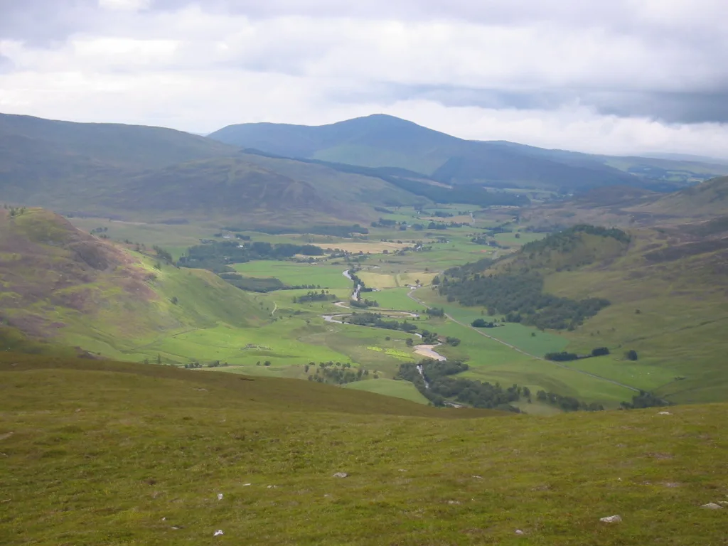
Shee Water in Perth and Kinross is a river. Shee Water is also known as Black Water. Ⓦ.
- Waterway Type
- river
Image
Convenience stores
Parking
Sports shops
Post offices
Off-licences
Guest house
Hotels
Chalet
Campsite
Places of worship
Bookshops
Tourist information offices
Public bookcases
Restaurants
Shelter
Petrol stations
Recycling centres
Bus stops
Viewpoint
Roads nearby
MacThomas Bridge3,1 km
Glenshee Bridge3,3 km
Bridge of Forter6,2 km
Old Military RoadSki Hire, Blackwater, Blackwater School House, Mains of Dalrulzion, Dalrulzion, Middleton of Dalrulzion, Devil's Elbow, Eagle Totem Pole, Snow Gate, Dalnoid, Glenkilrie, The Hermitage
7,7 km
Alpine huts nearby
Gulabin Lodge3,3 km
Body of waters nearby
Loch Beanie3,1 km
Drumore Loch7,7 km
Buildings nearby
Old Spittal Farm3,3 km
Upper Lunch Hut5,0 km
Forter Castle5,9 km
Blacklunans Telephone Exchange7,5 km
Cliffs nearby
Creag an Torraidh6,8 km
Farmyards nearby
Invereddrie650 m
Westerton of Runavey1,4 km
Finegand Farm1,7 km
Auchavan Farm6,2 km
Forests nearby
Corrydon1,4 km
Glenkilrie Wood7,2 km
Gift shops nearby
Glenshee Pottery4,3 km
Houses nearby
Dalnashee Lodge7,5 km
Industrial areas nearby
Glenkilrie Storage Area6,9 km
East Inverharity6,9 km
Places of worship nearby
Glenshee Parish Church3,4 km
Rivers nearby
Allt a'Ghlinne Bhig5,2 km
Glenbrighty Burn6,4 km
Allt Ghlinn Thaitneich7,3 km
Service buildings nearby
Glenshee Telephone Exchange1,2 km
Stones nearby
Clach na Coileach3,5 km
Streams nearby
Allt Choire Dhomhain1,1 km
Allt Coire na Ceardaich1,7 km
Allt Mòr2,2 km
Allt an Daimh2,2 km
Allt Coire Lanard2,4 km
Allt Corra-lairige3,9 km
Glen Beanie Burn4,4 km
Allt Coire a Bhlarain4,5 km
Allt an Lair4,6 km
Allt Coire a Ghearraig5,1 km
Allt Menach5,1 km
Allt a' Charnaich5,2 km
Ballloch Burn5,9 km
Alltansileach Burn6,1 km
Allt Coire Buidhe Beag6,5 km
Loward Burn6,6 km
Ashintully Burn7,6 km
Valleies nearby
Glen Beanie4,4 km
Glen Shee4,7 km
Glen Brighty5,9 km
Gleann Beag6,2 km
| Located in | Angus, Perth and Kinross |
|---|---|
| Country | United Kingdom |
| Mouth | River Ericht |
 Public transport map Perth and Kinross Legend
| Railway | |
| Bus | |
| Tram |
 Cycling map Perth and Kinross Legend
| Cycle path | |
| Cycle lane on road | |
| Cycling on bus lane | |
| Bicycle street | |
| Cyclists allowed | |
| Cyclists allowed, good surface | |
| No cycling | |
| Cobblestones |
| Long-distance cycle route | (depending on scale) | |
| Long-distance cycle route |
 Walking map Perth and Kinross Legend
| Path |
| Long-distance hiking trail | (depending on scale) | |
| Long-distance hiking trail | ||
| No pedestrians |