
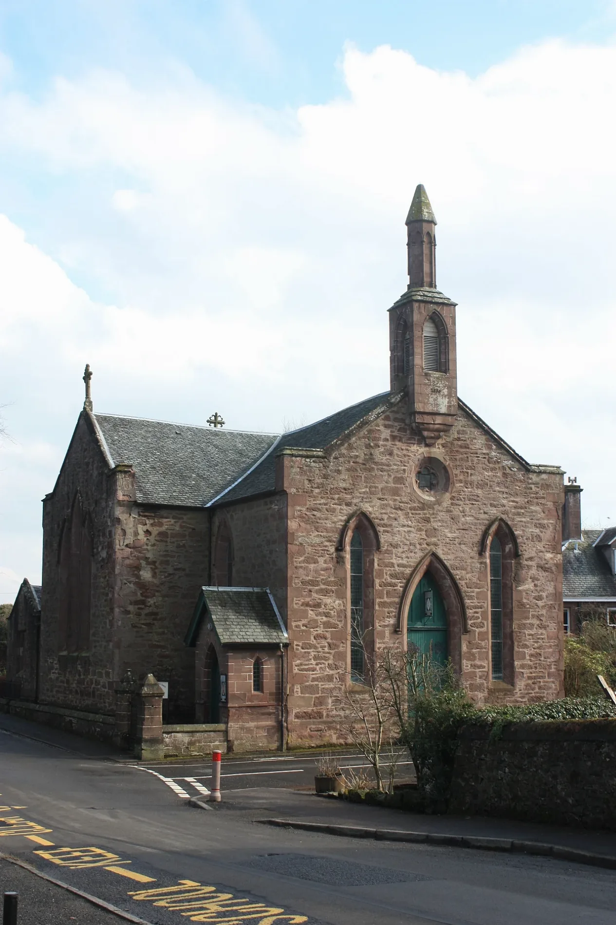
St James Episcopal Church in Perth and Kinross
St James Episcopal Church in Perth and Kinross is a church (PH5 2AR). It is near Wardside and is also known as Muthill, St James's Episcopal Church. The church is a listed building.
- Postal Code
- PH5 2AR
- Amenity
- place of worship
- Building Type
- church
Image
Hardware shops
Viewpoint
Arts centres
Convenience stores
Bakeries
Post depots
Hairdressers
Fast food restaurants
Attraction
Hotels
Art galleries
Funeral directors
Restaurants
Bus stops
Social facility
Artwork
Post offices
Pharmacy
Patisseries
Roads nearby
Station RoadFlying Geese, Ochil View, Mr Chans, Kinross Post Office, Greens of Kinross, Prince of India, Birnam Arts Cafe, Birnam Institute, Dunkeld and Birnam Station, Pitlochry Station Bookshop, Pitlochry, Drinking Fountain, Invergowrie, Rosamunde Pilcher Drive, Errol Recyling Area, Primary School, Viewlands, Station Road
100 m
The CrossMuthill, 3 Churches Charity Shop, Community Archive, Taste Talk, St Ninian's Wynd, Duchess Anne, Coupar Angus
100 m
Glebe Road150 m
Back RowCoorie Inn
150 m
The Wynd150 m
Willoughby StreetWilloughby St (Southbound), Willoughby St (Northbound)
200 m
Wardside300 m
Ancaster Way300 m
Drummond StreetMorrisons Daily, Premier, Senses face and body spa, Cafe Comrie, David Comrie and Son, The Handy Shop, Campbell's Bakery, Davidsons Chemists, Hansons kitchen, McIntyre Hair Design, The Fabric Studio, Urquhart Glass, Comrie Hotel
350 m
Pitkellony Street350 m
Ward Road350 m
Martin Gardens450 m
Lintibert Terrace450 m
Lintibert Road550 m
Queensferry Road600 m
Thornhill Street1,2 km
Muthill To Crieff Cyclepath1,4 km
Collapsed bridge1,9 km
MUTH/133 core path2,0 km
Abandoned railways nearby
Gleneagles Junction to Balquhidder Branch1,6 km
Attraction nearby
The Ceramic Experience1,8 km
Body of waters nearby
Pond of Drummond1,8 km
Bennybeg pond1,8 km
Buildings nearby
Muthill Telephone Exchange400 m
Farmyards nearby
Lintibert300 m
Fintalich Farm800 m
Boreland1,4 km
Overhill1,6 km
Strageath Hall1,6 km
Pett1,8 km
Dornock2,4 km
Forests nearby
Lintibert Strip950 m
Newra Wood1,1 km
Barnes Wood1,3 km
Parks nearby
Highlandman's Park350 m
Coronation Park350 m
Places of worship nearby
Muthill Parish Church100 m
Razed railways nearby
Crieff Branch2,1 km
Residential areas nearby
Culdees House & Castle1,9 km
Dornoch Mill2,2 km
Restaurants nearby
McLeans250 m
Rivers nearby
River Earn2,1 km
Sports pitches nearby
The Pitch100 m
Streams nearby
Drummond Burn1,2 km
Village greens nearby
Bishop's Green150 m
Woodlands nearby
Wood of Muthill450 m
Muir of Spot Wood1000 m
Sallvardoch Wood1,0 km
Lower Lairochs Wood2,0 km
| Heritage designation | category B listed building |
|---|---|
| Located in | Perth and Kinross, Muthill |
| Country | United Kingdom |
| Location | Muthill |
 Public transport map Perth and Kinross Legend
| Railway | |
| Bus | |
| Tram |
 Cycling map Perth and Kinross Legend
| Cycle path | |
| Cycle lane on road | |
| Cycling on bus lane | |
| Bicycle street | |
| Cyclists allowed | |
| Cyclists allowed, good surface | |
| No cycling | |
| Cobblestones |
| Long-distance cycle route | (depending on scale) | |
| Long-distance cycle route |
 Walking map Perth and Kinross Legend
| Path |
| Long-distance hiking trail | (depending on scale) | |
| Long-distance hiking trail | ||
| No pedestrians |