
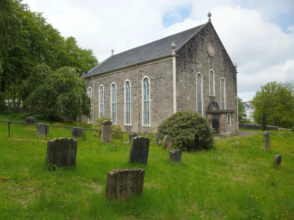
Castlehead Parish Church in Renfrewshire
Castlehead Parish Church in Renfrewshire is a Presbyteriana church. It is near Castle Street and is also known as Castlehead Church.
- Amenity
- place of worship
- Building Type
- building
Image
Places of worship
Pubs
Hairdressers
Guest house
Nightclubs
Bus stops
Cafés
Tourist information offices
Gallery
Copy shops
Roads nearby
Main RoadCastlehead, Jim's Food and Wine, Coast, Cawley Hotels & restaurant, Elderslie, Thornhill Avenue (Near), Elderslie, opp Barclay Avenue, Elderslie No 1 Junction, Park Avenue, Elderslie Post Office, Torq, Elderslie, Millennium Milepost Canal Street
50 m
Castle Street150 m
Argyle Street150 m
Maxwellton Court200 m
Tower Terrace200 m
Queen StreetBethany Evangelical Church
250 m
Maxwellton StreetPaisley, Maxwellton Street / Newton Street, Paisley West, Millennium Milepost Castlehead, Corsebar Junction
250 m
Cross Street250 m
Low Road250 m
High Road300 m
West Buchanan Place300 m
Walker Street300 m
Camphill300 m
Broomlands StreetKing Street, Tartan Rose
300 m
Lady Lane350 m
Sandholes Street350 m
West Street350 m
Wellmeadow StreetWest Brae
350 m
King Street400 m
West Brae400 m
Wilson Street400 m
William StreetJohnstone, Opposite Craigdonald Place
450 m
Clavering Street West450 m
Clavering Street East450 m
Underwood Lane450 m
Oakshaw Brae500 m
Gallacher Court500 m
Oakshawhead500 m
Hannay StreetArthur Street
550 m
Oakshaw Street West550 m
Arthur Street550 m
Gallow Green Road550 m
Henderson Street600 m
Brown StreetStoneybrae Junction AYR2/AYR3
650 m
Sutherland Street650 m
Well StreetUnderwood Road, Wellmeadow Street
700 m
Underwood Roadcef
700 m
Underwood Court700 m
Allotment gardens nearby
Well Street Allotments650 m
Community centres nearby
West End Community Centre550 m
Dormitories nearby
Lady Lane Student Flats300 m
Places of worship nearby
Paisley West Church350 m
St Mary's400 m
Thomas Coats Memorial Church450 m
Railway lines nearby
Paisley to Kilwinning700 m
Sports centres nearby
Wellmeadow Bowling Club300 m
Sports pitches nearby
Victoria Bowling Club250 m
University buildings nearby
Denholm Building400 m
Henry Building West400 m
| Located in | Renfrewshire, Paisley |
|---|---|
| Country | United Kingdom |
| Location | Paisley |
 Public transport map Renfrewshire Legend
| Railway | |
| Bus | |
| Tram |
 Cycling map Renfrewshire Legend
| Cycle path | |
| Cycle lane on road | |
| Cycling on bus lane | |
| Bicycle street | |
| Cyclists allowed | |
| Cyclists allowed, good surface | |
| No cycling | |
| Cobblestones |
| Long-distance cycle route | (depending on scale) | |
| Long-distance cycle route |
 Walking map Renfrewshire Legend
| Path |
| Long-distance hiking trail | (depending on scale) | |
| Long-distance hiking trail | ||
| No pedestrians |