
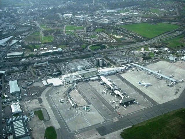
Glasgow Airport in Renfrewshire
Glasgow Airport in Renfrewshire is an airfield (IATA: GLA, ICAO: EGPF, Public) (PA3 2SW). Glasgow Airport is also known as GLA. Ⓦ.
- Postal Code
- PA3 2SW
- Operator
- Glasgow Airport Limited
Image
Newsagent's
Places of worship
Hotels
Car hires
Bus stops
Pubs
Petrol stations
Bar
Convenience stores
Post offices
Cafés
Restaurants
Chemist's
Roads nearby
Greenock RoadShortwoods, Greenock Road / St Mirrin Park, A737, Bishopton, The Braehead Tavern, Day-Today
750 m
Old Greenock RoadInchinnan, Balmoral Crescent, Broomlea Crescent
800 m
Inchinnan RoadInchinnan Road / Marchfield Avenue, Marchfield Avenue, Green Motion, JET, North Lodge, Love Street / Springbank Road, Inchinnan Road / Fleming Street, Robertson Park, Sunart Avenue, Normandy Hotel
850 m
Netherton Avenue950 m
Inchinnan DriveGreenock Road
1000 m
Netherton Square1,0 km
River Drive1,0 km
Sunart Avenue1,0 km
Vennacher Road1,0 km
Braemar Road1,1 km
Kirkfield Gardens1,1 km
Kirkfield1,1 km
Balmoral Crescent1,2 km
Ladyacres1,2 km
Ladyacres Way1,2 km
Allands Avenue1,2 km
Teucheen Circle1,2 km
Walkinshaw Road1,4 km
Westway1,5 km
Barnwell Street1,5 km
Arran Avenue1,5 km
Abbotsinch Road1,5 km
Buildings nearby
National Manufacturing Institute Scotland950 m
ScotSTAR1000 m
Medicines Manufacturing Innovation Centre1,0 km
Gama Maintenance Hangars1,0 km
Glasgow Airport Flying School1,2 km
Constructions nearby
Advanced Manufacturing Innovation District Scotland (AMIDS)900 m
Farmyards nearby
Stranadarrif650 m
Town of Inchinnan800 m
Portnauld850 m
Florish950 m
Old Mains1,2 km
Industrial areas nearby
Inchinnan Industrial Estate900 m
Industrial buildings nearby
Rolls-Royce1,1 km
Teknek Europe Ltd1,1 km
India of Inchinnan1,2 km
AFRC1,3 km
Marinas nearby
Inchinnan Cruising Club1,0 km
Places of worship nearby
Inchinnan Parish Church1,1 km
Religiouses nearby
All Hallows Church (Inchinnan Parish Church) - Ruins550 m
Rivers nearby
Black Cart Water850 m
White Cart Water1,0 km
Woodlands nearby
Teucheen Wood1,1 km
Other nearby
Gama Apron1000 m
Juliet Apron1,1 km
Apron Whisky1,2 km
General Aviation Apron1,3 km
NATS1,4 km
| Named after | Glasgow, Abbotsinch |
|---|---|
| Opening | 1966 |
| Elevation | 26 |
| Located in | Renfrewshire |
| Country | United Kingdom |
| Website | https://www.glasgowairport.com/ |
| Significant event | Glasgow Airport attack |
 Public transport map Renfrewshire Legend
| Railway | |
| Bus | |
| Tram |
 Cycling map Renfrewshire Legend
| Cycle path | |
| Cycle lane on road | |
| Cycling on bus lane | |
| Bicycle street | |
| Cyclists allowed | |
| Cyclists allowed, good surface | |
| No cycling | |
| Cobblestones |
| Long-distance cycle route | (depending on scale) | |
| Long-distance cycle route |
 Walking map Renfrewshire Legend
| Path |
| Long-distance hiking trail | (depending on scale) | |
| Long-distance hiking trail | ||
| No pedestrians |