
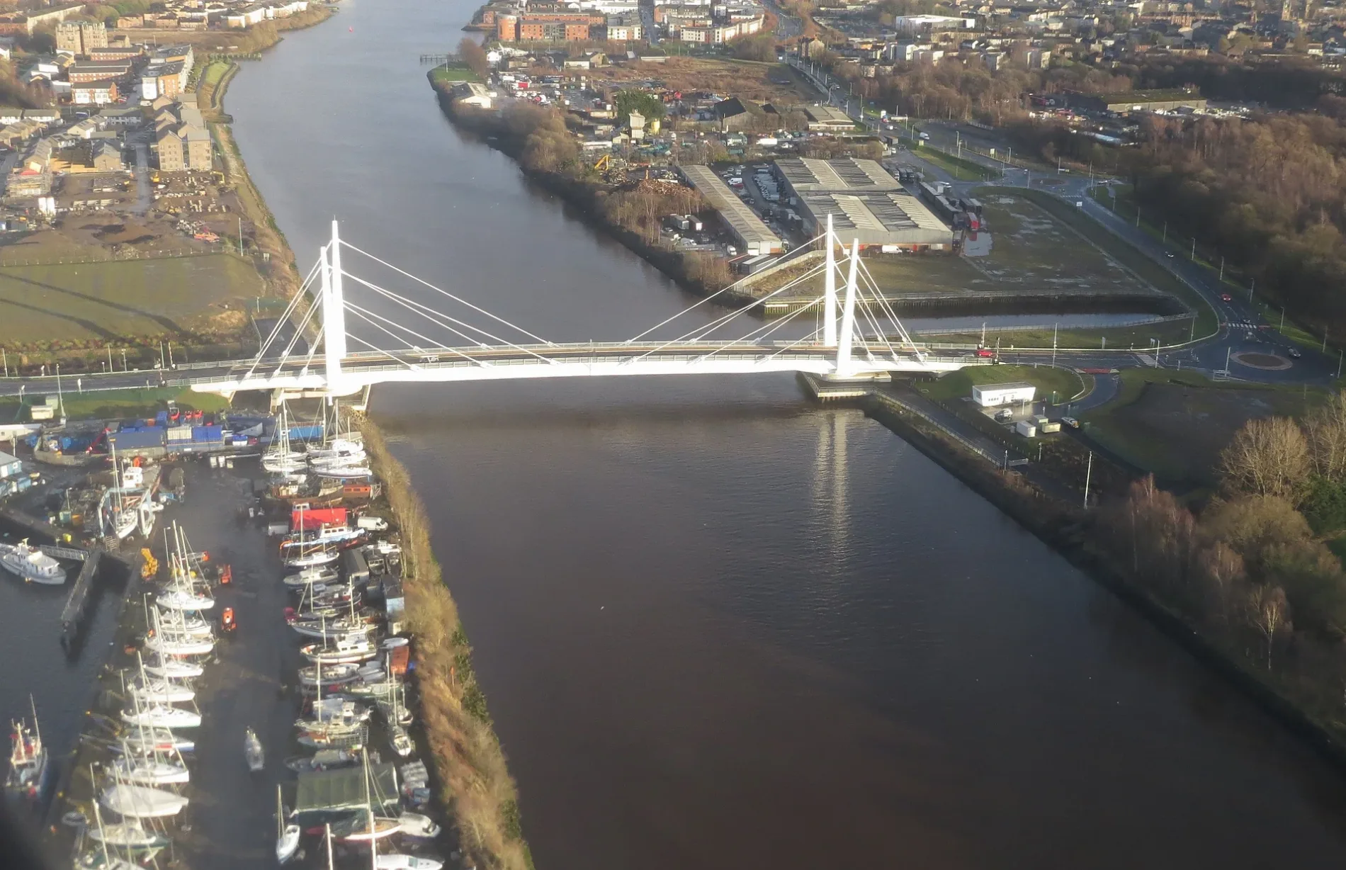
Renfrew-Yoker Bridge in Renfrewshire
Renfrew-Yoker Bridge in Renfrewshire is a two-lane, asphalted tertiary road. It runs in a northeast-southwest direction and ends at Renfrew North Development Road, while the other end is a cul-de-sac. Ⓦ.
- Road Type
- tertiary road
- Lanes
- 2
- Speed Limit
- 30 mph
- Route
- northeast-southwest
Image
Pubs
Bank
Post offices
Hairdressers
Museum
Fast food restaurants
Bookmakers
Convenience stores
Gift shops
Restaurants
Doctor's office
Bus stops
Stations
Petrol stations
Cafés
Funeral directors
Roads nearby
Renfrew North Development Road50 m
Meadowside Street Roundabout100 m
Meadowside Street West200 m
Meadowside Street Access 1250 m
Meadowside Street Access 3300 m
Meadowside Street Access 2300 m
Blythswood Roundabout300 m
Dock Street Roundabout300 m
Dock Street South350 m
Dock Street450 m
Neil Street500 m
Glasgow RoadFarmfoods, The Great Wee Roll Shop, Napier Street, North Bank Street, Roll 'n One, South Bank Street, KeyStore, Benvenuti Coffee House, Castlegreen Street, Dalreoch, Dumbarton East, Greggs, Subway, Domino's, Carols Barber Shop, William Jardine Carpets, Sweet Dreams, Silver Star, Nellie's Groom Room, Atomic Diner, Launderette, M & R Bodrum Turkish Barbers, Thomas Smith & Son, Glamoured, Leven Street, Bombay Grill, Hardgate Cafe, Cathie's Dry Cleaners, Castle Street, Perfect Catch, Boyce & Houston Veterinary Centre, Cycle Form, Hardgate, Tesco Express, Enterprise, Lilly's, Three in One, Hot!, Redmond & Rennison Dental Care, William Hill, Ladbrokes, Quoiters Bar, Hardgate Dry Cleaners, Empire, Fox, Sam's, McLaren & McKechnie, Hardgate House Hotel, Dalreoch Junction
500 m
Yoker Wharf500 m
Argyll Avenue550 m
Anchor Wynd550 m
Dumbarton RoadBP, Nisa Local, Old Kilpatrick Post Office, The Village Barbers, Ashtree Court, Travelodge, Masala Twist, Clydebank Central Junction, JET, Terminus Store, Esso, Amazon Hub Locker, Hardgate, at Cochno Road, Duntocher, opposite Roman Road, Duntocher, at Beeches Road, Hardgate, opposite Cochno Road, Duntocher Sports Centre (opp), Henry's, Dalmuir Barber Shop, Day-Today Express, The Mountblow, Villa Bakery, Old Kilpatrick, Gavinburn Street, Old Kilpatrick Church, Erskine View, Gavinburn Gardens, Kirk Crescent, Glenarbuck Lodge, Bowling, Bowling Shop & Snack, Creative Cutz, Bowling Railway Station, Beardmore Sculpture, Duntocher, Roman Crescent
550 m
Mill RoadGlasgow Road / Mill Road
550 m
Hamilton TerraceNisa Local
600 m
Hamilton Street600 m
Greenlaw Court600 m
Greenlaw Road650 m
Helm RoadYoker
650 m
Cooperage Court650 m
Meadowside Street650 m
South Elgin Street650 m
Napier Street650 m
Clyde Street700 m
North Elgin Place700 m
John Knox Street700 m
North Elgin StreetBoots
750 m
Abandoned railways nearby
Lanarkshire and Dumbartonshire Branch400 m
Renfrew and District Line650 m
Building under constructions nearby
Bridge Plant Room250 m
Buildings nearby
Clyde Crossing Bridge Control Room50 m
Stagehire Scotland Ltd300 m
Car repair shops nearby
NPG Motors450 m
Carpet shops nearby
J&W Carpets450 m
Commercial buildings nearby
The Garage Clydebank650 m
Docks nearby
Lobnitz Basin150 m
Rothesay Dock300 m
Industrial areas nearby
Exolum storage facility Clydebank550 m
Boatyard650 m
Petrol stations nearby
Laidlaw Service Station600 m
Pubs nearby
The Lovat Arms600 m
Razed railways nearby
Renfrew Branch600 m
Sports centres nearby
Holm Park500 m
Sports pitches nearby
Clydebank FC / Yoker Athletic FC550 m
Streams nearby
Garscadden Burn650 m
Supermarkets nearby
Lidl650 m
| Opening | 2025 |
|---|---|
| Located in | Renfrewshire, West Dunbartonshire |
| Country | United Kingdom |
| Crosses | River Clyde |
| Carries thoroughfare | road |
 Public transport map Renfrewshire Legend
| Railway | |
| Bus | |
| Tram |
 Cycling map Renfrewshire Legend
| Cycle path | |
| Cycle lane on road | |
| Cycling on bus lane | |
| Bicycle street | |
| Cyclists allowed | |
| Cyclists allowed, good surface | |
| No cycling | |
| Cobblestones |
| Long-distance cycle route | (depending on scale) | |
| Long-distance cycle route |
 Walking map Renfrewshire Legend
| Path |
| Long-distance hiking trail | (depending on scale) | |
| Long-distance hiking trail | ||
| No pedestrians |