
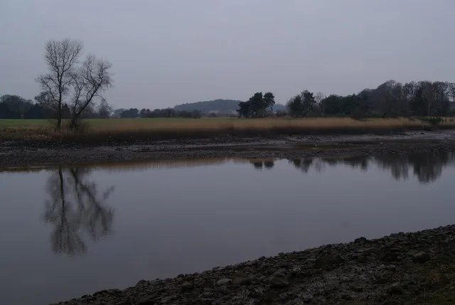
River Cart in Renfrewshire
River Cart in Renfrewshire is a river. River Cart is also known as Cart. Ⓦ.
- Waterway Type
- river
Image
Pubs
Restaurants
Post offices
Museum
Bookmakers
Bus stops
Petrol stations
Stations
Convenience stores
Fast food restaurants
Hotels
Places of worship
Hairdressers
Bank
Roads nearby
Argyll Avenue700 m
West Lodge Road750 m
Greenock RoadShortwoods, Greenock Road / St Mirrin Park, A737, Bishopton, The Braehead Tavern, Day-Today
800 m
Inchinnan RoadInchinnan Road / Marchfield Avenue, Marchfield Avenue, Green Motion, JET, North Lodge, Love Street / Springbank Road, Inchinnan Road / Fleming Street, Robertson Park, Sunart Avenue, Normandy Hotel
800 m
Morar Place900 m
Sunart Avenue900 m
Kirklandneuk Road950 m
Laggan Terrace950 m
Abbotsinch Road950 m
Vennacher Road1000 m
Aurora Avenue1,0 km
Garth DriveTitan Crane Shuttle Bus
1,1 km
Clyde Street1,1 km
Andrew Court1,1 km
South Elgin Place1,1 km
South Bank Street1,1 km
Alisa Road1,1 km
Cunard Court1,1 km
South Douglas Street1,2 km
Cunard Street1,2 km
Atlas Street1,2 km
Cart Street1,2 km
Bon Accord Square1,2 km
Ossian WayTitan Crane Shuttle Bus
1,3 km
Attraction nearby
Titan Crane1,2 km
Buildings nearby
Titan Crane Ticket Office950 m
Queens Quay Energy Centre and District Heating Network1,1 km
Charity shops nearby
The Salvation Army650 m
Churches nearby
Our Holy Redeemer Church Hall1,1 km
Constructions nearby
Advanced Manufacturing Innovation District Scotland (AMIDS)1,0 km
Farmyards nearby
Portnauld350 m
Old Mains450 m
Florish900 m
Stranadarrif1,1 km
Fitness centres nearby
JD Gyms700 m
Clydebank Leisure Centre1000 m
Golf courses nearby
Renfrew Golf Course500 m
Industrial areas nearby
Boatyard800 m
Marinas nearby
Inchinnan Cruising Club500 m
Places of worship nearby
Our Holy Redeemer RC Church1,1 km
Razed railways nearby
Lanarkshire and Dumbartonshire Branch1,2 km
Religiouses nearby
All Hallows Church (Inchinnan Parish Church) - Ruins750 m
Rivers nearby
White Cart Water550 m
Black Cart Water600 m
River Clyde1,1 km
Sports centres nearby
New Western Park900 m
Sports pitches nearby
Renfrew F.C.900 m
Wholesale shops nearby
Company Shop750 m
Woodlands nearby
Teucheen Wood1,2 km
| Length | 1 |
|---|---|
| Located in | Renfrewshire |
| Country | United Kingdom |
| Mouth | River Clyde |
| Tributary | Black Cart Water, White Cart Water |
 Public transport map Renfrewshire Legend
| Railway | |
| Bus | |
| Tram |
 Cycling map Renfrewshire Legend
| Cycle path | |
| Cycle lane on road | |
| Cycling on bus lane | |
| Bicycle street | |
| Cyclists allowed | |
| Cyclists allowed, good surface | |
| No cycling | |
| Cobblestones |
| Long-distance cycle route | (depending on scale) | |
| Long-distance cycle route |
 Walking map Renfrewshire Legend
| Path |
| Long-distance hiking trail | (depending on scale) | |
| Long-distance hiking trail | ||
| No pedestrians |