
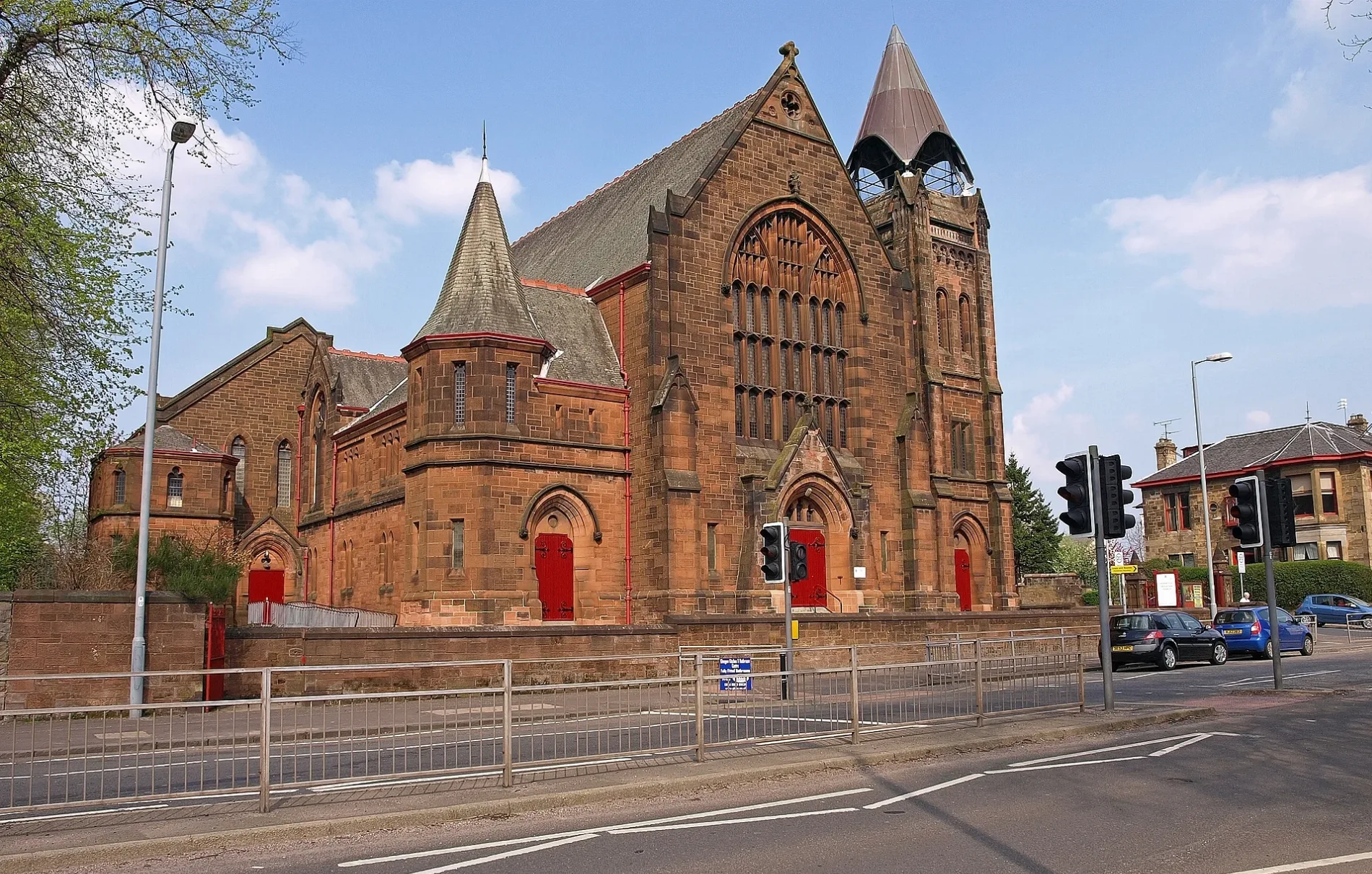
Sherwood Parish Church in Renfrewshire
Sherwood Parish Church in Renfrewshire is a church (PA1 3PA). It is near Greenlaw Avenue and is also known as Paisley, Glasgow Road, Sherwood Parish Church.
- Postal Code
- PA1 3PA
- Amenity
- place of worship
- Building Type
- building
Image
Pubs
Car washes
Police stations
Bed shops
Bus stops
Hairdressers
Fast food restaurants
Post offices
Copy shops
Roads nearby
Greenlaw Drive50 m
Williamsburgh Terrace100 m
Crossflat Crescent150 m
Kelburne Gardens150 m
Howard StreetWilliamsburgh
200 m
McKerrell Street200 m
Greenlaw Avenue250 m
Glasgow RoadGreenlaw Avenue, Merlinford Drive, Killearn Drive, Penilee Road, Buchlyvie Road, Dalfoil Court, Alton Road, Hawkhead Road, Strathmore Ave, Crookston Drive, Bathgo Avenue, Duchray Drive, Drummond Drive, Barshaw Park Middle, Oldhall Road, Whitehaugh Drive, Burgh Bar, Iceland, Greenlaw Drive, Alice Chinese Takeaway, Zika Barber, Robert's Barber Shop, Glasgow Road Post Office, Harvies Bar, Glasgow Rd, Kelburne Oval, Tirry Avenue, Mansionhouse Road, Christie Street, Paisley Grammar, Dean Park Road
250 m
Dunn Street300 m
Mansionhouse Road300 m
Kilnside Lane300 m
Kilnside Road350 m
Greenlaw Terrace400 m
Bank Street400 m
Dixon Street400 m
Christie Street400 m
Millar StreetWash HQ
400 m
Greenlaw Crescent400 m
Ladyburn Street400 m
Garthland LaneWallneuk Junction
400 m
Cochran Street450 m
Buchanan Mews500 m
Mill StreetMill Street Station
500 m
Gallowhill RoadGreen Law Junction, Arkleston Junction
500 m
East Buchanan Street500 m
Wallneuk Road550 m
Fitzalan Drive550 m
Silk StreetSilk Street Post Office, Print centre, Sandwich factory
550 m
Renfrew RoadReid Kerr Colleage, Paisley, Renfrew Road / Hamilton Street, Renfrew Road at Hamilton Street, Arnold Clark, Esso, Tesco Express, Paisley, Reid Kerr College Annexe, Paisley, Reid Kerr College, Renfrew Road / Dundonald Road, Trident House, Arkleston Interchange, Wright Street, Sandyford Road
600 m
Byres Crescent600 m
Byres Avenue600 m
Abbot Street650 m
Netherhill RoadBrabloch Crescent
650 m
Abandoned railways nearby
Renfrew Branch600 m
Buildings nearby
Abercorn Bowling Club400 m
Priorscroft Bowling Club450 m
Cafés nearby
Tim Hortons600 m
Car repair shops nearby
Kwik Fit500 m
National Tyres and Autocare550 m
Houseware shops nearby
The Range550 m
Office buildings nearby
Renfrewshire House600 m
Places of worship nearby
St Mirin's RC Cathedral450 m
The Salvation Army - Paisley450 m
Police stations nearby
Police Scotland550 m
Religiouses nearby
The Salvation Army450 m
Sports centres nearby
Paisley Lagoon Centre450 m
Sports pitches nearby
Paisley Indoor Bowling Club550 m
Supermarkets nearby
Lidl550 m
M&S Foodhall650 m
| Located in | Renfrewshire, Paisley |
|---|---|
| Country | United Kingdom |
| Location | Paisley |
 Public transport map Renfrewshire Legend
| Railway | |
| Bus | |
| Tram |
 Cycling map Renfrewshire Legend
| Cycle path | |
| Cycle lane on road | |
| Cycling on bus lane | |
| Bicycle street | |
| Cyclists allowed | |
| Cyclists allowed, good surface | |
| No cycling | |
| Cobblestones |
| Long-distance cycle route | (depending on scale) | |
| Long-distance cycle route |
 Walking map Renfrewshire Legend
| Path |
| Long-distance hiking trail | (depending on scale) | |
| Long-distance hiking trail | ||
| No pedestrians |