
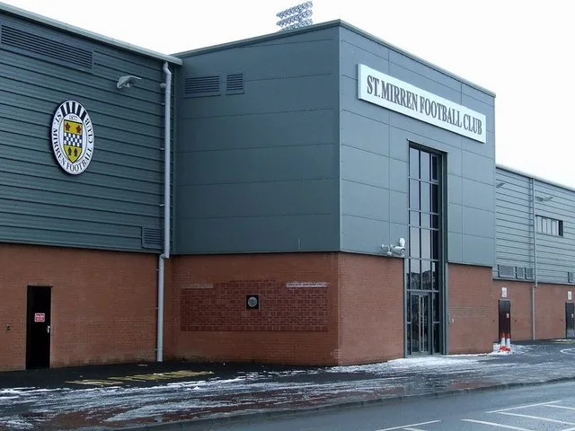
St Mirren Park in Renfrewshire
St Mirren Park in Renfrewshire is a stadium (Soccer, St Mirren FC), Greenhill Road. St Mirren Park is also known as Saint Mirren Park. Ⓦ.
- Street
- Greenhill Road
- Leisure
- stadium
- Operator
- St Mirren FC
Image
Cafés
Pubs
Bus stops
Stations
Recycling centres
Electrical shops
Convenience stores
Roads nearby
Greenhill RoadPaisley St James
150 m
Ferguslie Park AvenueTannahill Centre, Darkwood Drive, Barskiven Roundabout, Kinloch Lane
200 m
Murray Street200 m
Craigielea Drive200 m
Drums Crescent250 m
Drums Avenue250 m
Stirrat Crescent300 m
Middleton RoadLinwood Recycling Centre
300 m
Tannahill RoadTannahil Road, Drums Avenue
300 m
Tannahill Terrace300 m
McKenzie StreetMCKenzie Street
350 m
Stirrat Street350 m
Bankfoot Road400 m
Crawfurd Drive400 m
Muirdykes Crescent400 m
St James Avenue450 m
MacKean Street450 m
Clark Street450 m
Scadlock Road500 m
Muirdykes Road500 m
Underwood Roadcef
500 m
Darkwood Crescent500 m
King Street500 m
Blackstoun Oval550 m
Well StreetUnderwood Road, Wellmeadow Street
550 m
Douglas Street550 m
Darkwood Court550 m
Walkinshaw Crescent600 m
McFarlane Street600 m
Darkwood Drive600 m
Blackstoun RoadFerguslie Park
650 m
Falcon Crescent650 m
Westburn Avenue650 m
Greenock RoadShortwoods, Greenock Road / St Mirrin Park, A737, Bishopton, The Braehead Tavern, Day-Today
650 m
Westwood Gardens700 m
Kirklea Gardens750 m
Goudie Street750 m
St James' Interchange900 m
Abandoned railways nearby
Lyoncross to Paisley St James Line250 m
Walkinshaw Fork550 m
Allotment gardens nearby
Douglas Street Allotments550 m
Buildings nearby
Renfrewshire Council Clark Street depot350 m
Community centres nearby
Tannahill Centre700 m
Libraries nearby
Ferguslie Library650 m
Post depots nearby
Paisley Delivery Office450 m
Railway lines nearby
Paisley to Kilwinning500 m
Gourock Line700 m
Sports pitches nearby
St Mirren FC50 m
St Mirren Airdome50 m
| Opening | 2009 |
|---|---|
| Located in | Renfrewshire |
| Country | United Kingdom |
| Location | Paisley |
 Public transport map Renfrewshire Legend
| Railway | |
| Bus | |
| Tram |
 Cycling map Renfrewshire Legend
| Cycle path | |
| Cycle lane on road | |
| Cycling on bus lane | |
| Bicycle street | |
| Cyclists allowed | |
| Cyclists allowed, good surface | |
| No cycling | |
| Cobblestones |
| Long-distance cycle route | (depending on scale) | |
| Long-distance cycle route |
 Walking map Renfrewshire Legend
| Path |
| Long-distance hiking trail | (depending on scale) | |
| Long-distance hiking trail | ||
| No pedestrians |