
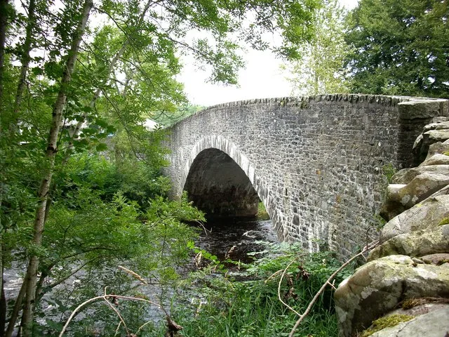
Carterhaugh Bridge in Scottish Borders
Carterhaugh Bridge in Scottish Borders is a unlit secondary road. This road is part of the bicycle routes Innerleithen Blue Route, Selkirk Green route and Selkirk Yellow Route. Carterhaugh Bridge is also known as Weatherhouse, Ettrick Water, Carterhaugh Bridge.
- Road Type
- secondary road
- Speed Limit
- 60 mph
Image
Roads nearby
Body Bag1,3 km
Duchess's Drive1,3 km
General's BridgeGeneral's Bridge
1,5 km
Lady’s Walk2,1 km
Mill Lade3,2 km
Ettrick RoadHowden Farm, Carterhaugh Bridge
3,2 km
Ettrickhaugh Road3,4 km
Corbie Linn Road3,5 km
Linglie RoadPhiliphaugh School, Levenlea Lodge
3,6 km
Broadmeadows3,8 km
Body of waters nearby
Bowhill Upper Loch1,1 km
Wester Moss3,6 km
Buildings nearby
Bowhill House1,2 km
Selkirk RFC3,5 km
Farmyards nearby
Harehead2,2 km
Middlestead2,2 km
Howden2,2 km
Old Mill Farm2,3 km
Corby Cottage3,0 km
Forests nearby
Harehead Wood1,8 km
Traquiar Plantation2,1 km
Middlepark Strip2,3 km
Fox Covert2,7 km
Tibby Tamson's Plantation2,7 km
Montrose Plantation2,8 km
Covenanters' Plantation2,8 km
Covenaters' Plantation2,9 km
Young Plantation2,9 km
Hare Plantation3,2 km
Manor Hill Plantation3,4 km
Headshaw New Plantation3,7 km
Hotel nearby
Philipburn Hotel3,5 km
Residential areas nearby
Scaurhead650 m
East Lodge1,5 km
West Lodge1,5 km
The Thirladean1,9 km
Beechwood2,4 km
Newarkmill2,8 km
Ruins nearby
Newark Castle2,9 km
Sports pitches nearby
Selkirk F.C.3,3 km
Streams nearby
Newark Burn2,1 km
Loch Sike3,2 km
Long Philip Burn3,4 km
Weirs nearby
Murray's Cauld2,0 km
Woodlands nearby
Egg Plantation600 m
The Cants1,0 km
Howden Bank1,8 km
Junctionhaugh Plantation2,0 km
Brockhill Wood4,0 km
| Heritage designation | category B listed building |
|---|---|
| Located in | Scottish Borders, Selkirk |
| Country | United Kingdom |
| Crosses | Ettrick Water |
| Carries thoroughfare | B7039 road |
 Public transport map Scottish Borders Legend
 | Railway | |
| Bus | |
| Tram |
 Cycling map Scottish Borders Legend
 | Cycle path | |
| Cycle lane on road | |
| Cycling on bus lane | |
| Bicycle street | |
| Cyclists allowed | |
| Cyclists allowed, good surface | |
| No cycling | |
| Cobblestones |
| Long-distance cycle route | (depending on scale) | |
| Long-distance cycle route |
 Walking map Scottish Borders Legend
 | Path |
| Long-distance hiking trail | (depending on scale) | |
| Long-distance hiking trail | ||
| No pedestrians |