
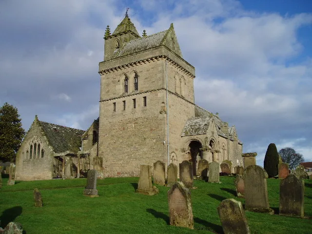
Chirnside Parish Church in Scottish Borders
Chirnside Parish Church in Scottish Borders is a church. It is near Kirkgate and is also known as Chirnside, Kirkgate, The Old Church. The church is a listed building. Ⓦ.
- Amenity
- place of worship
- Building Type
- church
Image
Roads nearby
Waterloo Park150 m
Kirkgate150 m
The Glebe200 m
Erskine Place300 m
Crosshill350 m
Whitehall Close350 m
Jim Clark DriveWhiteadder View
400 m
Erskine Road450 m
Swan Avenue450 m
Greenwell Avenue450 m
South Crofts450 m
Whiteadder WayNinewell house
450 m
Windram Road450 m
Windsor Locks500 m
Blackadder Way500 m
Windram Terrace550 m
Whitehall Road550 m
East Croftsfield550 m
David Hume View550 m
Cheviot Avenue550 m
Park View550 m
Windram Place550 m
Croftsfield550 m
LammerviewLammerview
600 m
Main Street West EndChirnside, Memorial Clock, Co-op, Naismiths Arms, Market Road, Crosshill, Masonic Hall, Andrew Mitchell & Co
600 m
Dominies Loan600 m
The Loaning600 m
Croft Court650 m
Carters Way650 m
Crofts to East End Link Path650 m
Northfield Terrace650 m
Dominies Way750 m
Dominies Road750 m
Main Street East EndCintra, Eastfield, East End Garage
950 m
Mabons Place1000 m
East End North1000 m
Buildings nearby
Ninewells Dovecot200 m
Chirnside Telephone Exchange650 m
Community centres nearby
Chirnside Community Centre550 m
Industrial areas nearby
Chirnside STW400 m
Saw Mill550 m
Places of worship nearby
South View Evangelical Church550 m
Pubs nearby
The Waterloo Arms100 m
Recreation grounds nearby
Comrades Park650 m
Residential areas nearby
Ninewells North Lodge550 m
Whitehall North Lodge600 m
Ninewells South Lodge650 m
Residential buildings nearby
Trust Housing Association650 m
Supermarkets nearby
The Co-operative Food600 m
| Located in | Scottish Borders, Chirnside |
|---|---|
| Country | United Kingdom |
| Has part | Chirnside Parish Churchyard |
 Public transport map Scottish Borders Legend
| Railway | |
| Bus | |
| Tram |
 Cycling map Scottish Borders Legend
| Cycle path | |
| Cycle lane on road | |
| Cycling on bus lane | |
| Bicycle street | |
| Cyclists allowed | |
| Cyclists allowed, good surface | |
| No cycling | |
| Cobblestones |
| Long-distance cycle route | (depending on scale) | |
| Long-distance cycle route |
 Walking map Scottish Borders Legend
| Path |
| Long-distance hiking trail | (depending on scale) | |
| Long-distance hiking trail | ||
| No pedestrians |