
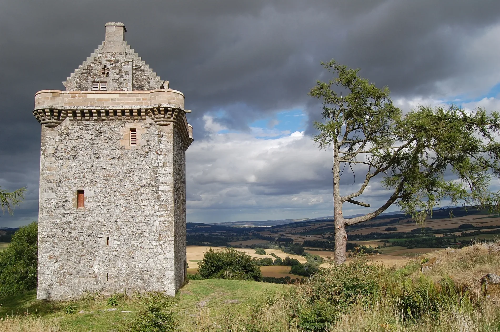
Fatlips Castle in Scottish Borders
Fatlips Castle in Scottish Borders is a castle (defensive castle, built in 1857). Fatlips Castle is near Jedburgh Road. Ⓦ.
- Building Type
- castle
- Website
- https://www.fatlipscastle.com/
Image
Roads nearby
Jedburgh RoadAmbulance Station, Springwood Bank, Craignethan, Ardath
1,5 km
Rule Bridge1,6 km
Teviotbank Gardens2,5 km
Bulman Lane2,5 km
Croft Field2,5 km
Minto Gardens2,6 km
Cannongate2,6 km
Selby Close2,6 km
Croftfield2,6 km
Minto Road2,6 km
Riverside Drive2,6 km
KirksideDenholm
2,7 km
Eastlea Drive2,7 km
EastgateEastlea Drive, Cream Puff Cafe, Douglas and Son, RBS, Forsyths Quality Butchers, Fat Face, Save the Children, Nationwide, KeyStore, East, Peebles Rugby Club, The Three Fishes Gallery & Framing, Post Office, Forsyths Quality Bakers, Graham McGrath
2,7 km
Leydens RoadThomas B. Oliver
2,7 km
Elm House Court2,7 km
Ruberslaw Road2,8 km
The Loaning2,8 km
Ruberslaw Drive2,8 km
Whinnie Close2,9 km
Body of waters nearby
Rule Water1,0 km
River Teviot1,3 km
Buildings nearby
Lilylaw700 m
Cemeteries nearby
Denholm Cemetery2,3 km
Farmyards nearby
Cleuch Head700 m
Deanfoot900 m
Barnhills1,2 km
Spittal On Rule1,3 km
Denholm Mains1,8 km
Troneyhill2,2 km
Forests nearby
Fox Covert550 m
Stobedge Wood750 m
Lambslair Plantation1,0 km
Barnhills Moor Plantation1,2 km
Barnhills North Covert1,5 km
Hillend Strip1,7 km
North Lodge Strip1,8 km
Troneyhill Plantation1,9 km
Trips Plantation2,3 km
Golf courses nearby
Minto Golf Course1,2 km
Houses nearby
East Lodge550 m
Industrial areas nearby
Sewerage Works2,3 km
Outdoor seatings nearby
Fox & Hounds Beer Garden2,8 km
Places of worship nearby
Ruberslaw Parish Church2,7 km
Pubs nearby
The Fox and Hounds Inn2,8 km
Scrublands nearby
East Bleaching Green2,4 km
Streams nearby
Grinding Burn2,4 km
Tower Burn2,5 km
Village greens nearby
Small Green2,6 km
| Heritage designation | scheduled monument, category B listed building |
|---|---|
| Located in | Scottish Borders, Minto |
| Country | United Kingdom |
 Public transport map Scottish Borders Legend
 | Railway | |
| Bus | |
| Tram |
 Cycling map Scottish Borders Legend
 | Cycle path | |
| Cycle lane on road | |
| Cycling on bus lane | |
| Bicycle street | |
| Cyclists allowed | |
| Cyclists allowed, good surface | |
| No cycling | |
| Cobblestones |
| Long-distance cycle route | (depending on scale) | |
| Long-distance cycle route |
 Walking map Scottish Borders Legend
 | Path |
| Long-distance hiking trail | (depending on scale) | |
| Long-distance hiking trail | ||
| No pedestrians |