
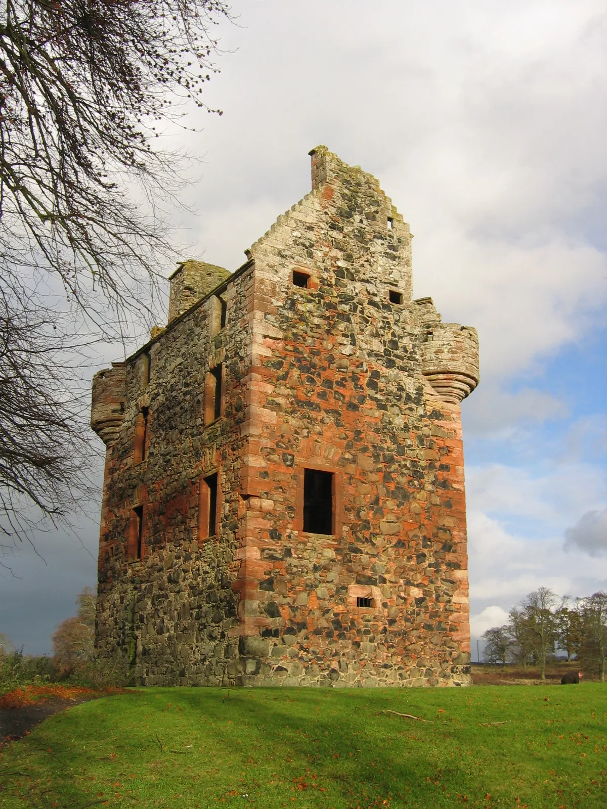
Greenknowe Tower in Scottish Borders
Greenknowe Tower in Scottish Borders is a castle. Greenknowe Tower is also known as Greenknowe Tower, Gordon. Greenknowe Tower is near West End. Ⓦ.
- Building Type
- building
Image
Roads nearby
West EndGordon Public Hall, School Wynd
550 m
Sunnybraes600 m
Main StreetGordon, Post Office, Coronation Garden, The Old Bakehouse, West Linton Pharmacy, West Linton Post Office, Co-op Food, Cross Keys Inn, Tak Tent in Time, Cross Keys Restaurant, Newstead, Claymires Lane, St John's Wynd, Rushbank, The Orchard, West End, Reston Post Office, Reston, Trimontium - The Place of the Three (Eildon) Hills, Village Green;Kirk Yetholm, Pennine Way, End of the Pennine Way, Border Hotel, Morebattle, School, Morebattle Community Shop, Leitholm, Cotter Lea, Leitholm Shop, Playground, Leitholm Playground, Village Hall, Sook Sook Thai Kitchen By Puy, The Plough Inn, Weirgate Brae, Jean Lawrie Court, Morrisons Daily, Mainstreet Books, Shimmer Hair Studio, St Boswells Post Office, Fry Masters, JM Quality Meats, Main Street Trading, Mainstreet Cafe, Oriental, Trends, Copperpot Interiors, Kirk Yetholm, Springfield Terrace, The Glebe, Gordon Arms Hotel, Heiton, Ladyrig Road Junction, Ladyrig View, Sunlaws Road Junction, Goldilands B&B, Borders Gunroom, Stichill, Wellfield, War Memorial, Swinton, The Green
700 m
Manse RoadOblò, Eyemouth Library
800 m
Glebe Park850 m
MurrayfieldMurrayfield, St Abbs Post Office & Shop, Gordon Primary School
850 m
Station RoadBroomlee Crescent, Knoll Hospital, Boston Court, Get Knotted, Oxton Village Stores, The Station House, Fillin Station, Station Road, Maxmill Park, Sprouston Road, Riccarton Halt, Halmyre Mains, Earlston Square Bus Stance, Village Hall, Oxton Luxury Apartments
850 m
Blackrigg Park900 m
Kelso RoadLees Farm, Health Centre
950 m
Eden RoadEden Road, Smailholm Church
1000 m
The Beeches1000 m
EdenbrookGordon East Mains
1,9 km
EdengroveRowanlea
2,0 km
ColtcrooksColtcrooks
2,6 km
Abandoned railways nearby
St. Boswells & Reston300 m
Buildings nearby
Gordon Telephone Exchange900 m
Cemeteries nearby
Gordon Cemetery900 m
Commercial areas nearby
Old Station Yard1,3 km
Farmyards nearby
Gordon Cottage1,1 km
Greenknowe1,3 km
Lightfield1,5 km
Rowanlea1,8 km
Upper Huntlywood2,2 km
Forests nearby
Greenknowe Moss650 m
Scot's Plantation1,8 km
Shusie Covert2,0 km
Horsehoe Plantation2,2 km
Henless Plantation2,2 km
Bonaparte's Covert2,4 km
Long Raxes2,7 km
Hotel nearby
The Gordon Arms650 m
Houses nearby
Eden Brook Farm1,9 km
Places of worship nearby
St Michael's Kirk650 m
Residential areas nearby
West MainsHuntshaw
600 m
Gordon Station1,1 km
Gordon Mid Mill2,1 km
Bowes2,2 km
Residential buildings nearby
Greenknowe Cottage300 m
Edenside Cottage2,0 km
Restaurants nearby
Valentines Restaurant900 m
Rivers nearby
Eden Water2,4 km
School buildings nearby
Gordon Primary School700 m
Streams nearby
Tower Burn150 m
Hareford Burn1,4 km
Woodlands nearby
Sunnybraes Plantation500 m
Station Plantation1000 m
Bogle Plantation1,2 km
Other nearby
Nether Huntlywood Airfield2,1 km
Nether Huntlywood2,3 km
| Heritage designation | scheduled monument, category A listed building |
|---|---|
| Located in | Scottish Borders, Gordon |
| Country | United Kingdom |
| Described by source | CastlesFortsBattles |
 Public transport map Scottish Borders Legend
 | Railway | |
| Bus | |
| Tram |
 Cycling map Scottish Borders Legend
 | Cycle path | |
| Cycle lane on road | |
| Cycling on bus lane | |
| Bicycle street | |
| Cyclists allowed | |
| Cyclists allowed, good surface | |
| No cycling | |
| Cobblestones |
| Long-distance cycle route | (depending on scale) | |
| Long-distance cycle route |
 Walking map Scottish Borders Legend
 | Path |
| Long-distance hiking trail | (depending on scale) | |
| Long-distance hiking trail | ||
| No pedestrians |