
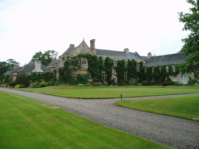
Monteviot House in Scottish Borders
Monteviot House in Scottish Borders is a residential building. Monteviot House is near Monteviot Bridge. Ⓦ.
- Building Type
- residential building
Image
Roads nearby
Monteviot Bridge200 m
Jedfoot Bridge1,4 km
Ancrum Old Bridge1,4 km
South MyrescroftSouth Myrescroft
1,8 km
North MyrescroftNorth Myrescroft, Ancrum, Ancrum Pantry
1,9 km
Landene2,0 km
Dere StreetStreethouse, Forest Lodge, Threstle, Pennymuir Fair Ground, Camping by numbers
2,0 km
Myrescroft Road2,0 km
West Myrescroft2,0 km
Nisbet HillheadNisbet Hillhead
2,2 km
Tourism nearby
Waterloo Monument1,7 km
Attraction nearby
Harestanes Countryside Visitor Centre750 m
Body of waters nearby
Perch Pond1,7 km
Witch Burn2,2 km
Baron's Loch2,2 km
Buildings nearby
Ancrum Telephone Exchange2,0 km
New Mill2,1 km
Timpendean Tower2,4 km
Car repair shops nearby
Bonjedward Garage1,4 km
Commercial areas nearby
AC Burn Ltd.2,0 km
Farmyards nearby
Nisbet Mill1,4 km
Mounthooly1,6 km
Copland1,7 km
Monklaw2,0 km
Forests nearby
Victoria Clump1,4 km
Cleikemin Wood1,5 km
Calderwood Wood1,5 km
Monklaw Strip1,6 km
Whinny Plantation1,8 km
Pipergate Plantation1,8 km
Fiddle Clump1,8 km
Sunnybrae Plantation1,9 km
Stoney Wood2,3 km
Golf courses nearby
Mounthooly Golf Driving Range1,7 km
Houses nearby
Braeside Cottage2,0 km
Huts nearby
Borders Forest Trust750 m
Industrial areas nearby
Jedburgh WwTW2,3 km
Razed railways nearby
Jedburgh Branch1,7 km
Residential areas nearby
Bonjedward House2,3 km
Residential buildings nearby
Lodge1,3 km
Boathouse2,3 km
Mount Ulston House2,4 km
Restaurants nearby
Caddy Mann Restaurant1,7 km
Rivers nearby
River Teviot550 m
Sports pitches nearby
Ancrum F.C.1,3 km
Streams nearby
Marble Burn900 m
Mill Lead1,0 km
Harden Burn2,0 km
Woodlands nearby
Curries Clump2,3 km
| Heritage designation | category B listed building |
|---|---|
| Located in | Scottish Borders, Crailing |
| Country | United Kingdom |
 Public transport map Scottish Borders Legend
 | Railway | |
| Bus | |
| Tram |
 Cycling map Scottish Borders Legend
 | Cycle path | |
| Cycle lane on road | |
| Cycling on bus lane | |
| Bicycle street | |
| Cyclists allowed | |
| Cyclists allowed, good surface | |
| No cycling | |
| Cobblestones |
| Long-distance cycle route | (depending on scale) | |
| Long-distance cycle route |
 Walking map Scottish Borders Legend
 | Path |
| Long-distance hiking trail | (depending on scale) | |
| Long-distance hiking trail | ||
| No pedestrians |