
New Halland Laird's House in Shetland
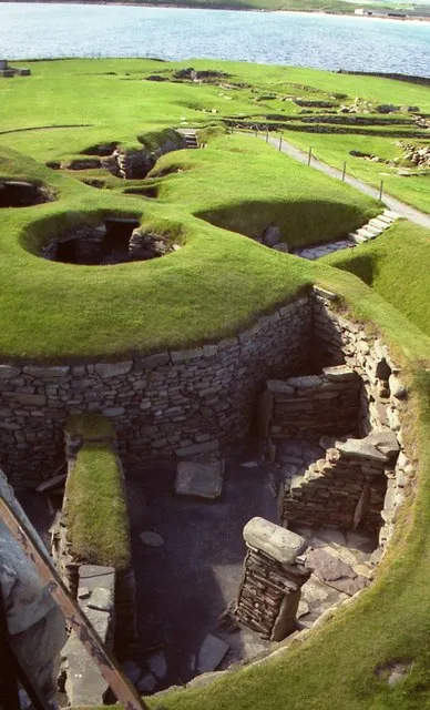
New Halland Laird's House in Shetland Islands is ruins. New Halland Laird's House is also known as Jarlshof, broch & settlement. New Halland Laird's House is near Ferry Lane. Ⓦ.
- Building Type
- building
Image
Roads nearby
Ferry LaneGrutness, Grutness Pier, End section 7
800 m
Sumburgh Head lane950 m
Airport Wide RoadSumburgh Hotel Gate
950 m
The Scat Ness1,0 km
Colonial Place1,0 km
Approach RoadSumburgh
1,1 km
Sanblister PlaceScatness Junction, Colonial Place, Scatness
1,1 km
Old Scatness RoadScatness Junction
1,5 km
Eastshore LanePool of Virkie, Punds
2,0 km
Sumburgh Links Road2,0 km
Toab RoadToab, Toab Shop, Virkie Post Office
2,0 km
Exnaboe RoadExnaboe
2,4 km
Horseshoe Close2,4 km
North TrackNorth Town
2,6 km
Hestingott RoadThistle Court, Road End
2,7 km
Ninian DriveHestingott
2,8 km
Thistle Court2,9 km
Ward Hill3,5 km
Quendale TrackQuendale, Quendale Mill, Hillwell
4,6 km
Voe Road4,7 km
Nature nearby
Little Holm1,9 km
Lady's Holm2,3 km
Horse Island2,7 km
Artwork nearby
Orca statue1,7 km
Attraction nearby
Jarlshof150 m
Baies nearby
Pool of Virkie1,6 km
Body of waters nearby
Loch of Gards1,1 km
Loch of Huesbreck4,4 km
Loch of Mails4,6 km
Buildings nearby
Jarlshof Visitor Centre50 m
Radar1000 m
lime kiln1,0 km
Foghorn1,9 km
WW2 Air Ministry MF/DF aerial ruins3,1 km
WW2 Admiralty MF/DF aerial ruins3,8 km
WW2 Admiralty Billet ruins3,8 km
WW2 Admiralty HF/DF aerial ruins4,0 km
Quendale Water Mill4,6 km
Community centres nearby
Bruce Memorial Hall2,1 km
Hotels nearby
Sumburgh Hotel200 m
Meadowvale Lodge2,4 km
Marinas nearby
Ness Boating Club Marina1,7 km
Streams nearby
Holm Burn4,3 km
Burn of Quendale4,4 km
Eel Burn4,6 km
Other nearby
South Taxiway600 m
East Taxiway1,1 km
North Taxiway1,2 km
Sumburgh Airport1,5 km
| Heritage designation | scheduled monument |
|---|---|
| Located in | Shetland Islands, Dunrossness |
| Country | United Kingdom |
Public transport map Shetland Islands Legend
| Railway | |
| Bus | |
| Tram |
Cycling map Shetland Islands Legend
| Cycle path | |
| Cycle lane on road | |
| Cycling on bus lane | |
| Bicycle street | |
| Cyclists allowed | |
| Cyclists allowed, good surface | |
| No cycling | |
| Cobblestones |
| Long-distance cycle route | (depending on scale) | |
| Long-distance cycle route |
Walking map Shetland Islands Legend
| Path |
| Long-distance hiking trail | (depending on scale) | |
| Long-distance hiking trail | ||
| No pedestrians |