
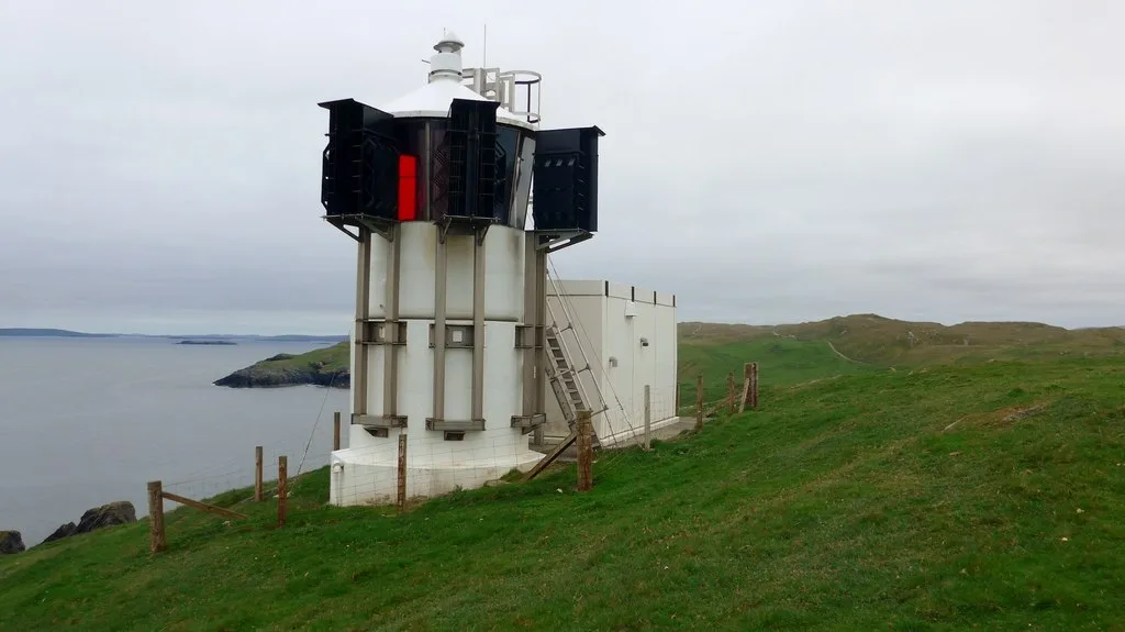
Fethaland Lighthouse in Northmavine
Fethaland Lighthouse in Shetland Islands, Northmavine is a lighthouse. Fethaland Lighthouse is also known as Point of Fethaland lighthouse. Fethaland Lighthouse is near Anniesland.
- Building Type
- building
Image
Convenience stores
Post offices
Guest house
Restaurants
Tourist information offices
General stores
- Ollaberry Co-operative (opening hours: Mon–Fri 9–18:15; Thu 9–19; Sat 9–18; Sun 14–17) at Ollaberry Industrial Estate (ZE2 9RT). A thriving general store owned and run by the local community offering a wide range of everyday items such as fresh fruit and vegetables, fresh bread and dairy, groceries, wines and beers, household goods, and greetings cards. – approx. 16,0 km.
Bus stops
Caravan site
Nature nearby
Gruney1,9 km
Flae-ass2,1 km
Barlcudda2,2 km
The Club2,2 km
Fladda2,4 km
Ofoora2,5 km
Stab2,6 km
Hyter2,6 km
Speolk2,7 km
Turla2,8 km
Scordar3,0 km
Outer Stack3,1 km
Gaut Skerries3,4 km
North Holm of Burravoe5,2 km
South Holm of Burravoe5,5 km
Muckle Holm6,2 km
Sweinna Stack6,4 km
Holm of West Sandwick7,8 km
Body of waters nearby
Loch of Breibister1,8 km
Viga Water2,1 km
Upper Loch of Setter2,5 km
Lower Loch of Setter2,8 km
Loch of Houllsquey3,7 km
Loch of Flugarth4,4 km
Loch of Beith5,3 km
Fishermen's Loch6,0 km
Innes Loch6,1 km
Mauns TUllock's Waters6,2 km
Ure Water7,3 km
Shuna Grey7,6 km
Mill Lochs of Sandvoe7,7 km
Pund Loch7,7 km
Loch of Skelberry8,0 km
Sandy Lochs8,5 km
Buildings nearby
North Roe Telephone Exchange7,1 km
Cemeteries nearby
Isbister burial ground3,8 km
Sandvoe cemetery4,2 km
Gardens nearby
Nort Trow Community Garden5,4 km
Ruins nearby
Houllsquey3,7 km
Streams nearby
Burn of Skinisfield1,5 km
Viga Burn1,9 km
Burn of Sandvoe5,7 km
Pettadale Burn6,1 km
Reiss Burn6,1 km
Mill Burn6,7 km
Whitler Burn7,0 km
Burn of Houlland7,0 km
| Inception | 1977 |
|---|---|
| Height | 7 m |
| Operator | Northern Lighthouse Board |
| Located in | Shetland Islands |
| Country | United Kingdom |
| Location | Point of Fethaland, Shetland Islands Council |
 Public transport map Northmavine Legend
| Railway | |
| Bus | |
| Tram |
 Cycling map Northmavine Legend
| Cycle path | |
| Cycle lane on road | |
| Cycling on bus lane | |
| Bicycle street | |
| Cyclists allowed | |
| Cyclists allowed, good surface | |
| No cycling | |
| Cobblestones |
| Long-distance cycle route | (depending on scale) | |
| Long-distance cycle route |
 Walking map Northmavine Legend
| Path |
| Long-distance hiking trail | (depending on scale) | |
| Long-distance hiking trail | ||
| No pedestrians |