
Bound Skerry in Skerries, Shetland Islands
Bound Skerry in Shetland Islands, Skerries is a Coastline. Ⓦ.
- Nature
- coastline
Image
Petrol stations
Post offices
Roads nearby
Skerries Bridge1,7 km
Nature nearby
Tamma Skerry100 m
Little Bound Skerry250 m
Horn Skerry350 m
The Hogg500 m
Bruray1,0 km
Stoura Stack1,3 km
Old Man's Stack1,4 km
Tou Geo1,5 km
Tou Stack1,6 km
Hevda Skerries2,0 km
Vogans Point2,0 km
Shops nearby
East Isle Shop1,7 km
Bare rocks nearby
Lamba Stack900 m
Flat Lamba Stack950 m
Beaches nearby
Long Ayre1000 m
Body of waters nearby
Da Burn1,4 km
Buildings nearby
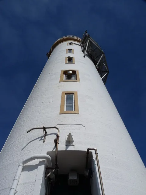
Out Skerries Lighthouse100 m
Factory1,2 km
Emohruo1,2 km
Out Skerries Telephone Exchange1,3 km
Seelaberg1,8 km
Ugie Brae2,0 km
Chalet nearby
Hillside1,3 km
Houses nearby
Grunay House650 m
Haa1,4 km
Fairhaven1,5 km
Houll1,5 km
Rocklea1,6 km
Hillcrest1,6 km
1 Harbour View1,8 km
3 Harbour View1,8 km
5 Harbour View1,8 km
7 Harbour View1,8 km
9 Harbour View1,8 km
Bridgend1,8 km
Industrial buildings nearby
Water storage tank1,4 km
Water Treatment Plant1,4 km
Sheds nearby
Beach Barn1,3 km
Store1,3 km
Linkspan Control Hut1,3 km
Three-in-one1,5 km
Old hall1,9 km
Straits nearby
Northeast Mouth1,1 km
South Mouth1,4 km
North Mouth1,7 km
Supermarkets nearby
A. Humphray General Stores1,3 km
Other nearby
Out Skerries Airfield1,2 km
Battlepund1,8 km
| Located in | Shetland Islands |
|---|---|
| Country | United Kingdom |
| Body of water | Atlantic Ocean |
| Part of | Shetland Islands, Out Skerries |
 Public transport map Skerries Legend
| Railway | |
| Bus | |
| Tram |
 Cycling map Skerries Legend
| Cycle path | |
| Cycle lane on road | |
| Cycling on bus lane | |
| Bicycle street | |
| Cyclists allowed | |
| Cyclists allowed, good surface | |
| No cycling | |
| Cobblestones |
| Long-distance cycle route | (depending on scale) | |
| Long-distance cycle route |
 Walking map Skerries Legend
| Path |
| Long-distance hiking trail | (depending on scale) | |
| Long-distance hiking trail | ||
| No pedestrians |