
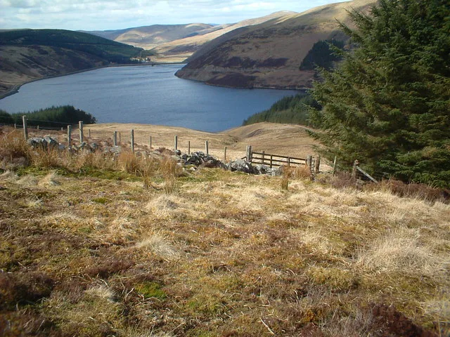
Camps Reservoir in South Lanarkshire
Camps Reservoir in South Lanarkshire is a body of water.
- Nature
- body of water
Bus stops
Tourist information offices
Attraction
Convenience stores
Newsagent's
Places of worship
Fast food restaurants
Specialist shops
Fire station
Charging stations
Cafés
Parking
Body of waters nearby
Spillway1,2 km
Cowgill Upper Reservoir4,6 km
Cliffs nearby
The Craigs4,1 km
Dams nearby
Coulter Dam5,2 km
Forests nearby
Camps Knowe wood1,2 km
Streams nearby
Howe Cleuch400 m
Martins Cleuch550 m
Yearn Gill1,8 km
Camps water2,5 km
Earns Gill2,7 km
Stane Gill2,7 km
Big Tinnan2,8 km
Whelphill Hope3,0 km
Little Tinnan3,0 km
Hine Gill3,0 km
Rine Gill3,1 km
Hopelaw Burn3,2 km
Normangill Burn3,4 km
Upper Deer Gill3,5 km
Hillshaw Burn3,5 km
Nether Deer Gill3,6 km
Little Gill3,6 km
Ramsey Gill3,7 km
Duncan Gill3,8 km
Back Gill4,0 km
Midlock Water4,0 km
Ram Gill4,1 km
Yarn Cleuch4,1 km
Fair Burn4,2 km
Shalf Grain4,2 km
Snow Gill4,2 km
Little Sup4,3 km
East Water4,3 km
The Grip4,4 km
West Water4,4 km
Reddie Grains4,5 km
Horse Grain4,5 km
Wandel Burn4,5 km
Rashy4,6 km
Pagan Slop4,7 km
Mere Cleuch4,8 km
Little Stone Gill4,9 km
Eask Gill5,1 km
Stone Gill5,1 km
Houphead Rig5,1 km
Eastside Burn5,3 km
Other nearby
Camps Water Treatment Works2,8 km
Clyde Wind Farm North Substation3,6 km
Coulter Water Treatment Works5,1 km
| Area | 78.8 ha |
|---|---|
| Located in | South Lanarkshire |
| Country | United Kingdom |
 Public transport map South Lanarkshire Legend
| Railway | |
| Bus | |
| Tram |
 Cycling map South Lanarkshire Legend
| Cycle path | |
| Cycle lane on road | |
| Cycling on bus lane | |
| Bicycle street | |
| Cyclists allowed | |
| Cyclists allowed, good surface | |
| No cycling | |
| Cobblestones |
| Long-distance cycle route | (depending on scale) | |
| Long-distance cycle route |
 Walking map South Lanarkshire Legend
| Path |
| Long-distance hiking trail | (depending on scale) | |
| Long-distance hiking trail | ||
| No pedestrians |