
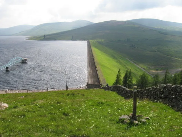
Daer Reservoir in South Lanarkshire
Daer Reservoir in South Lanarkshire is a body of water. Ⓦ.
- Nature
- body of water
Image
Stations
Fire station
Hofläden
Museum
Bus stops
Fountains
Specialist shops
Tourist information offices
Attraction
Places of worship
Hotels
Convenience stores
Roads nearby
ROMAN ROAD (course)5,4 km
Buildings nearby
Daerhead3,4 km
Rivers nearby
Crook Burn100 m
Potrail Water5,0 km
Potrenick Burn5,1 km
Daer Water5,5 km
Streams nearby
Nether Ornscleugh1,5 km
Black Burn1,8 km
Carsehope Burn1,8 km
Over Ornscleugh1,9 km
Lamb Sike2,3 km
White Burn2,5 km
Old Town Burn2,7 km
Coom Burn3,2 km
Sweetshaw Burn3,3 km
Calf Burn3,3 km
Meikle Burn3,4 km
Marlinn Grain3,5 km
Bees Beck3,6 km
Berry Grain4,0 km
Hapturnell Burn4,0 km
Rushy Grain4,1 km
Kirkstane Grain4,1 km
Nether burn4,1 km
Benuff Burn4,2 km
Annant Scar Cleugh4,2 km
Gana Burn4,2 km
Ever Burn4,2 km
Penny Gill4,3 km
Hard Grain4,4 km
Smithwood Burn4,5 km
Boretree Sike4,5 km
Blairmuc Burn4,5 km
Midge Grain4,6 km
Kinnel Water4,6 km
Gate Sike4,7 km
Wintercleuch Burn5,0 km
Fang Burn5,2 km
Rushy Sike5,3 km
Dowcleugh Burn5,3 km
Fingland Burn5,4 km
Allershaw Burn5,5 km
Respie Grain5,6 km
Dick's Grain5,6 km
Fenny Gutter5,6 km
Lang Grain5,8 km
Rushy Lane5,8 km
Burley Sike5,9 km
Wilderness huts nearby
Brattleburn4,5 km
| Located in | South Lanarkshire |
|---|---|
| Country | United Kingdom |
 Public transport map South Lanarkshire Legend
| Railway | |
| Bus | |
| Tram |
 Cycling map South Lanarkshire Legend
| Cycle path | |
| Cycle lane on road | |
| Cycling on bus lane | |
| Bicycle street | |
| Cyclists allowed | |
| Cyclists allowed, good surface | |
| No cycling | |
| Cobblestones |
| Long-distance cycle route | (depending on scale) | |
| Long-distance cycle route |
 Walking map South Lanarkshire Legend
| Path |
| Long-distance hiking trail | (depending on scale) | |
| Long-distance hiking trail | ||
| No pedestrians |