
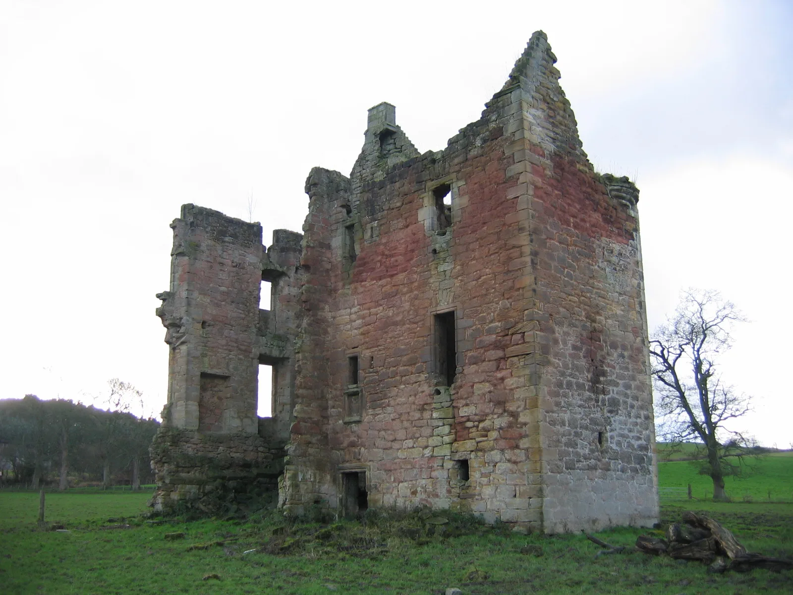
Gilbertfield Castle in South Lanarkshire
Gilbertfield Castle in South Lanarkshire is a castle. Gilbertfield Castle is near Ell Crescent. Ⓦ.
- Building Type
- ruins
Image
Restaurants
Bus stops
Roads nearby
Drumgray Drive450 m
Ell Crescent500 m
Virtuewell Grove500 m
Pyotshaw Way600 m
Gilbertfield Wynd650 m
Blackband Terrace650 m
Newcomen Gardens650 m
Murdoch Avenue650 m
East Greenlees Drive650 m
Upper Ell Gate650 m
Trinity Drive700 m
Auld Kirk Road700 m
East Greenlees Crescent750 m
Gilbertfield Road750 m
East Greenlees Avenue750 m
Dechmont Avenue800 m
Dechmont Place850 m
Deans Avenue850 m
East Greenlees Road850 m
Castle Chimmins Road850 m
East Greenlees Gardens850 m
Rosebank DriveOak Drive, Wellside Drive
900 m
Quarry Avenue900 m
Fernbank Avenue950 m
Ivybank Avenue950 m
Tanzieknowe Avenue950 m
Tanzieknowe Road1000 m
Castle Chimmins Avenue1000 m
Cairnswell AvenueHamilton Crescent, Cairns
1000 m
Well Side Drive1000 m
Lomond ViewTurnlaw Farm
1000 m
Lilybank Avenue1000 m
Glen Street1000 m
Tanzieknowe Drive1000 m
Dean Park Drive1000 m
Craigallian Avenue1000 m
Bruce Avenue1000 m
Hollybank Place1,0 km
Kirkhill Gardens1,0 km
Woodland CrescentTrinity Drive, Fernbank Avenue, Lilybank Avenue
1,0 km
Tanzieknowe Place1,1 km
Farmyards nearby
Gilbertfield Farm150 m
Turnlaw Farm950 m
Military areas nearby
Dechmont Training Area500 m
Glasgow and Lanarkshire Battalion Army Cadet Force800 m
Parks nearby
Cambuslang Park1,1 km
Places of worship nearby
St Cadoc's Catholic Church1000 m
Streams nearby
Light Burn650 m
Woodlands nearby
Kissing Trees750 m
| Heritage designation | scheduled monument, category B listed building |
|---|---|
| Located in | South Lanarkshire, Cambuslang |
| Country | United Kingdom |
 Public transport map South Lanarkshire Legend
| Railway | |
| Bus | |
| Tram |
 Cycling map South Lanarkshire Legend
| Cycle path | |
| Cycle lane on road | |
| Cycling on bus lane | |
| Bicycle street | |
| Cyclists allowed | |
| Cyclists allowed, good surface | |
| No cycling | |
| Cobblestones |
| Long-distance cycle route | (depending on scale) | |
| Long-distance cycle route |
 Walking map South Lanarkshire Legend
| Path |
| Long-distance hiking trail | (depending on scale) | |
| Long-distance hiking trail | ||
| No pedestrians |