
High Mill in South Lanarkshire
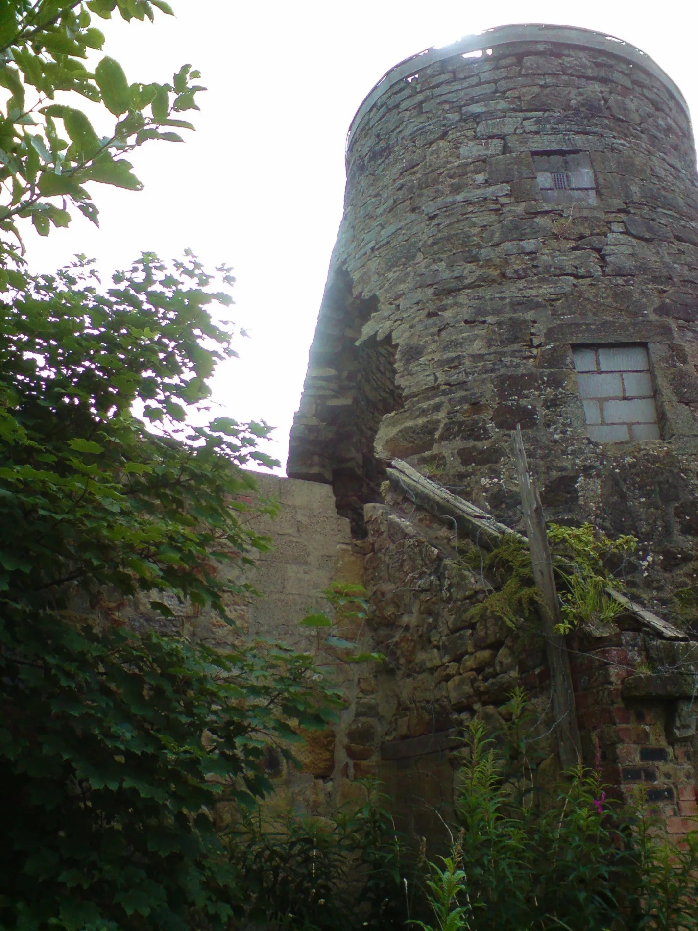
High Mill in South Lanarkshire is ruins. High Mill is also known as Carluke, Chapel Street, High Mill. High Mill is near Windmill Gardens. High Mill is made of crushed stone and brick. Ⓦ.
- Building Type
- ruins
Image
Cafés
Variety stores
Pharmacy
Chemist's
Butcher's
Bus stops
Fast food restaurants
Restaurants
Convenience stores
School
Funeral directors
Opticians
Pubs
Roads nearby
Windmill Gardens100 m
Cairnhill Court100 m
Chapel StreetRankin Street, Scotfresh
100 m
Market RoadBig B's, Bizzyberry Nursery, Victoria Park Primary School
150 m
Cairneymount Road150 m
Hillhead Avenue200 m
Greenbank Terrace200 m
Moorside Street250 m
High Mill Road250 m
Miller StreetThe Original Factory Shop
250 m
Lockhart StreetLockhart Place, Inglis Court, Candermill Road
250 m
Langshaw Crescent250 m
Thomson StreetThomson St.
250 m
Needle Green250 m
Belstane RoadBellstane Mews, Belstane Mews
250 m
Hope StreetCrown Tavern, North Vennel
300 m
King's Crescent300 m
Park Avenue300 m
Sandy RoadG.McAllister Funeral Directors, Langshaw Crescent, Brown Street
350 m
Newlands Terrace350 m
Hozier Street350 m
Rankin Street350 m
Market Court350 m
Milledge350 m
Black Bull Close350 m
Carnwath RoadGlenafeoch Road, Pettinain Road, Eastshield, Braehead, Main Street, Kersewell Avenue, Carstairs South Junction
350 m
Belstane Park400 m
Weir's Lane400 m
John StreetMachanhill View, Church street, Corn Exchange
400 m
Belstane Mews400 m
High StreetCarluke, Boots, King's Coffee, Scotmid, The Co-operative Funeralcare, Clear Vision Opticians, Poundland, Leather & Lace, Taj Mahal, Brooks, Broughton Road, Biggar Dental Practice, Rowan Design, Biggar, The Coffee Spot, K-Wok, The Fryery, RBS, Graeme Pharmacy, Robert Boa Iron, The Olive Tree Deli, The Elphinstone Hotel, The Fleming arms, Hendries Barbers, The Crown, Brownlie's, John Street, Gasworks Road, Atkinson-Pryce Books, Spar, Lilly Lu, Hendrie's, Harper Opticians, The Barony, High Street Dentist, Celebrity, The Boutique, The Biggar Gallery, New Image, Aroma, Biggar Sorting Office, Andrew Ironside, The Gillespie Centre, Charcoal Grey, The Kirkstyle Hotel, Two Rivers Veterinary Practice, Diamond, Lanark
400 m
Hamilton StreetGreggs, The Bubbles Factory
400 m
Cassels StreetCafe Kudos
400 m
Cassells LaneCapital Inn Carluke
400 m
Park Street500 m
Glenafeoch RoadAngus Road, Caldwell Road
500 m
James StreetJohn Street
550 m
Old Bridgend550 m
Allotment gardens nearby
Carluke Highmill and Community Gardens50 m
Cemeteries nearby
Carluke Old Cemetery350 m
Doctor's practice nearby
Carluke Health Centre250 m
Industrial areas nearby
Photoflash Travel550 m
Libraries nearby
Carluke Library450 m
Parks nearby
Moor Park250 m
Places of worship nearby
Carluke Kirkstyle Baptist Church300 m
St Johns Church500 m
Post offices nearby
Carluke Post Office450 m
School buildings nearby
St. Athanasius Primary450 m
Sports pitches nearby
Castlehill Bowling Club350 m
| Material | crushed stone, brick |
|---|---|
| Heritage designation | category A listed building |
| Located in | South Lanarkshire, Carluke |
| Country | United Kingdom |
| Location | Carluke |
 Public transport map South Lanarkshire Legend
| Railway | |
| Bus | |
| Tram |
 Cycling map South Lanarkshire Legend
| Cycle path | |
| Cycle lane on road | |
| Cycling on bus lane | |
| Bicycle street | |
| Cyclists allowed | |
| Cyclists allowed, good surface | |
| No cycling | |
| Cobblestones |
| Long-distance cycle route | (depending on scale) | |
| Long-distance cycle route |
 Walking map South Lanarkshire Legend
| Path |
| Long-distance hiking trail | (depending on scale) | |
| Long-distance hiking trail | ||
| No pedestrians |